Name/Title
MapEntry/Object ID
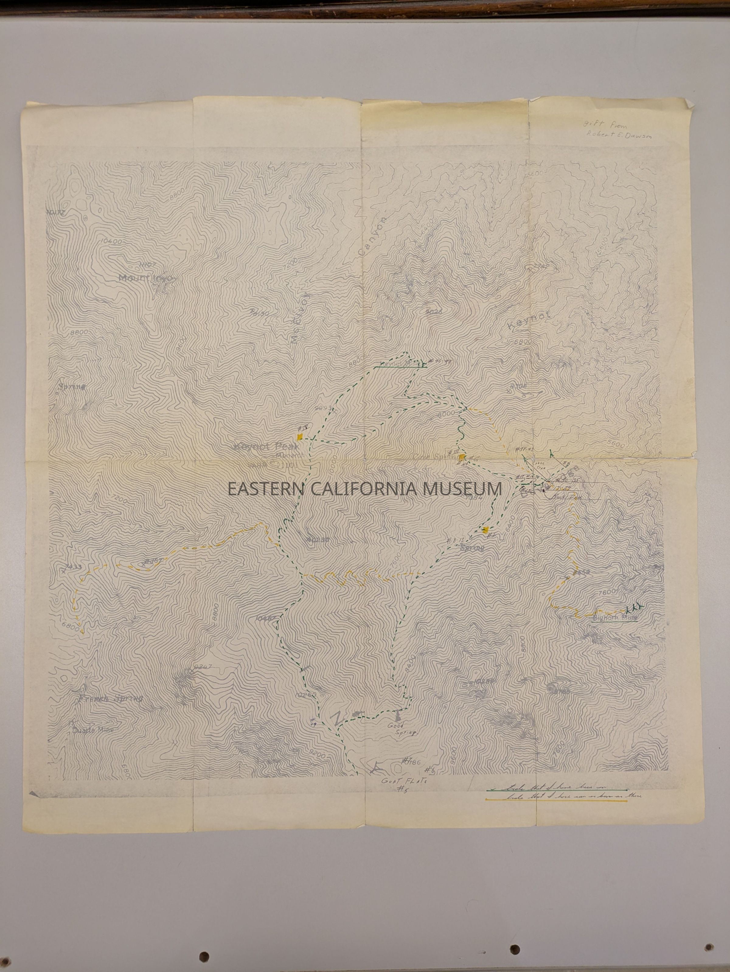
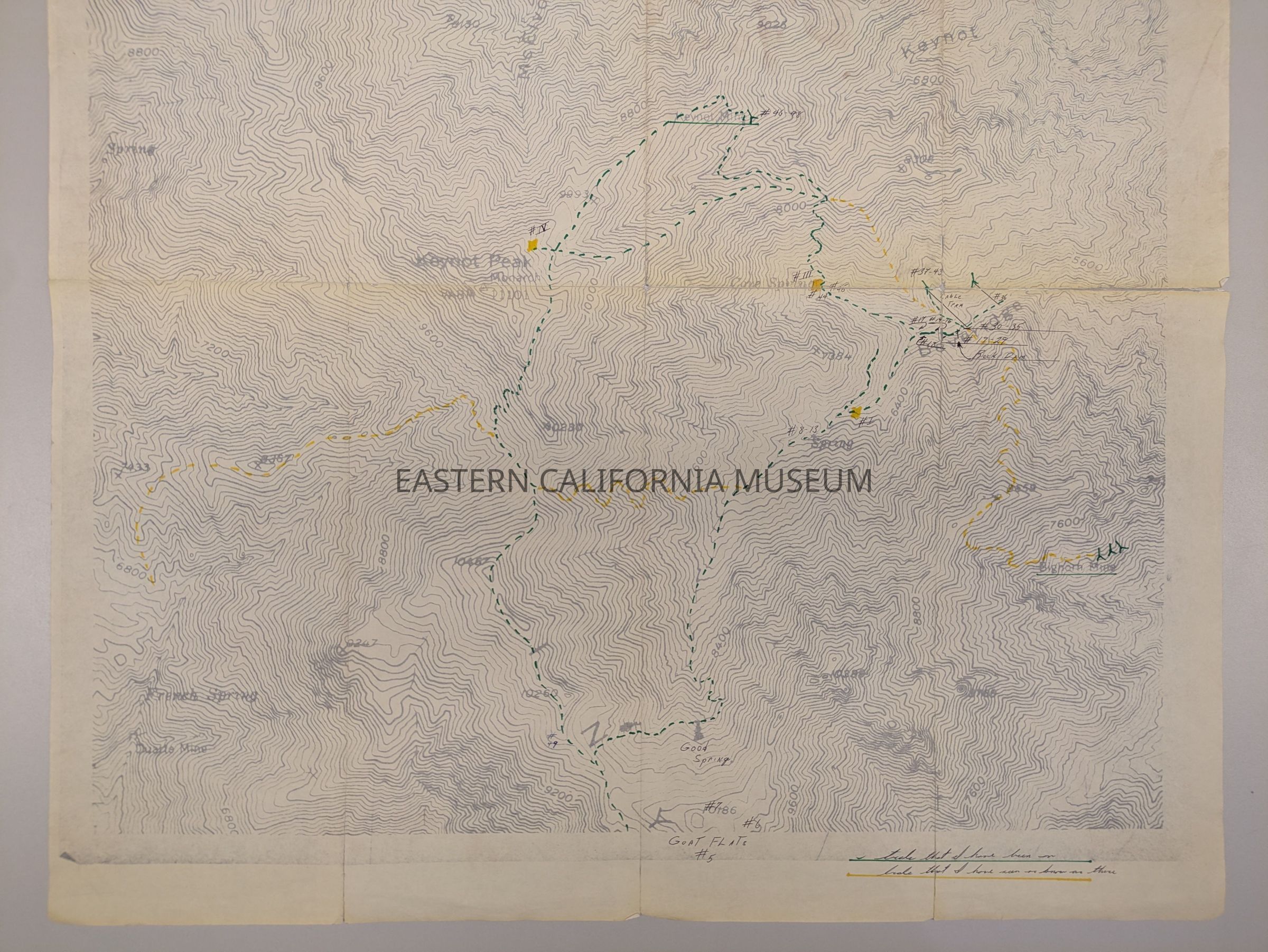
2025.0.136Description
Photocopied topo map of the Keynot Peak region, showing Beveridge, McElvoy Canyon, French Spring (among other springs), and mines. The hand-drawn path in green represents "trails that I [Robert Dawson] have been on" and the path in yellow represents "trails that I have seen or know are there."
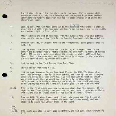
The numbers written on this map correspond to photos 2025.0.137-186.
It was a gift from Robert E. Dawson, but seems to have not been accessioned upon receipt.