Name/Title
MapEntry/Object ID
2025.3.11Description
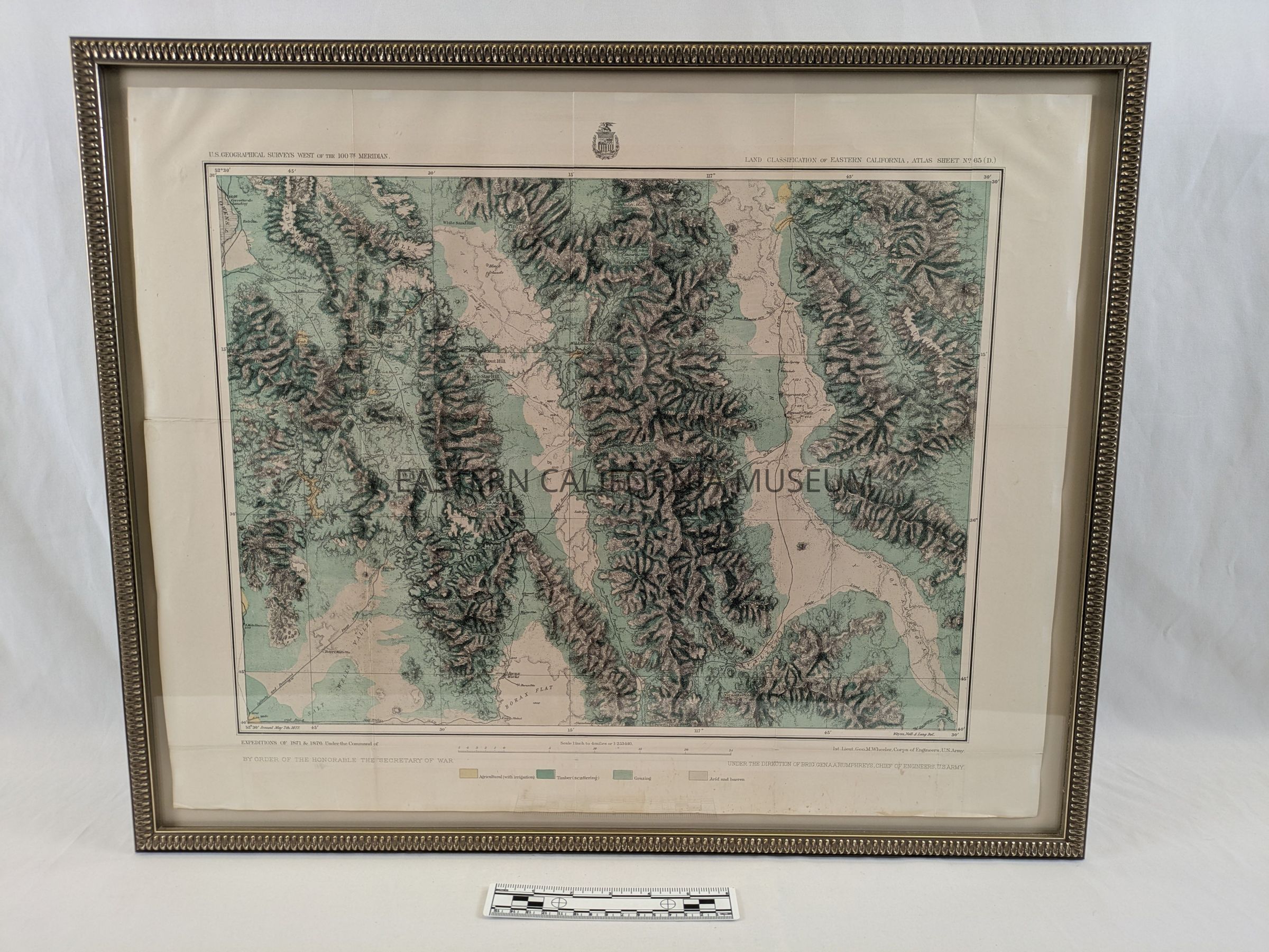
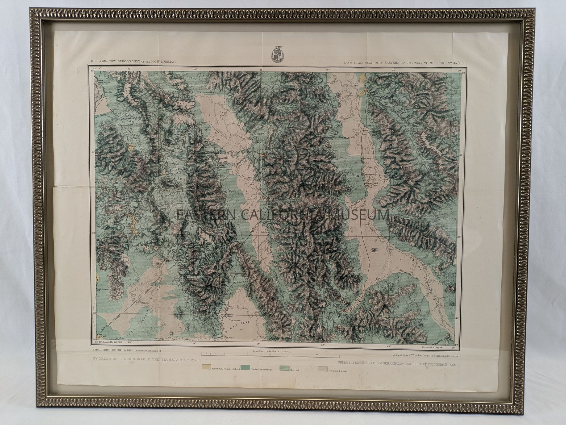
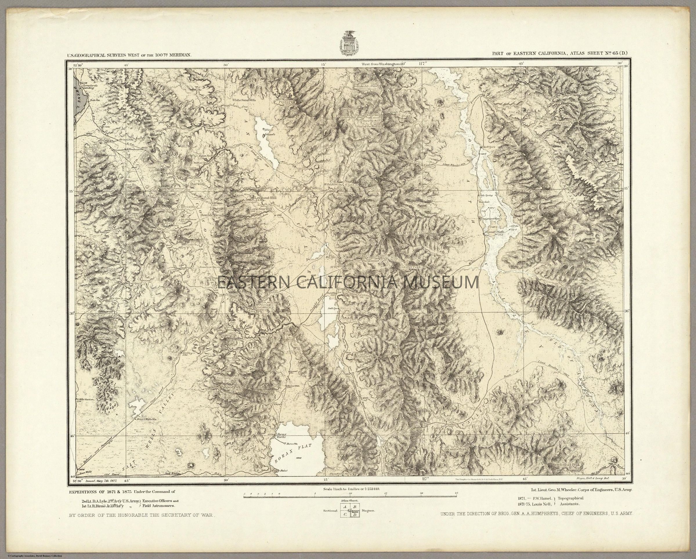
Framed map no. 65 (D) from the U.S. Geological Surveys West of the 100th Meridian, also referred to at the Wheeler Survey of 1871. It shows a section of Owens Lake in the upper left, the Panamint Valley, Death Valley, Argus Range, Panamint Range, and Funeral Range. Springs, wells, routes, and other items of note are included.Collection
Jeffrey Burbank Collection