Name/Title
PostcardEntry/Object ID
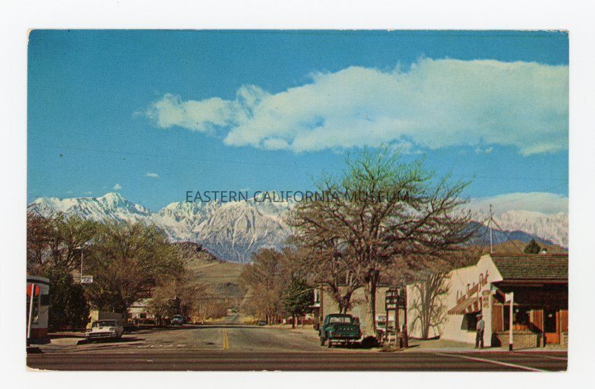
2019.22.8Description
Color photo postcard of a street scene looking toward the snow covered Sierra Nevada. A store on the right corner appears to be a Trading Post. Label on reverse says, "Lone Pine, Sierra Nevada: Lone Pine was named after a tall Jeffrey pine that stood along Lone Pine Creek, later washed out in a flood. In 1861 Bart and Alny [Alney] McGee built the first cabin in the valley. The mines of Cerro Gordo, Darwin, and Panamint City brought in a great number of immigrants. For many years Sept. 16, the anniversary of Mexico's liberation, was Lone Pine's day of celebration. Lone Pine Peak is 12,944 feet high with Mt. Whitney the highest (14,495 ft.). There are six peaks in the area over 14,000 ft. high. In 1872 an earthquake caused the land to drop 20 feet and took the lives of 26 people. At one time Mt. Whitney was named Fisherman's Peak. The first trail was built to the top of Mt. Whitney in 1881 and 20 years later people of Lone Pine raised the money to build a better trail to the top." Photo-color by Merle Porter. B-977. S-71919.Photograph Details
Subject Place
City
Lone PineCounty
Inyo CountyState/Province
CaliforniaCollection
Mono County Historical Society CollectionMade/Created
Artist Information
Artist
Porter, MerleRole
Photographer