Name/Title
MapEntry/Object ID
2022.13.41a-jDescription
Collection of 10 maps from Phil Pister's 1950 Convict Basin Lakes, Inyo National Forest, Study (thesis).
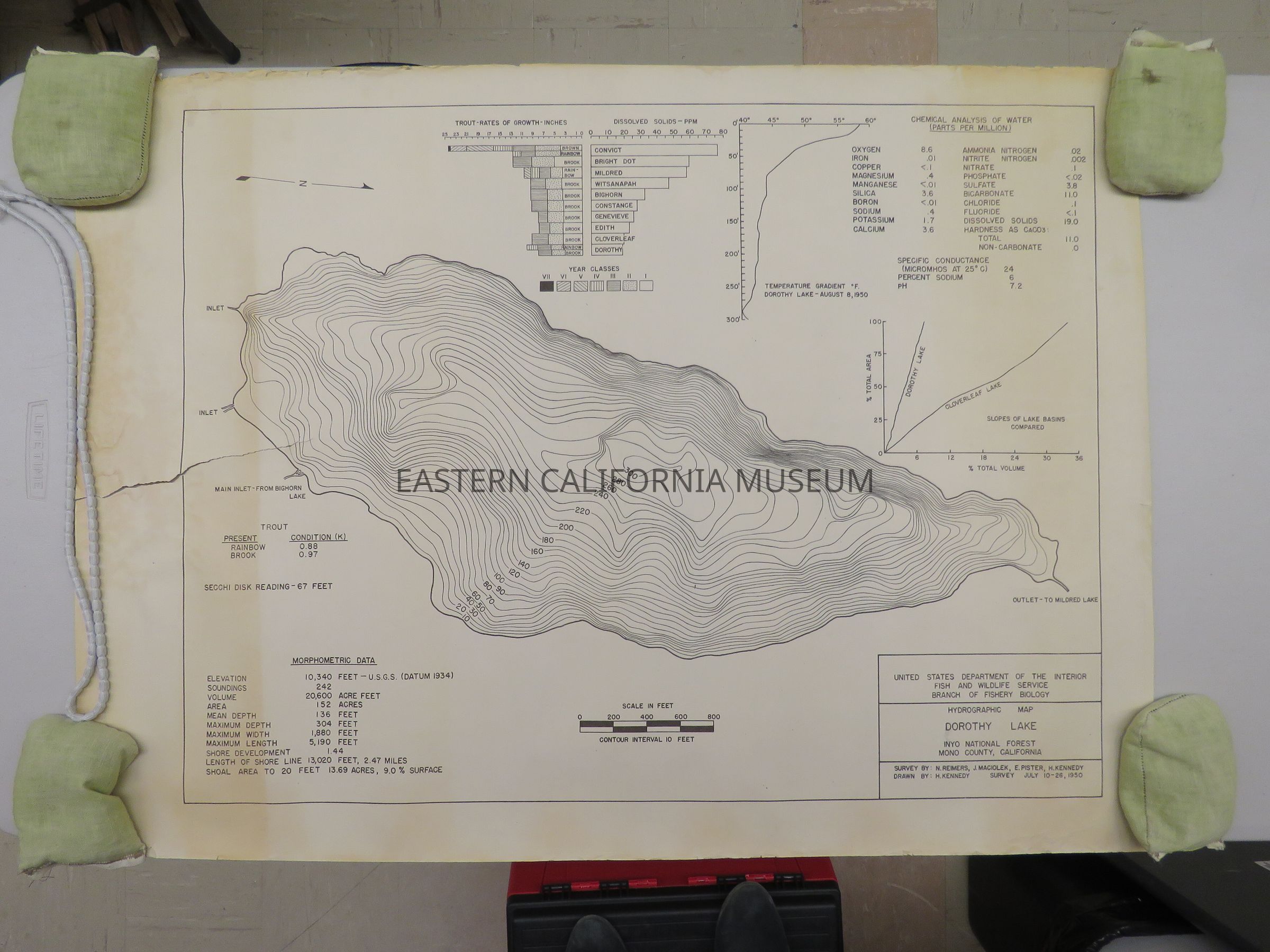
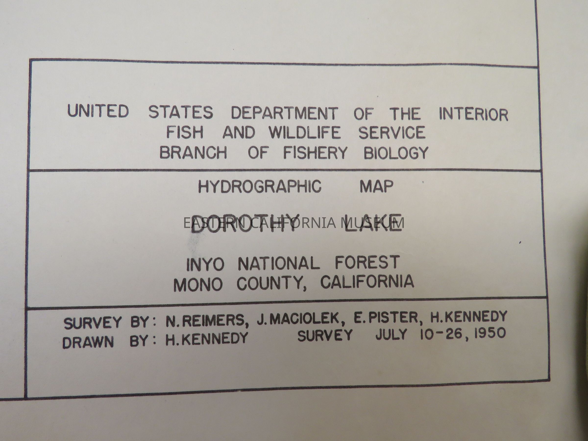
41a. Hydrographic Map, Dorothy Lake, 1950. Large 7.5" tear from left side. 32.5" x 24"
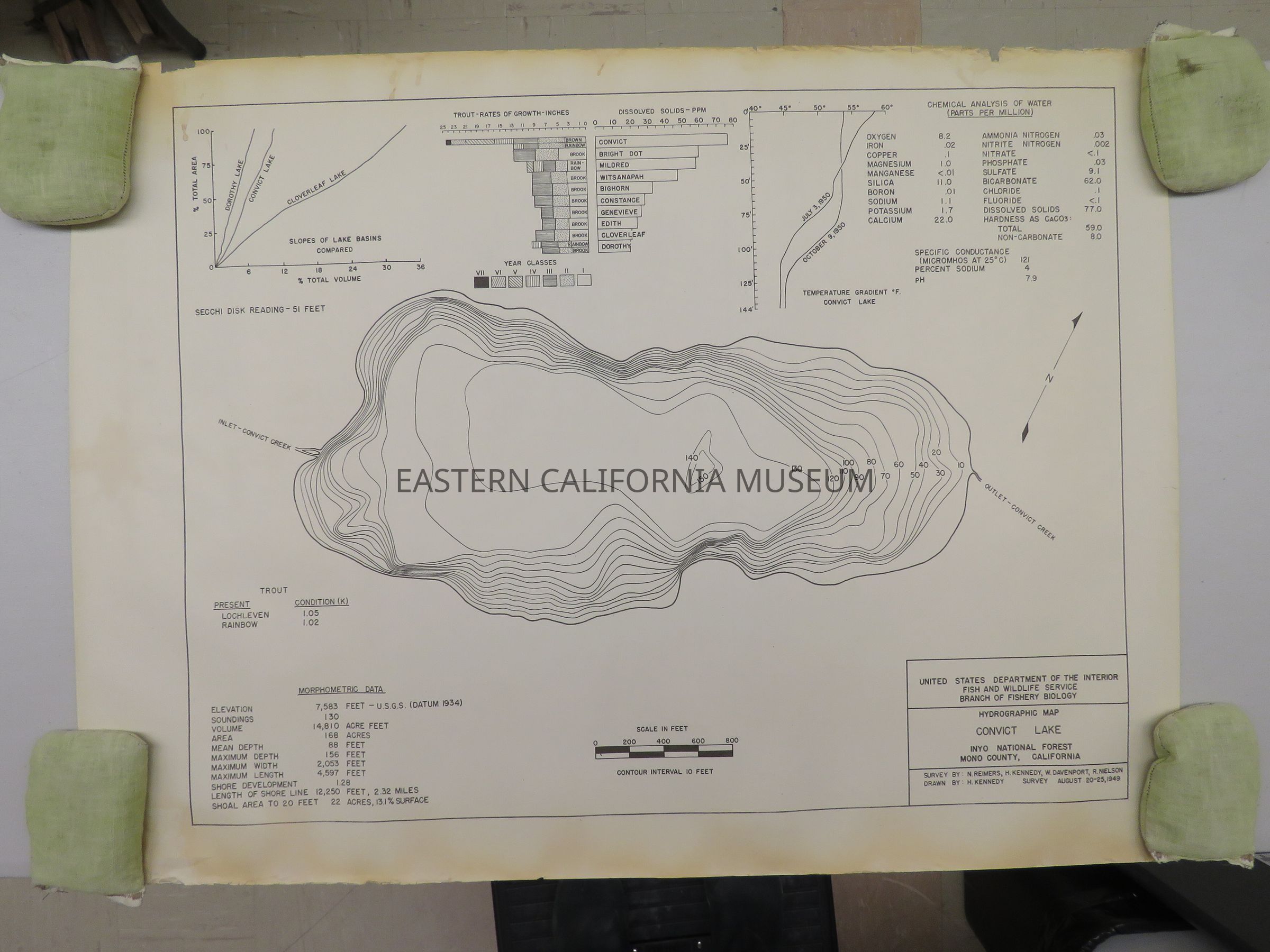
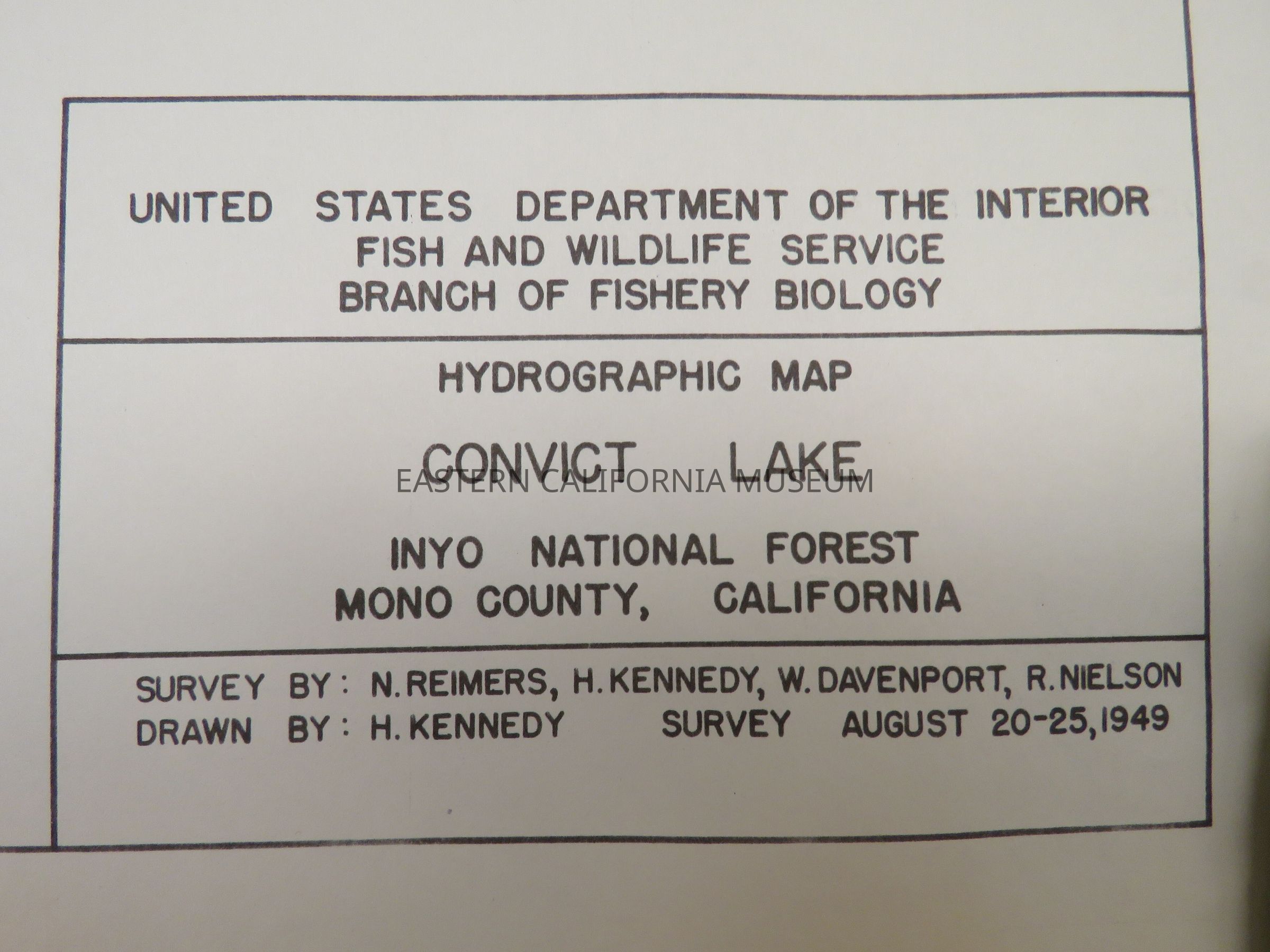
41b. Hydrographic Map, Convict Lake, 1949. 32.5" x 24"
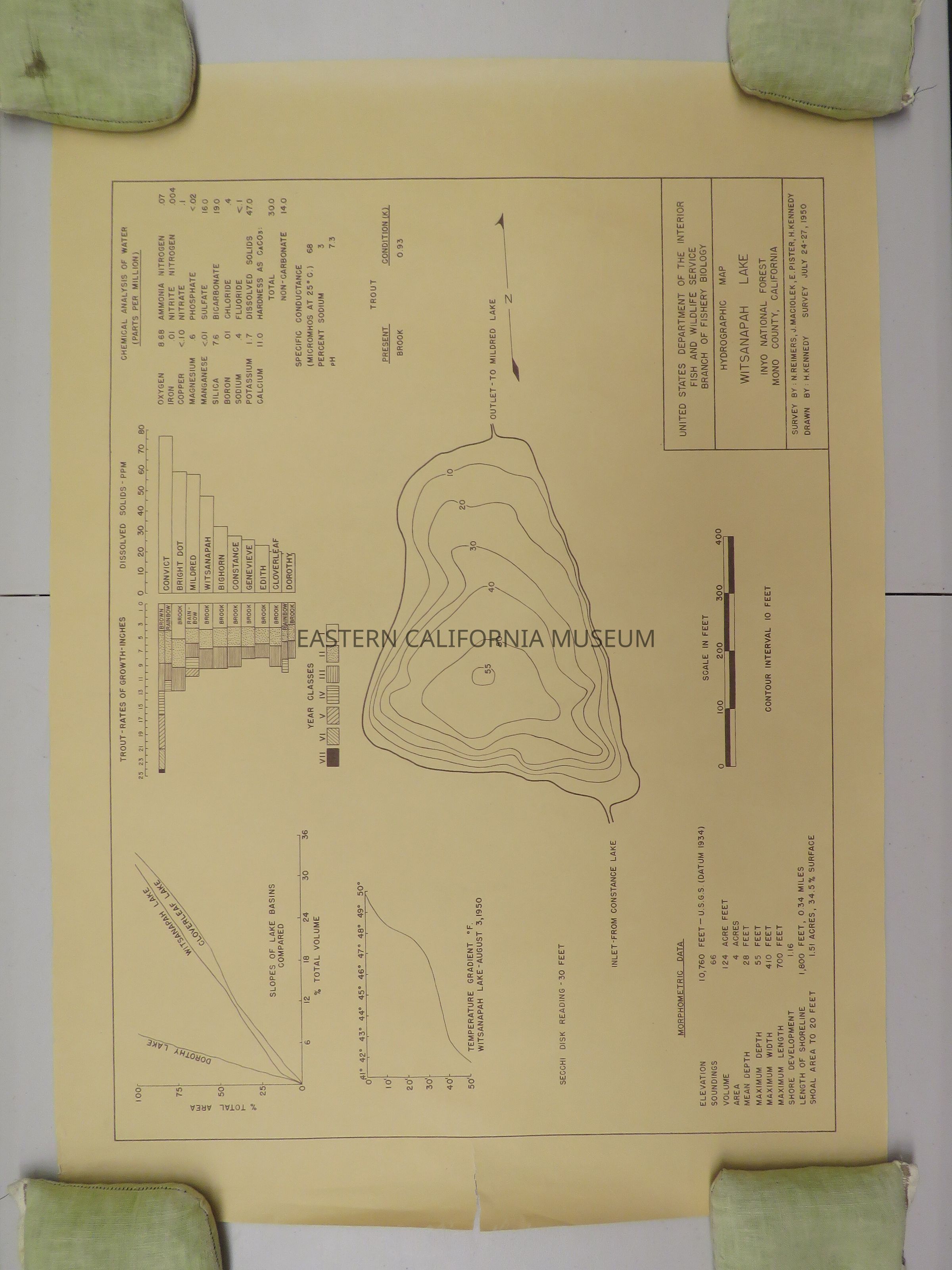
41c. Hydrographic Map, Witsanapah Lake, 1950. Small 2" tear from left side, four holes in corner, discolored (likely pinned up and light damage). 28.25" x 20.25"
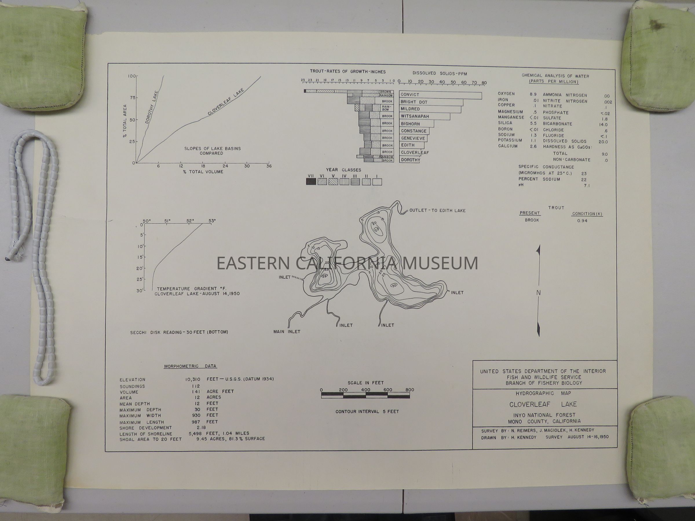
41d. Hydrographic Map, Cloverleaf Lake, 1950. Medium 4" tear from left side. 28.25" x 20.5"
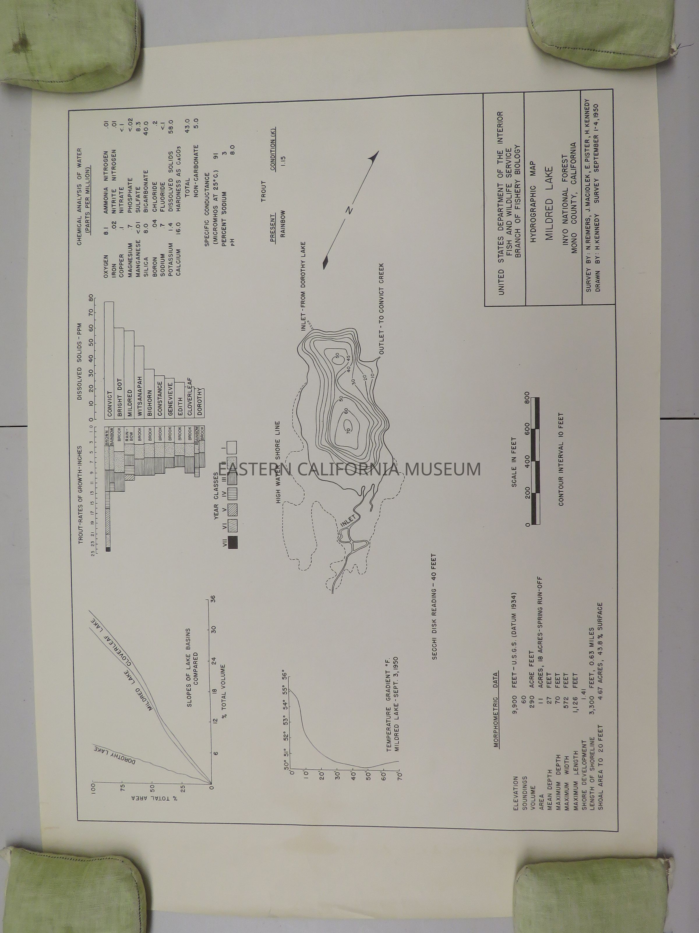
41e. Hydrographic Map, Mildred Lake, 1950. 28.25"x 20"
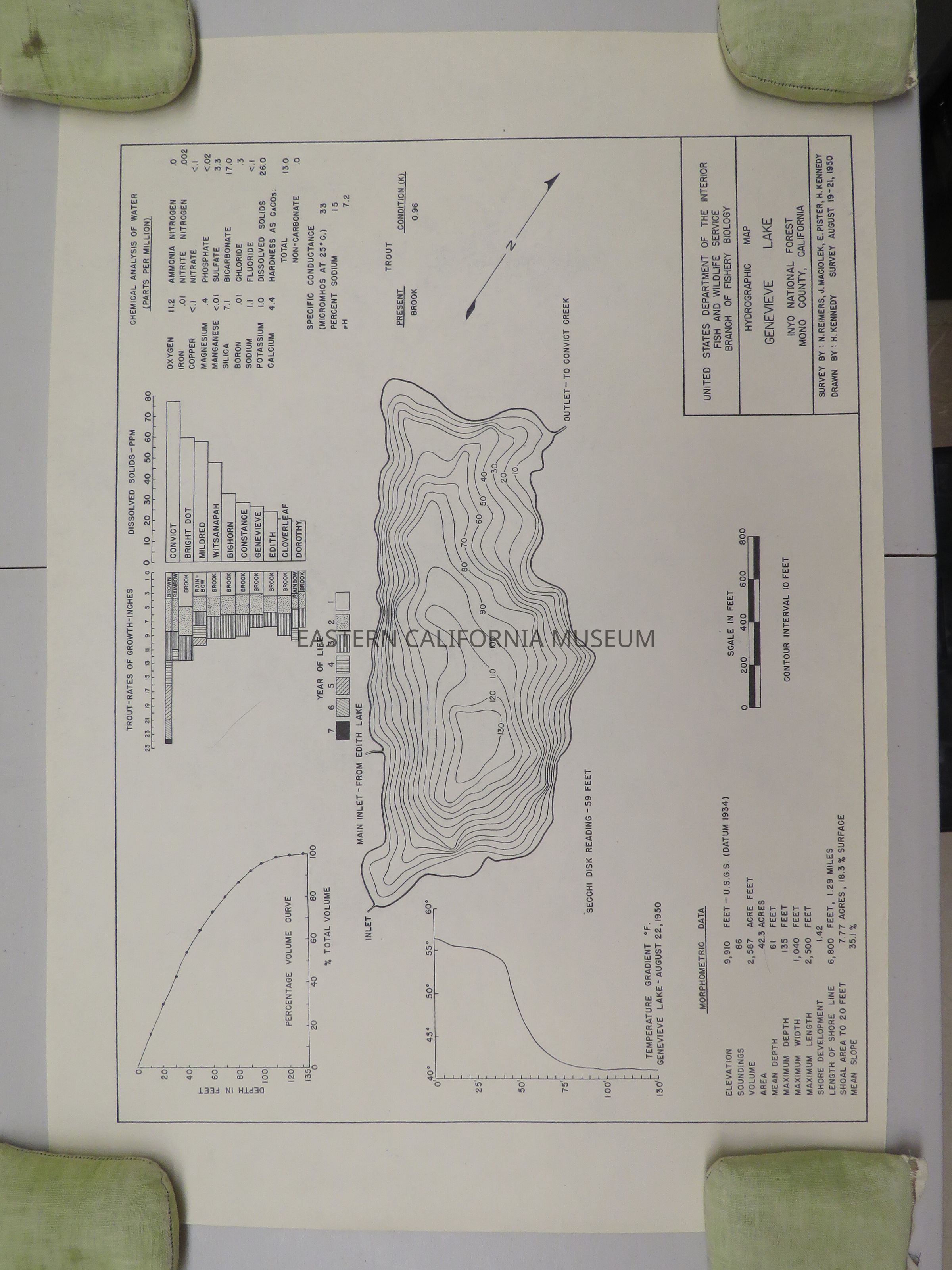
41f. Hydrographic Map, Genevieve Lake, 1950. 28.25" x 19.5"
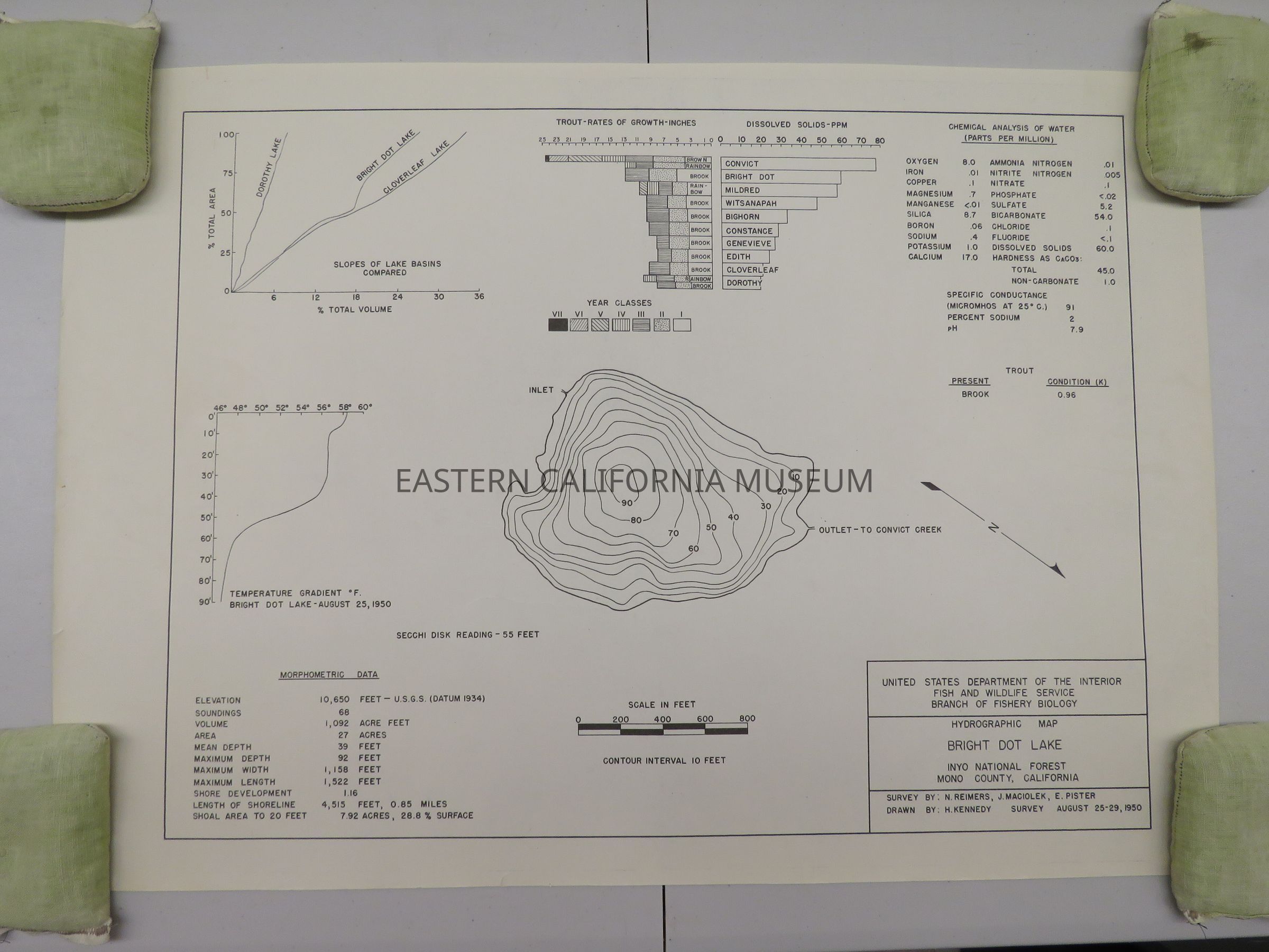
41g. Hydrographic Map, Bright Dot Lake, 1950. 27.75" x 19.75"
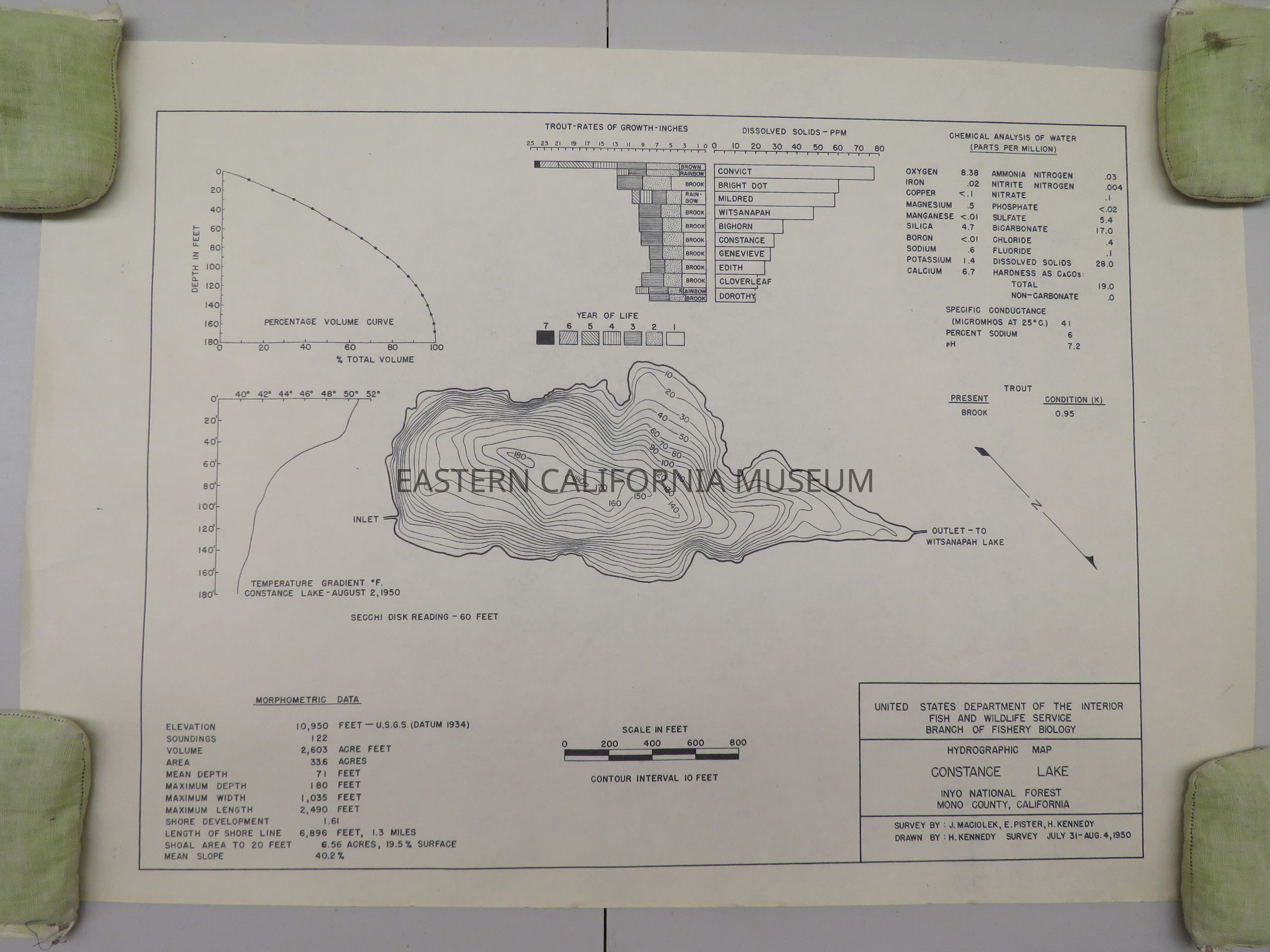
41h. Hydrographic Map, Constance Lake, 1950. 28.75" x 20"
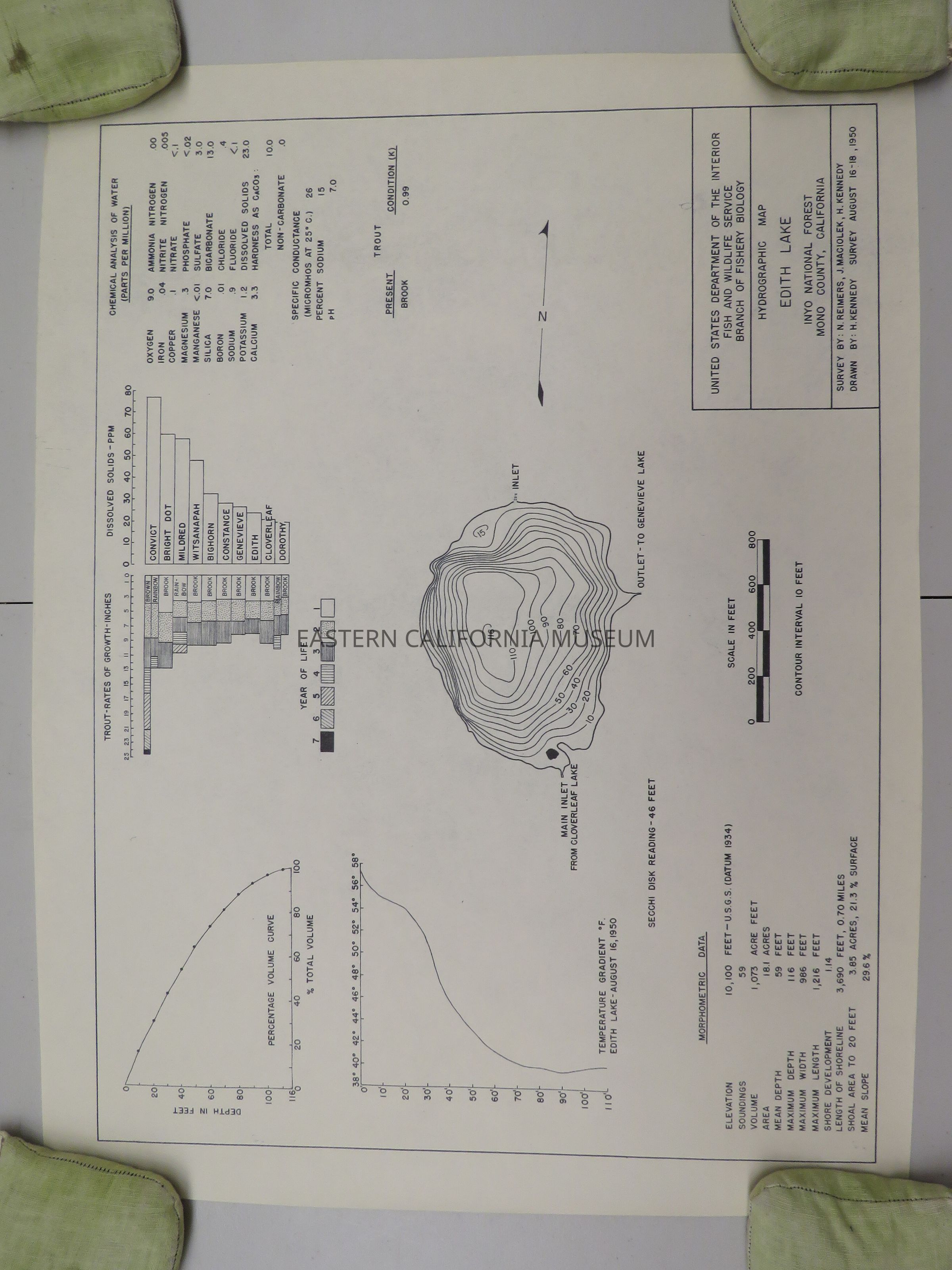
41i. Hydrographic Map, Edith Lake, 1950. 25.75" x 19.75"
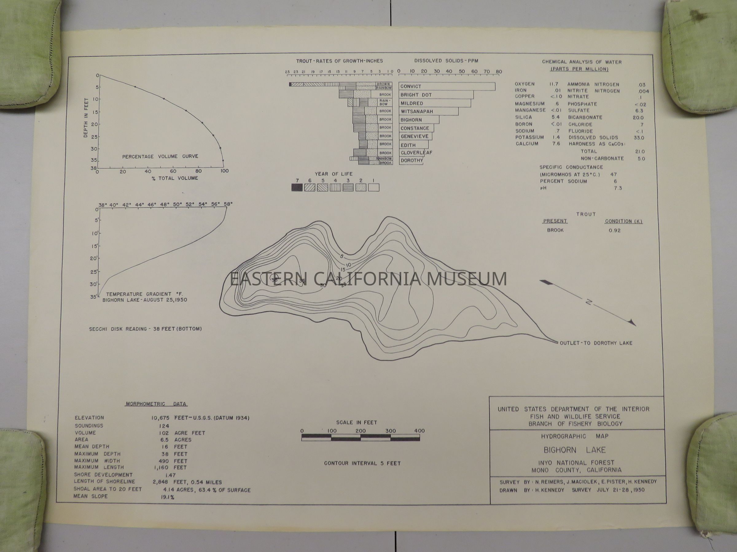
41j. Hydrographic Map, Bighorn Lake, 1950. 26.5" x 19.5"Map Details
Publisher
U.S. Department of the Interior, Fish and Wildlife Service, Branch of Fishery BiologyDate Published
1950