Name/Title
MapEntry/Object ID
1978.551.1Description
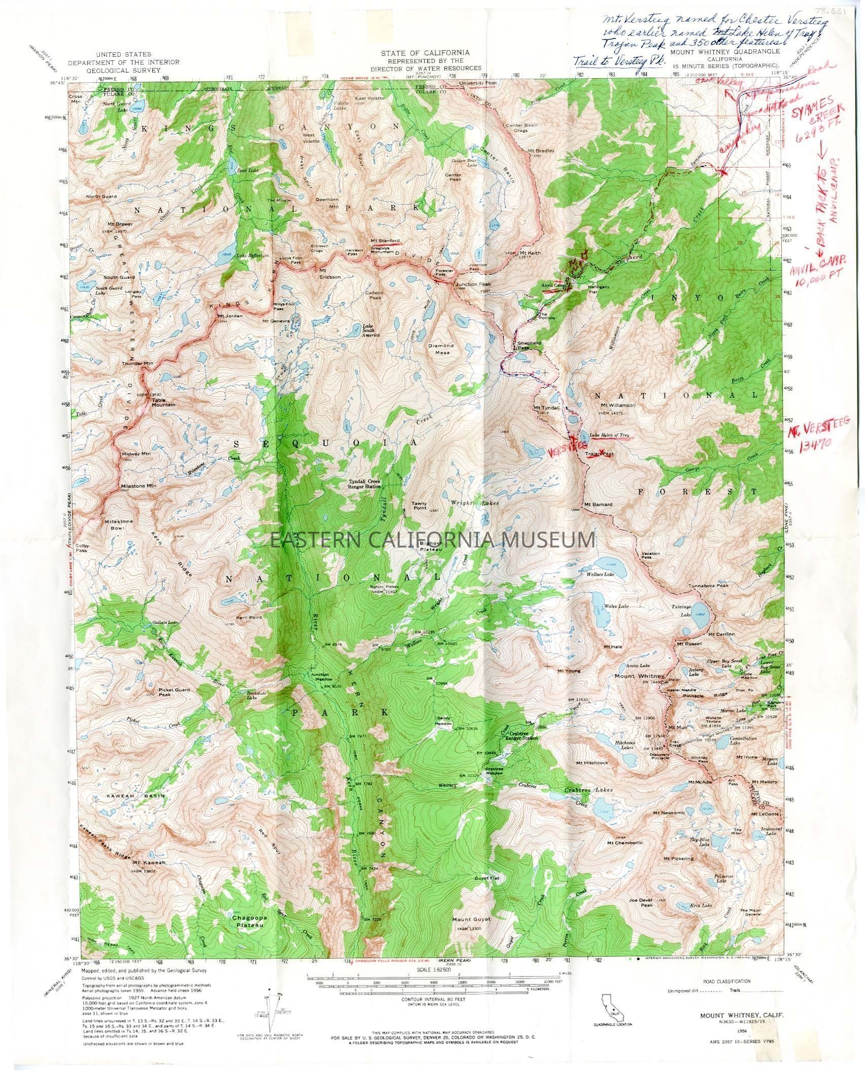
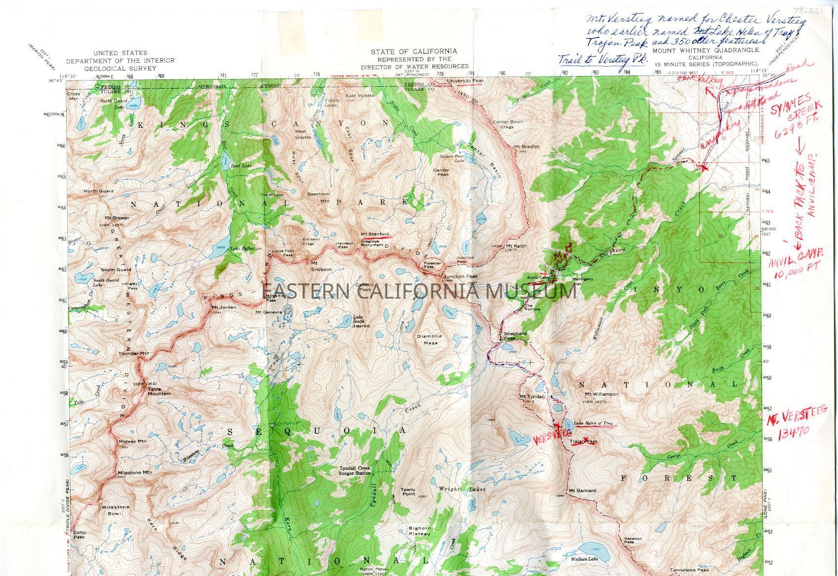
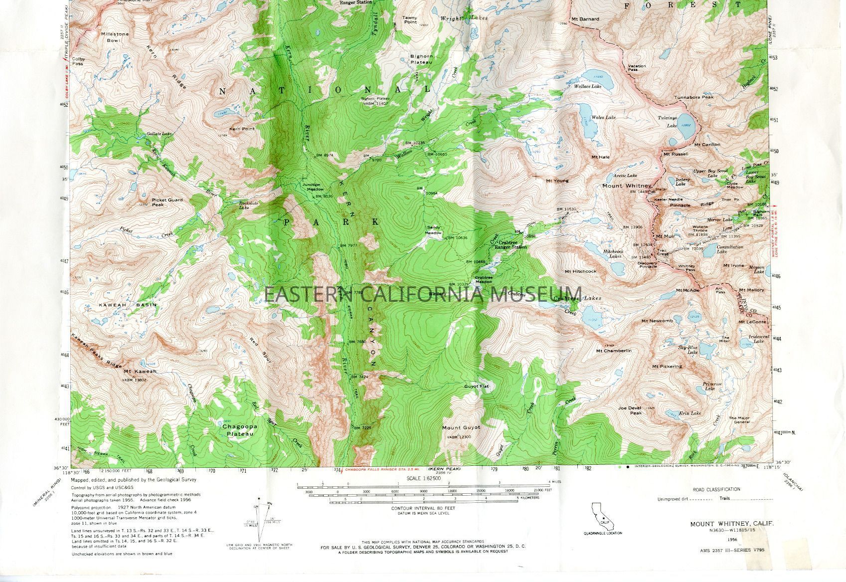
Topographical map of the Mt. Whitney Quadrangle (15 minute series, advance field check 1956) with the trail marked in red from Independence to Mt. Versteeg (13,470 ft.).
Written in blue ink on top right corner: Mt. Versteeg named for Chester Versteeg who earlier named Lake Helen of Troy, Trojan Peak, and 350 other features. Trail to Versteeg Pk.