Name/Title
Print, PhotographicEntry/Object ID
1969.120.2Description
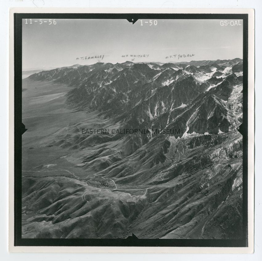
One of two pictures used in preparing modern topographic maps from aerial photographs. These are stereo pictures and areoblique pictures of the east face of the Sierra just west of Independence showing the new road up to Mt. Kearsarge. Pictures are numbered 1-49 and 1-50, dated 11/05/1956 from the U.S. Geological Survey. Community of 7 Pines and Onion Valley Road are visible.
This map has handwritten labels identifying Mt. Langley, Mt. Whitney, and Mt. Tyndall.Collection
Stewart MacKenzie CollectionMade/Created
Date made
November 5, 1956