HUB
Collections
Classifications
About
App
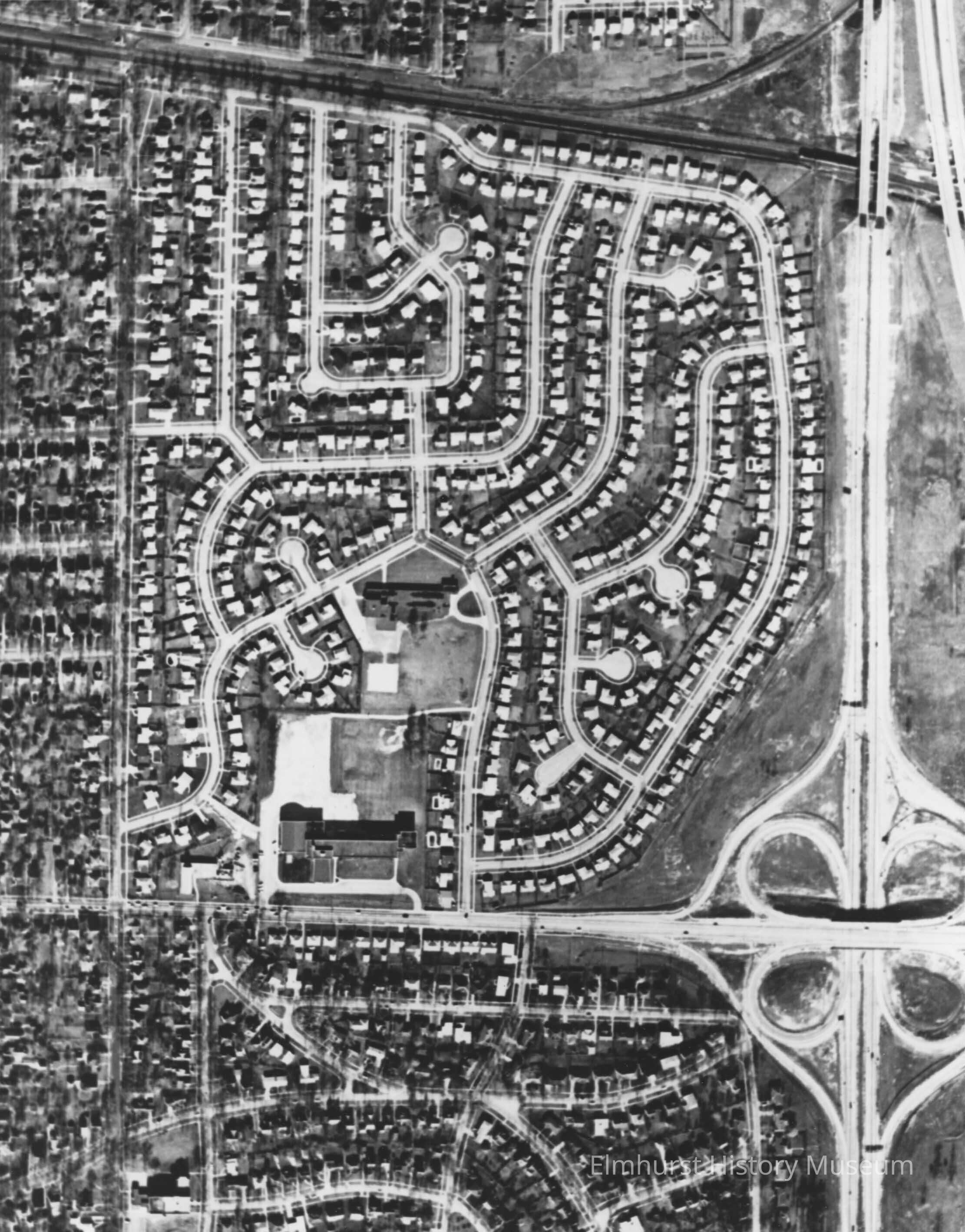
Brynhaven Subdivision
Photograph
-
Elmhurst History Museum
Name/Title
Brynhaven Subdivision
Entry/Object ID
M2011.1.6
Description
Aerial view of Brynhaven Subdivision. It is bordered by Poplar Avenue on the west, I-290 on the east, St. Charles Road on the south and Park Avenue on the north. It was developed circa 1954-1958.
Photograph Details
Type of Photograph
Black and White Print
Made/Created
Date made
circa 1958
Time Period
1950s
Lexicon
Nomenclature 4.0
Nomenclature Secondary Object Term
Print, Photographic
Nomenclature Primary Object Term
Photograph
Nomenclature Sub-Class
Graphic Documents
Nomenclature Class
Documentary Objects
Nomenclature Category
Category 08: Communication Objects