Name/Title
MapEntry/Object ID
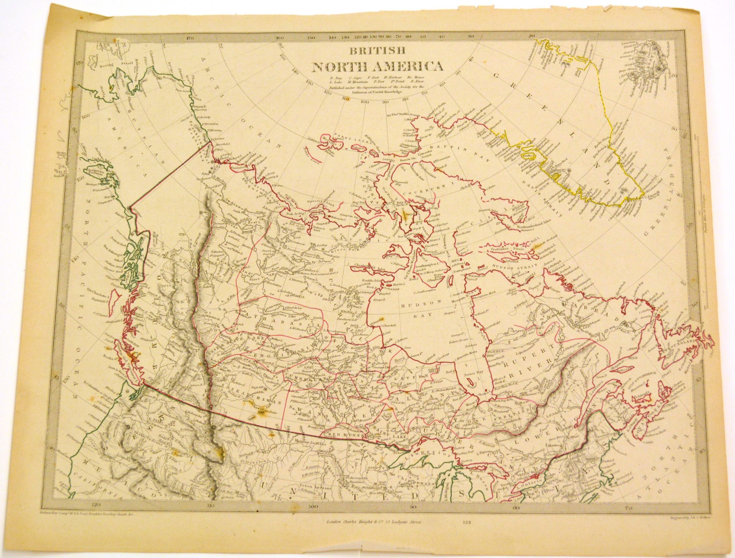
2002.05.01Description
Map of British North America c. 1850. The map illustrates the northern United States up through Alaska and the Arctic Ocean, including Greenland and Iceland. British territories are outlined in red, Alaska, labeled "Russian America," and the United States territories are outlined in green, Greenland is outlined in yellow, and Iceland is simply black and white. Engraved by J.&C. Walker, published London, Charles Knight and Co., 22 Ludgate Street. Map is a page torn from a book, measures 16 3/4 inches by 13 3/4 inches.Dimensions
Height
13-3/4 inWidth
16-3/4 in