Name/Title
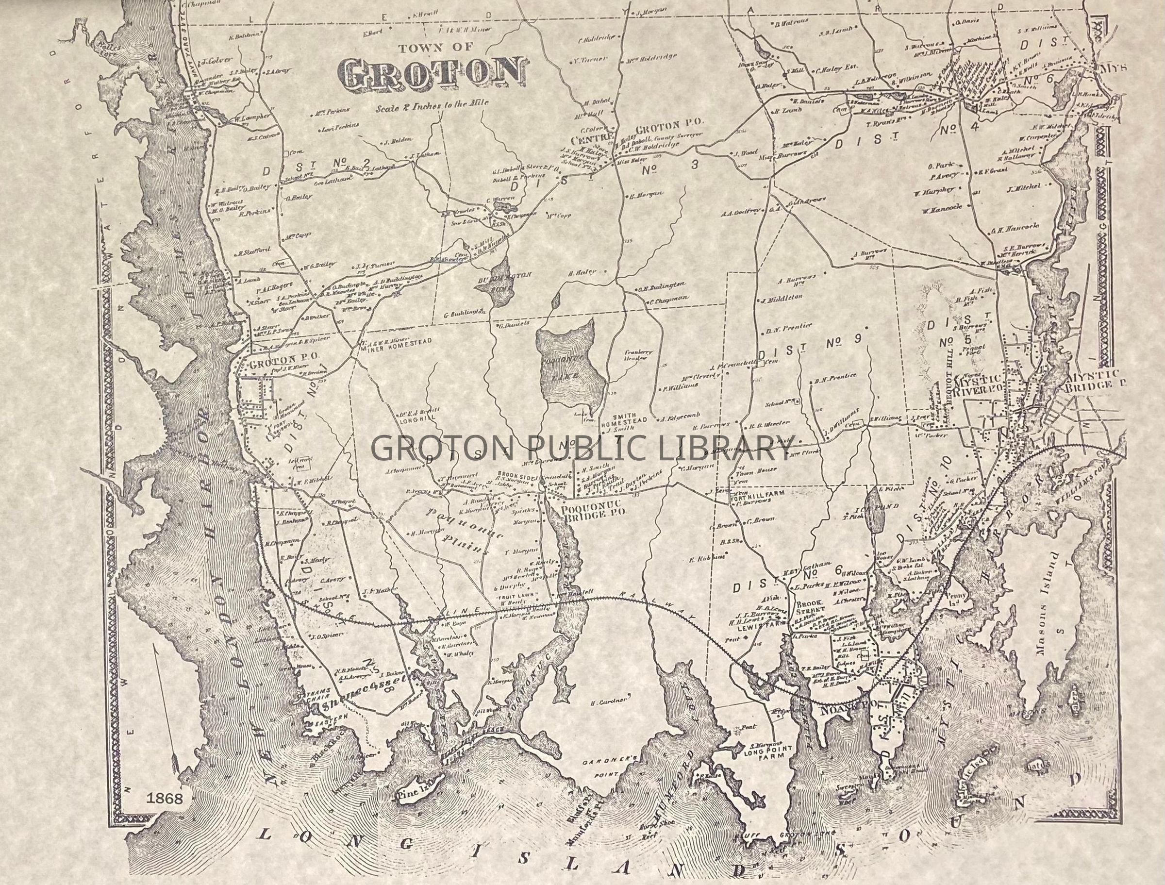
Beers Atlas Map of Groton, 1868Entry/Object ID
2026.023.003Scope and Content
Map of "Town of Groton," showing all 9 districts, published by Beers Atlas, 1868. Individual land owners, businesses, churches, cemeteries and schools are identified. Original map and 2 reproduction copies printed in 1976.Collection
Streeter CollectionAcquisition
Accession
2026.023Source or Donor
Mr. James L. StreeterAcquisition Method
DonationLexicon
Nomenclature 4.0
Nomenclature Secondary Object Term
MapNomenclature Primary Object Term
CartographNomenclature Sub-Class
Graphic DocumentsNomenclature Class
Documentary ObjectsNomenclature Category
Category 08: Communication ObjectsSearch Terms
Noank, Groton Bank, Groton Borough, Groton Long Point, Mystic, Center Groton, Poquonnock Bridge, Pleasant Valley, Old Mystic, Shoreline RailroadArchive Details
Creator
Beers AtlasDate(s) of Creation
1868Archive Size/Extent
3 MapsArchive Notes
Date(s): 1868