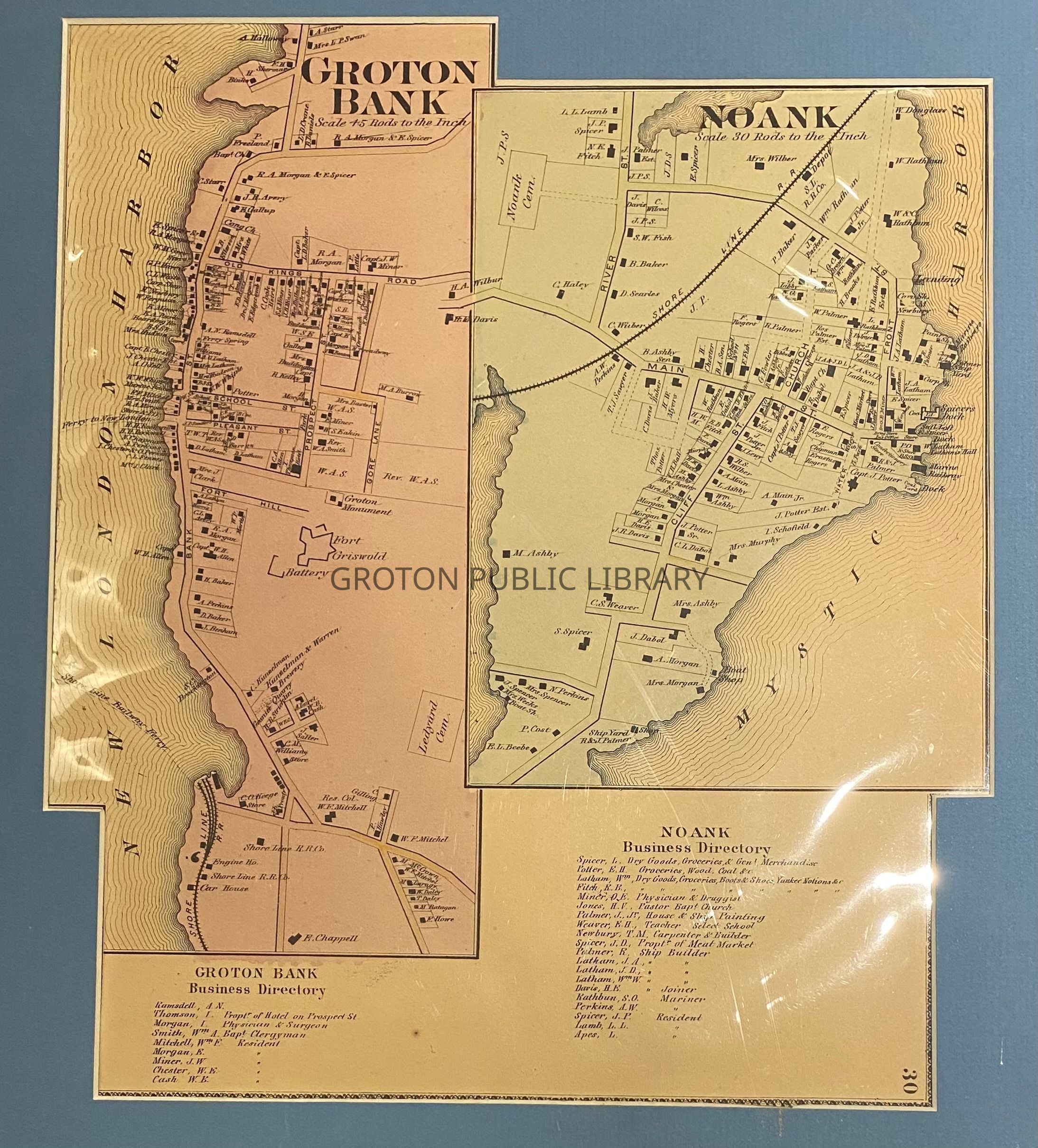
Beers Atlas Map of Groton Bank and Noank, 1868

Beers Atlas, Groton Bank and Noank, 1868

Name/Title

Beers Atlas Map of Groton Bank and Noank, 1868

Entry/Object ID

2026.023.002

Scope and Content

Map of "Groton Bank and Noank," with corresponding business directory, published by Beers Atlas, 1868. Individual home owners, businesses, cemeteries and churches are clearly labeled. 2 copies.

Collection

Streeter Collection

Acquisition

Accession

2026.023

Source or Donor

Mr. James L. Streeter

Acquisition Method

Donation

Lexicon

Nomenclature 4.0

Nomenclature Secondary Object Term

Map

Nomenclature Primary Object Term

Cartograph

Nomenclature Sub-Class

Graphic Documents

Nomenclature Class

Documentary Objects

Nomenclature Category

Category 08: Communication Objects

Search Terms

Thames Street, School St., Pleasant St., Fort Street, Bank Street, Colonel Ledyard Cemetary, Fort Griswold, Fort Griswold Battlefield State Park, City of Groton, Groton Borough, Shoreline Railroad, Noank Baptist Church, Noank Valley Cemetery, Palmer Shipyard, Main Street, Old Kings Road, Noank
Archive Details

Creator

Beers Atlas

Date(s) of Creation

1868

Archive Size/Extent

2 Maps

Archive Notes

Date(s): 1868