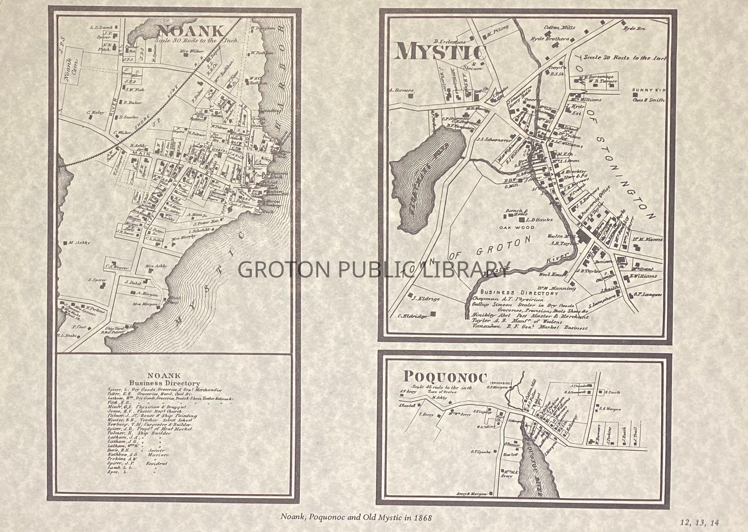
Beers Atlas Map of Poquonnock Bridge, Noank and Old Mystic, 1868
Entry/Object ID
2026.023.004
Scope and Content
Reproduction print, maps of Poquonnock Bridge, Noank and Old Mystic, published by Beers Atlas, 1868 and reprinted by the Mystic River Historical Society in 1976. Individual land owners, businesses, churches, cemeteries and schools are identified.
Collection
Streeter Collection
Acquisition
Accession
2026.023
Source or Donor
Mr. James L. Streeter
Acquisition Method
Donation
Lexicon
Nomenclature 4.0
Nomenclature Secondary Object Term
Map
Nomenclature Primary Object Term
Cartograph
Nomenclature Sub-Class
Graphic Documents
Nomenclature Class
Documentary Objects
Nomenclature Category
Category 08: Communication Objects
Search Terms
Noank, Poquonnock Bridge, Old Mystic, Shoreline Railroad