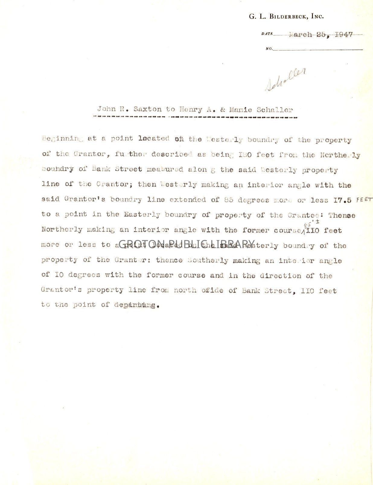
Document - G.L. Bilderbeck, Inc. Date March 25, 1947 (Schaller is handwritten in pencil, along with a few other notations.) John R. Saxton to Henry A. & Mamie Schaller, Property measurements.
Document - G.L. Bilderbeck, Inc. Date March 25, 1947 ("Schaller" is handwritten in pencil, along with a few other notations.) John R. Saxton to Henry A. & Mamie Schaller, Property measurements.
Entry/Object ID
2016.1.1206
Scope and Content
A copy of a form document on white paper with black print, typed with typoss. It begins, "G.L. Bilderbeck, Inc. Date March 25, 1947 No______ ("Schaller" is handwritten in pencil, along with a few other notations.) John R. Saxton to Henry A. & Mamie Schaller, Beginning at a point located on the Westerly boundry of the property of the Grantor, further decribed as being 180 feet from the Northerly boundry of Bank Street measured along the said Westerly property of the grantor,;;;" This seems to be a duplicate??
Collection
James L. Streeter Collection
Acquisition
Accession
2016.1
Source or Donor
Streeter, James L.
Acquisition Method
Gift
Lexicon
Nomenclature 4.0
Nomenclature Tertiary Object Term
Survey, Land
Nomenclature Secondary Object Term
Map
Nomenclature Primary Object Term
Note
Nomenclature Primary Object Term
Cartograph
Nomenclature Sub-Class
Other Documents
Nomenclature Sub-Class
Graphic Documents
Nomenclature Class
Documentary Objects
Nomenclature Category
Category 08: Communication Objects
LOC Thesaurus for Graphic Materials
Business & finance, Measuring
Search Terms
Communications & Public Utilities, Real Estate, Records, Land, Bank Street, G.L. Bilderbeck Incorporated Engineers and Architects, Land Records
Archive Details
Creator
G.L. Bilderbeck, Inc.
Date(s) of Creation
Mar 25, 1947
Restrictions
Access: Discolouration/fading, surface soiling, wear and wrinkles
General Notes
Note
Status: Good
Status By: Maureen A. McClellan
Status Date: 2020-01-27