Name/Title
Groton Geological Survey, 1934-1955Entry/Object ID
2026.023.014Scope and Content
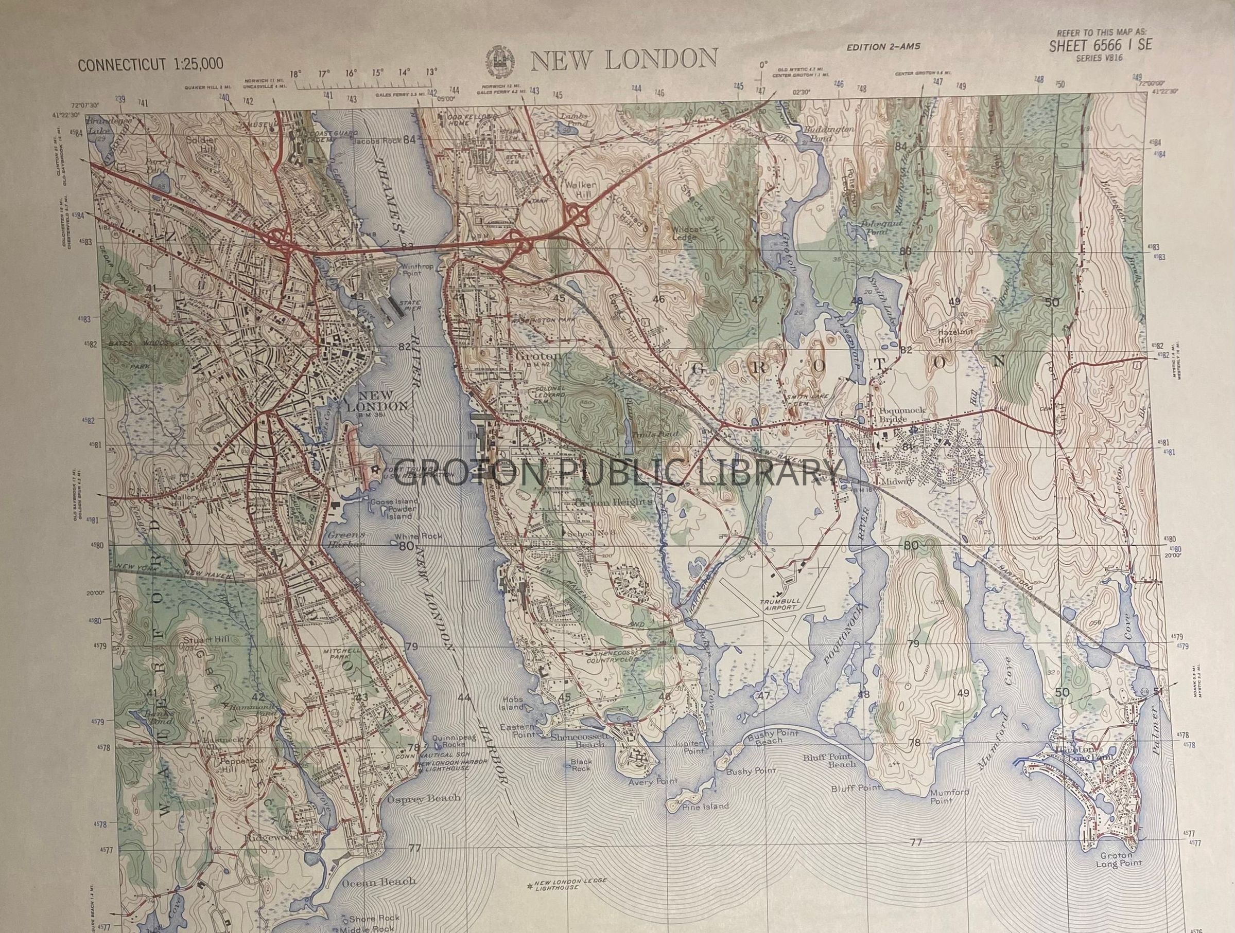
Map, "New London," depicting a full view of Groton from the Thames River to Palmer Cove, printed by the Army Map Service. Original map compiled by the U.S. Geological Survey, 1934, revised 1949, copied from the USCG 1955.Collection
Streeter CollectionAcquisition
Accession
2026.023Source or Donor
Mr. James L. StreeterAcquisition Method
DonationLexicon
Nomenclature 4.0
Nomenclature Secondary Object Term
MapNomenclature Primary Object Term
CartographNomenclature Sub-Class
Graphic DocumentsNomenclature Class
Documentary ObjectsNomenclature Category
Category 08: Communication ObjectsSearch Terms
New London Harbor, Avery Point, Eastern Point, Baker's Cove, Pine Island, Bushy Point, Bluff Point, Poquonnock River, Mumford Cove, Palmer CoveArchive Details
Creator
U.S. Army Map ServiceDate(s) of Creation
1934 - 1955Archive Notes
Date(s) Created: 1934-1955