Name/Title
Highway SurveyEntry/Object ID
2026.014.077Scope and Content
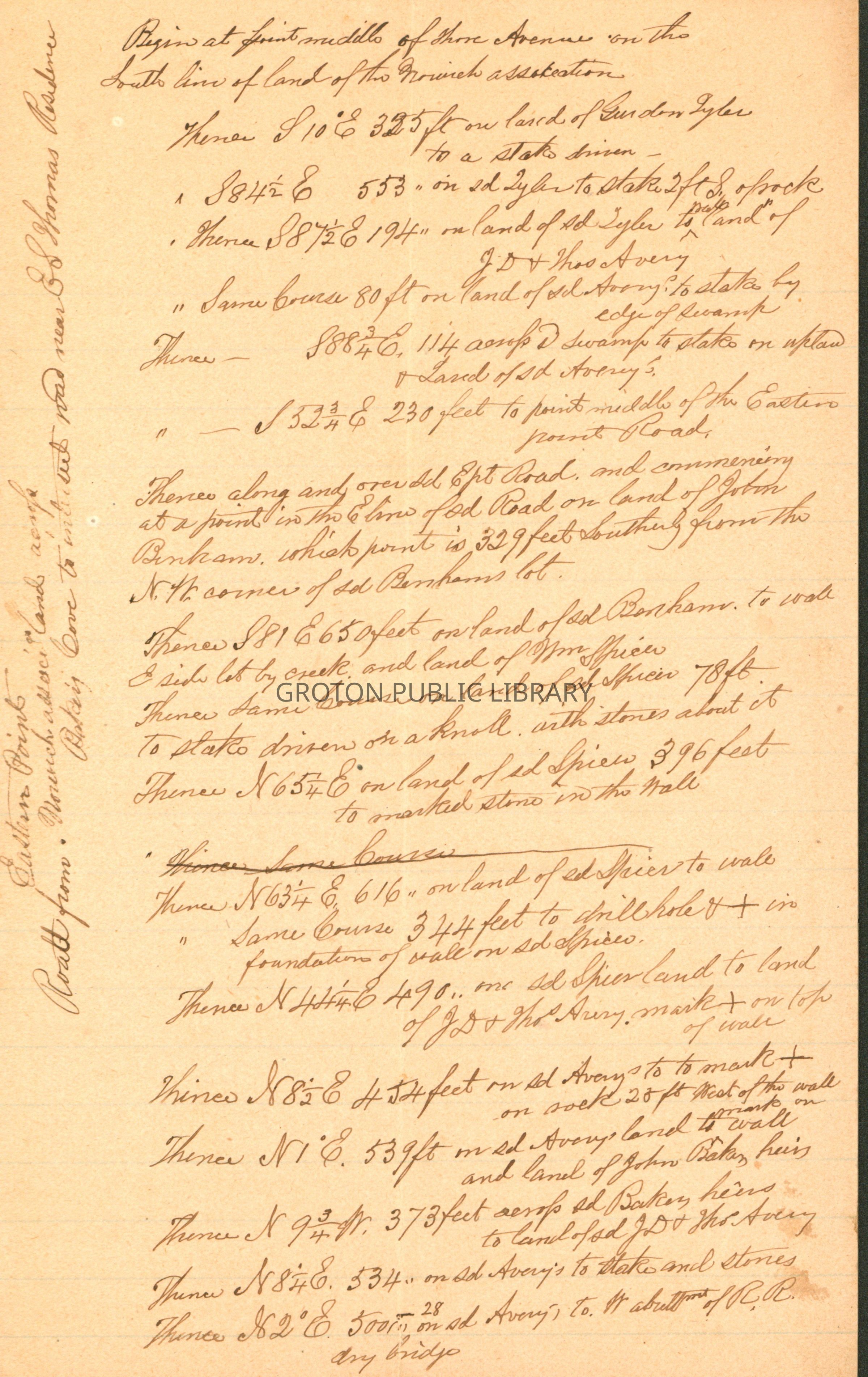
Survey for the layout of a road running from Eastern Point, across Baker's Cove to intersect the road near E. S. Thomas' house AND from the highway near the railroad viaduct out to Eastern Point Road near the home of Frederick Bill, undated.
The road would begin at a point on Shore Avenue and run across lands of the Norwich Association, Gurdon Tyler, J.D. Avery, Thomas Avery, Eastern Point Road, John Benham, William Spicer, John Baker, Railroad, J.J. Mathis and Elisha S. Thomas, and end at the road leading from the Poquonnock Depot to Groton.
The second road would begin in the center of the highway across Baker's Cove and cross the lands of J.J. Mathis, Charles D. Avery and Christopher Avery, and end at the Eastern Point Road.Collection
Lacerte CollectionAcquisition
Accession
2026.014Source or Donor
James LacerteAcquisition Method
GiftLexicon
Search Terms
Road Construction, Eastern Point, Baker's Cove, Railroad Bridge, Railroads