Name/Title
Highway Survey, 1818Entry/Object ID
2026.014.037Scope and Content
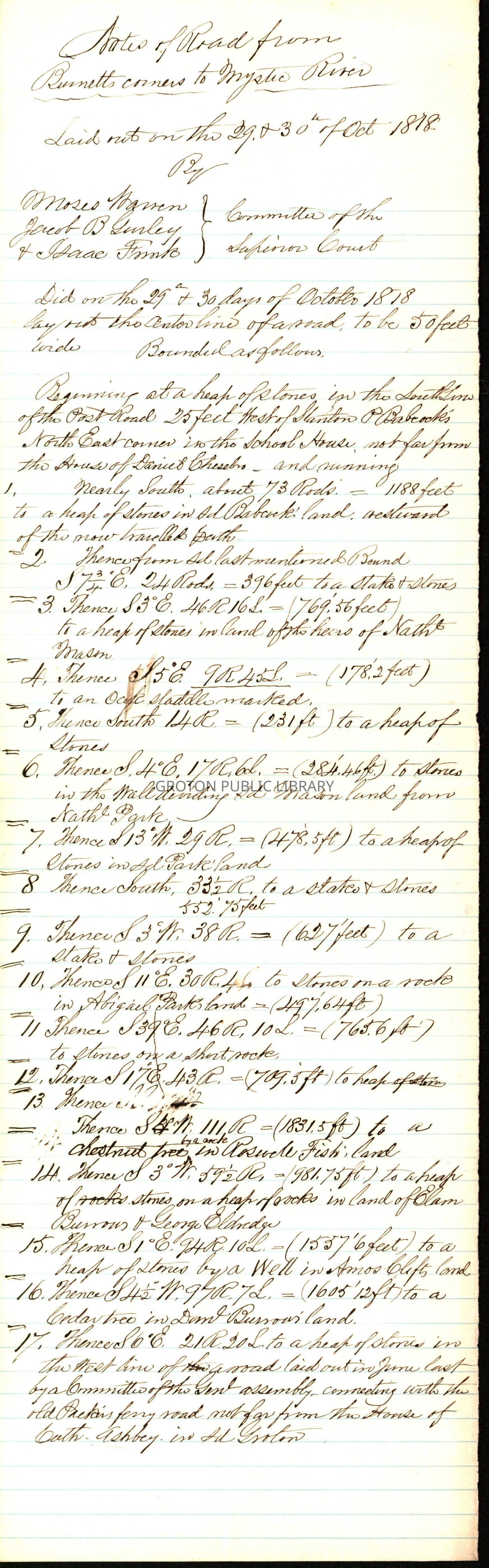
Notes on road from Burnett's Corners to Mystic River, laid out October 30, 1818 by Moses Warren, Isaac Frink and Jacob B. Lurley.
The new road passed through or by the lands of Stanton Babcock, Daniel Chesebro, Nathaniel Mason, Nathaniel Park, Abigal Park, Elam Burrows, George Eldredge, Daniel Burrows, Capt. Ashby.Collection
Lacerte CollectionAcquisition
Accession
2026.014Source or Donor
James LacerteAcquisition Method
GiftLexicon
Nomenclature 4.0
Nomenclature Tertiary Object Term
Survey, LandNomenclature Secondary Object Term
MapNomenclature Primary Object Term
CartographNomenclature Sub-Class
Graphic DocumentsNomenclature Class
Documentary ObjectsNomenclature Category
Category 08: Communication ObjectsSearch Terms
Road Construction, Burnett's Corner, Mystic RiverArchive Details
Date(s) of Creation
1818Archive Notes
Date(s): 1818