Name/Title
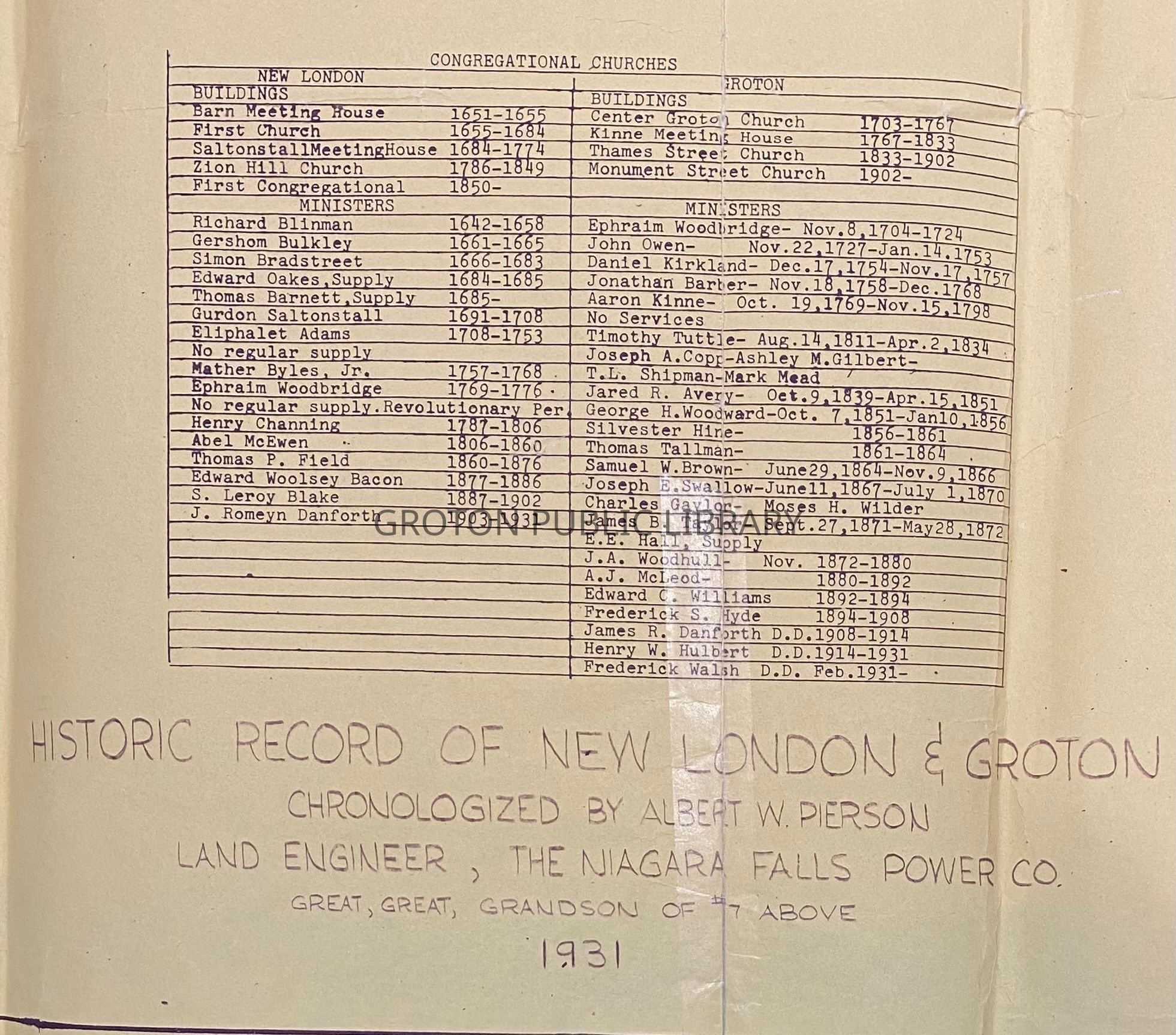
Historic Record of New London and Groton, 1931Entry/Object ID
2026.011.006Scope and Content
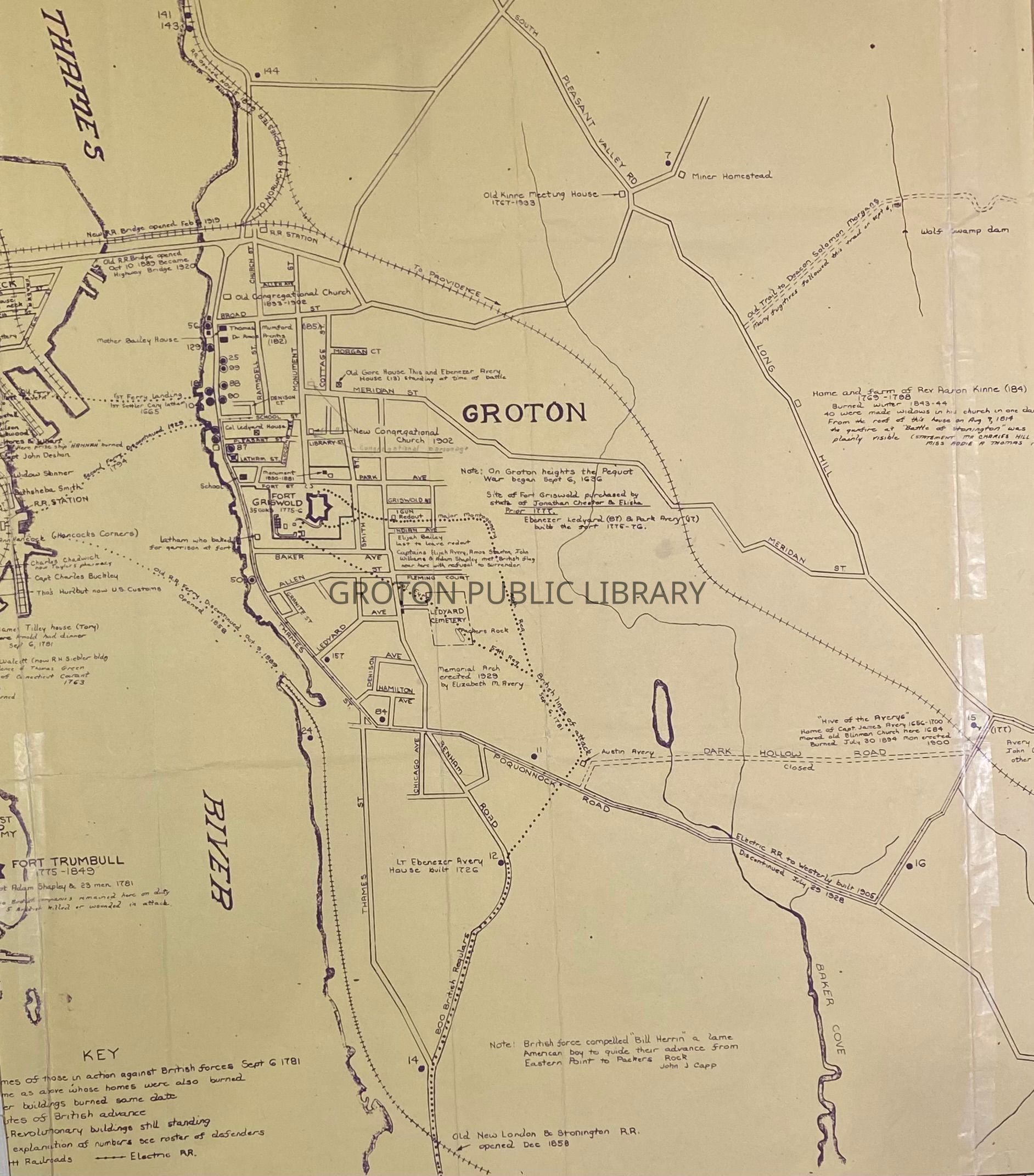
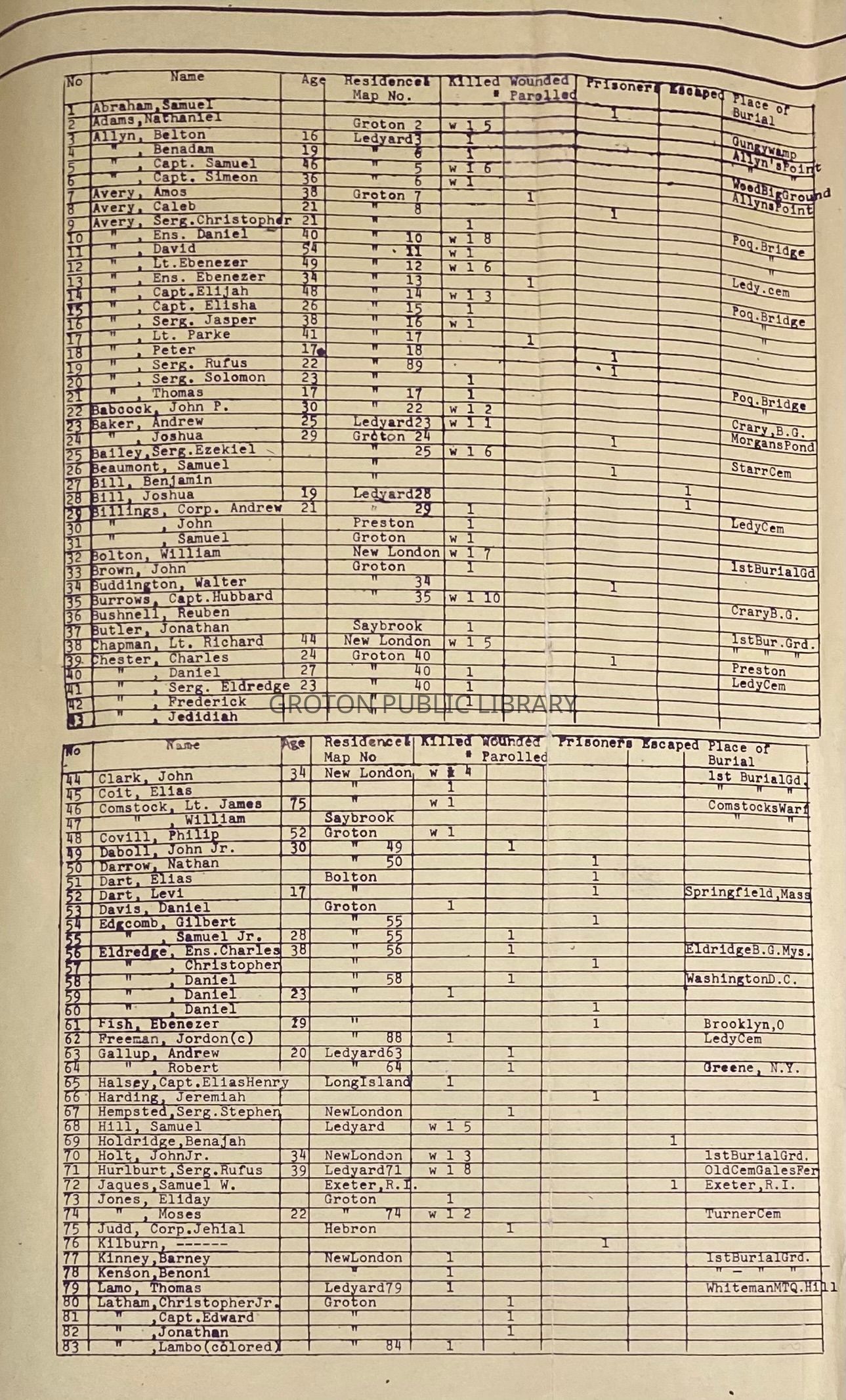
Map, "Historic Record of New London and Groton," chronologized by Albert W. Pierson, 1931. Depicts the shoreline Groton Bank section of Groton from the intersection of Thames Street and Eastern Point Road north to the Railroad Bridge. Includes index of significant historical sites, events and residences. Points on interest include the path of British soldiers to Fort Griswold in September 1781, Mother Bailey House, 1st ferry landing in Groton, old railroad ferry, old Kinne meeting house (1767-1833), home and farm of Rev. Aaron Kinne (1769-1798), old Gore House, Ebenezer Avery House, Hive of the Averys, and Groton and Stonington Trolley Tracks. 2 copies.Collection
Map CollectionAcquisition
Accession
2026.011Source or Donor
Found in CollectionAcquisition Method
Found in CollectionLexicon
Nomenclature 4.0
Nomenclature Secondary Object Term
MapNomenclature Primary Object Term
CartographNomenclature Sub-Class
Graphic DocumentsNomenclature Class
Documentary ObjectsNomenclature Category
Category 08: Communication ObjectsSearch Terms
City of Groton, Groton Bank, Thames Street, Fort Griswold, Fort Griswold Battlefield State Park, Hive of the Averys, Ferries, Mother Bailey House, Groton & Stonington R.R. Co., Battle of Groton HeightsArchive Details
Creator
Albert PiersonDate(s) of Creation
1931Archive Notes
Date(s): 1931