Name/Title
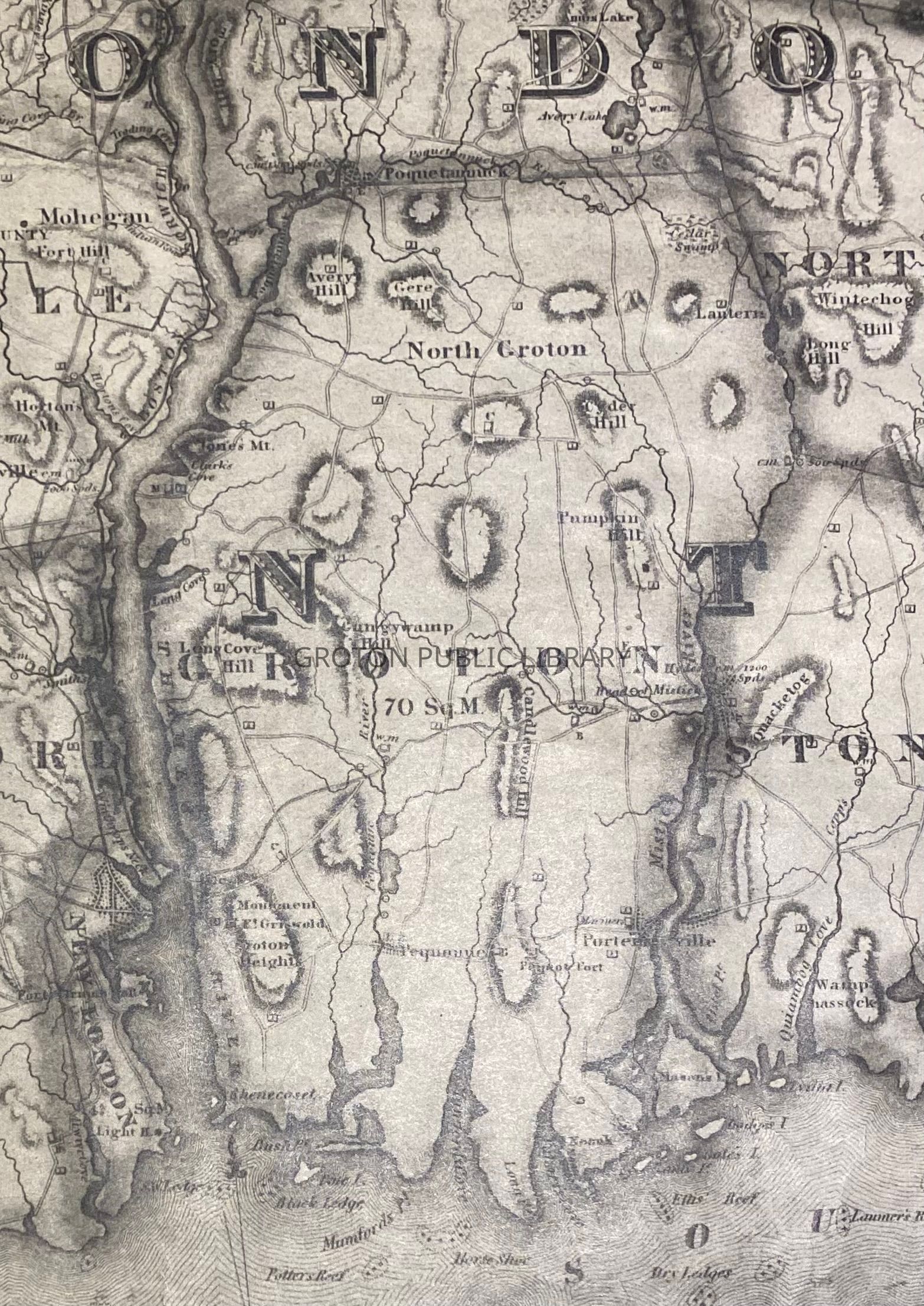
Map of Connecticut, 1833Entry/Object ID
2026.011.030Scope and Content
Reproduction copy, "Map of New London and Windham Counties," by William Lester Jr., engraved by Daggett & Ely, New Haven, 1833. 2 pages including additional enlargement of the Groton section of the map. Landmarks include Groton Heights, Shennecosset, Pequot Fort (Fort Hill), Long Point, Portersville, Mariner's Church (later Union Baptist Church), Long Cove Hill, Gungywamp Hill, Pumpkin Hill, Long Point, Noank, Mumford Cove, Pine Island, Black Ledge, Clark's Cove, Jones' Mountain, Geer Hill, Cider Hill, Avery Hill, Cedar Swamp, Potter's Reef, Fort Griswold Monument, and Candlewood Hill.Collection
Map CollectionAcquisition
Accession
2026.011Source or Donor
Found in CollectionAcquisition Method
Found in CollectionLexicon
Nomenclature 4.0
Nomenclature Secondary Object Term
MapNomenclature Primary Object Term
CartographNomenclature Sub-Class
Graphic DocumentsNomenclature Class
Documentary ObjectsNomenclature Category
Category 08: Communication Objects