Name/Title
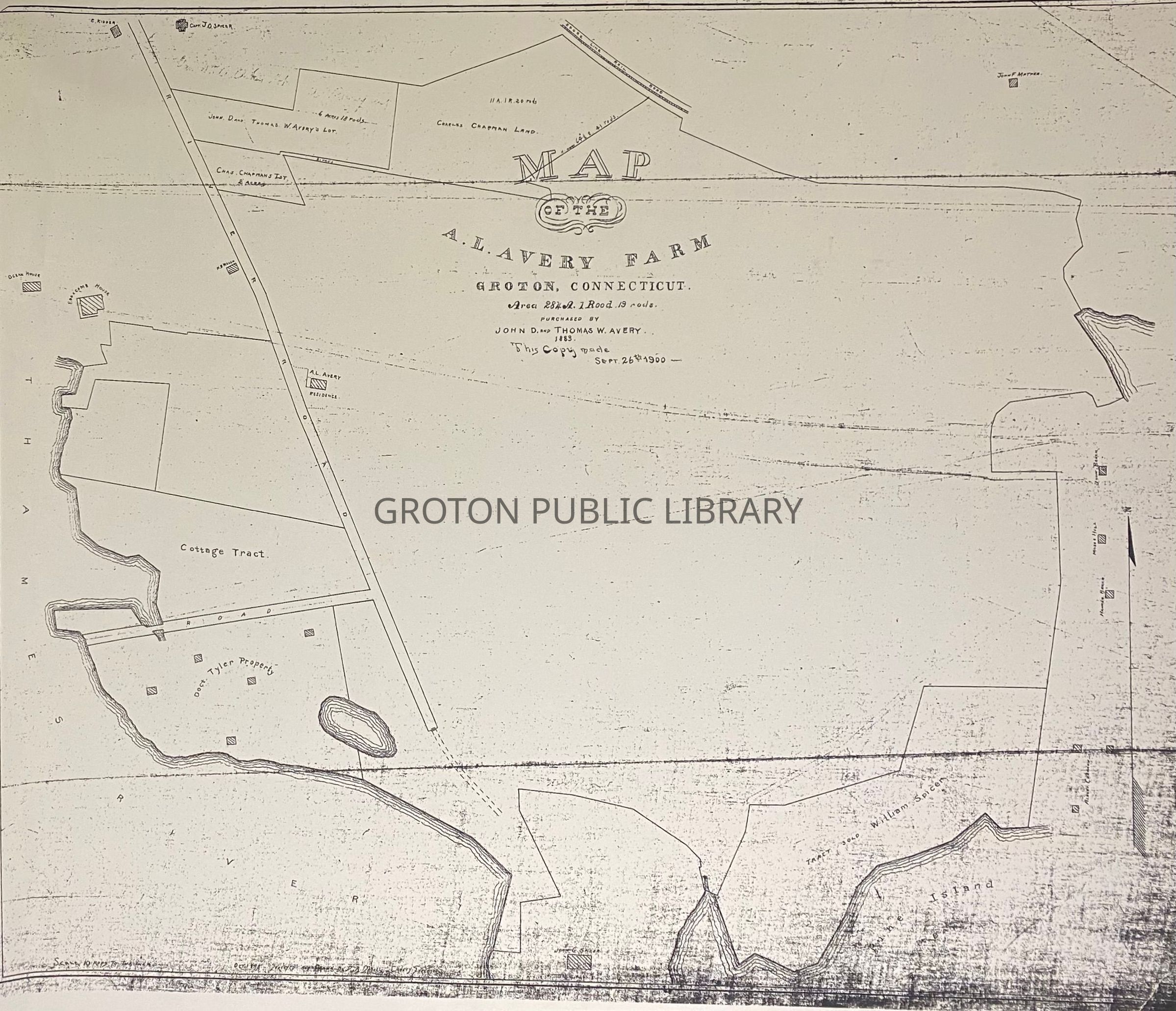
"Map of the A. L. Avery Farm, Groton," 1883Entry/Object ID
2026.023.030Scope and Content
Reproduction print, "Map of the A. L. Avery Farm, Groton, Connecticut, Purchased by John D. and Thomas W. Avery, 1883," surveyed by D. A. Daboll, copy made September 26, 1900. Map of the farmland owned by Albert Lay Avery (1812-1888) at Eastern Point. The property was purchased by his sons, Thomas Wheeler Avery (1858-1926) and John Dean Avery (1852-1930) in 1883. The maps also includes the Edgecomb House and the Ocean House as well as plots owned by Charles Chapman, John Grant Spicer, Capt. John O. Spicer, William Spicer, and Doctor Tyler.Collection
Streeter CollectionAcquisition
Accession
2026.023Source or Donor
Mr. James L. StreeterAcquisition Method
DonationLexicon
Nomenclature 4.0
Nomenclature Secondary Object Term
MapNomenclature Primary Object Term
CartographNomenclature Sub-Class
Graphic DocumentsNomenclature Class
Documentary ObjectsNomenclature Category
Category 08: Communication ObjectsSearch Terms
Eastern Point, Avery Point, Ocean House, Edgcomb House, Tyler House, Eastern Point Beach, Shore Ave., Shoreline Railroad, Eastern Point RoadArchive Details
Creator
D.A. DabollDate(s) of Creation
1900Archive Notes
Date(s): 1883