Name/Title
"Plan of Cedar Crest, West Mystic," 1907Entry/Object ID
2026.011.109Scope and Content
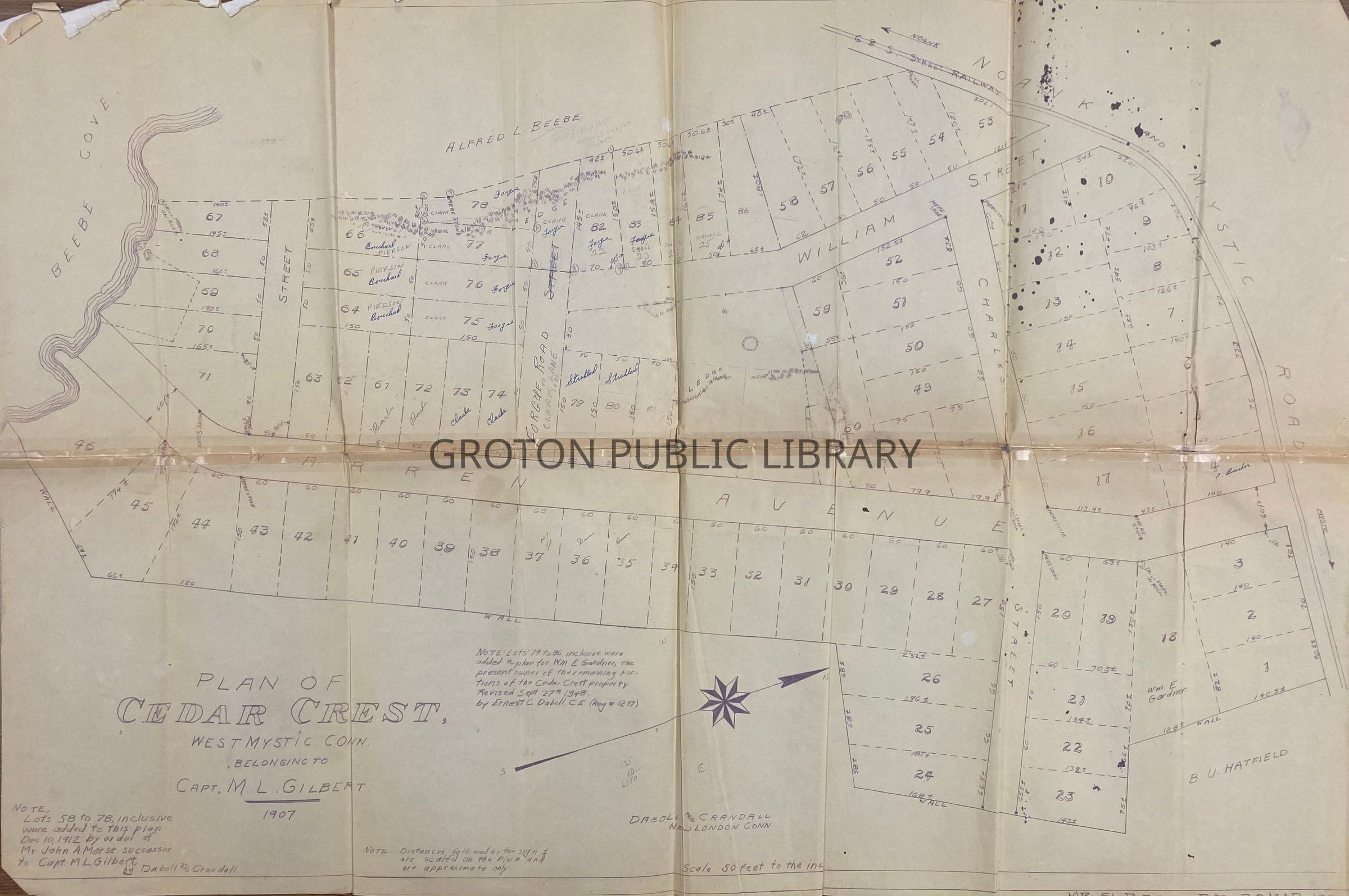
Map, "Plan of Cedar Crest, West Mystic, Conn., Belonging to Capt. M. L. Gilbert," drawn by Daboll & Crandall, 1907. Note that lots 58-78 were added to this plan on December 10, 1912 by order of John A. Morse, successor to Capt. M. L. Gilbert. Lots 79-86 were added to the plan by the order of William E. Gardner, the owner of the remaining portion of the property in 1948.
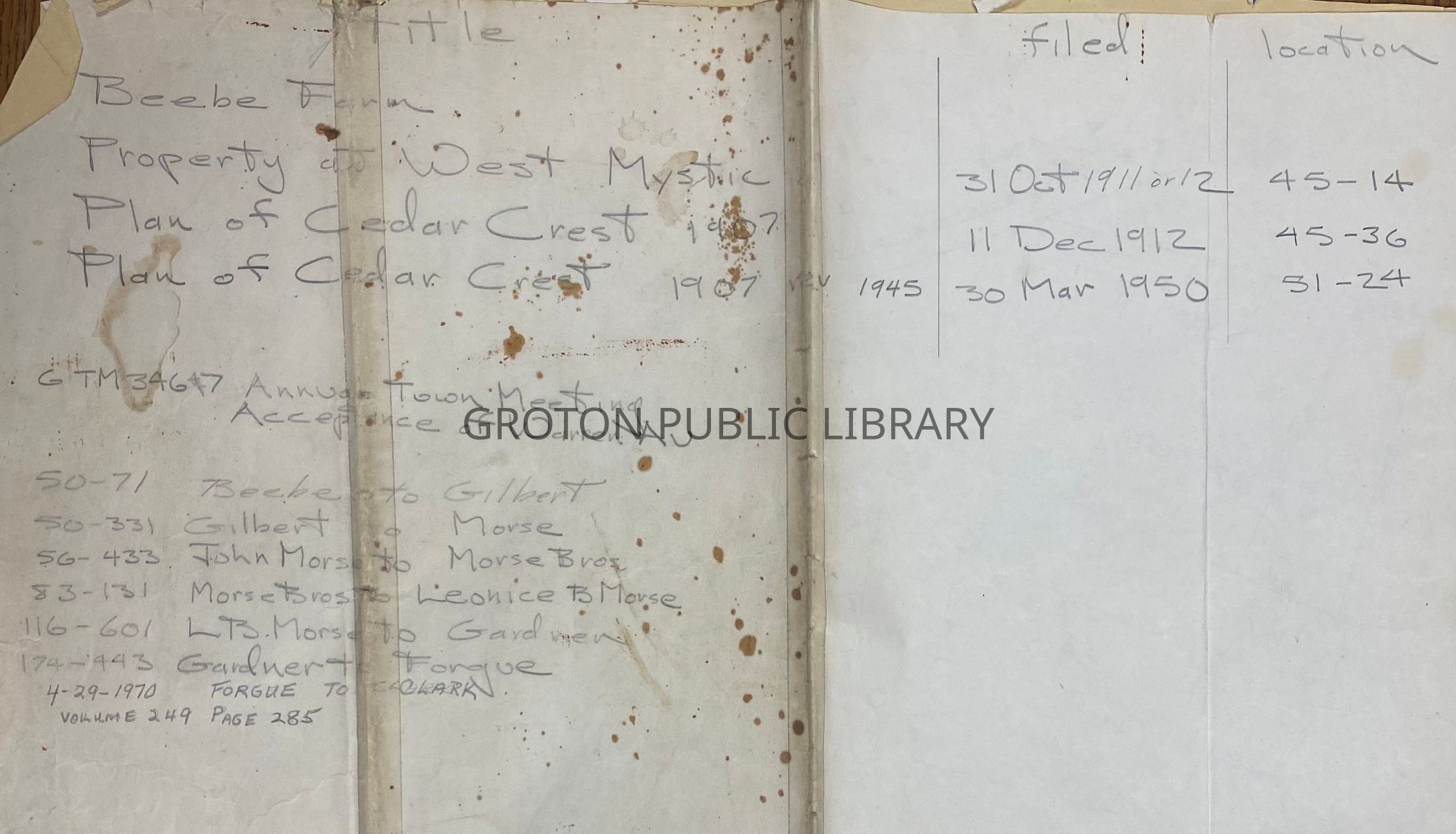
The maps shows the neighborhood "Cedar Crest" around Warren Avenue off Route-215 near Beebe Cove. The property was originally developed by Capt. Mark Gilbert of the Gilbert Transportation Co. in Mystic. Names of adjoining property owners are included as well as surnames for several of the lot owners (Pierson, Bouchard, Clarke, Forgue, Small, Barber and Strickland). Handwritten notes on back trace the from 1907-1970.Collection
Map CollectionAcquisition
Accession
2026.011Source or Donor
Found in CollectionAcquisition Method
Found in CollectionLexicon
Nomenclature 4.0
Nomenclature Secondary Object Term
MapNomenclature Primary Object Term
CartographNomenclature Sub-Class
Graphic DocumentsNomenclature Class
Documentary ObjectsNomenclature Category
Category 08: Communication ObjectsSearch Terms
Warren Ave., Forgue Road, Clark Lane, William Street, Charles Street, Cedar Crest, Beebe Cove, Groton & Stonington R.R. Co., Morse Bros.Archive Details
Date(s) of Creation
1907 - 1970Archive Notes
Date(s) Created: 1907, 1912, 1948 and 1970General Notes
Note
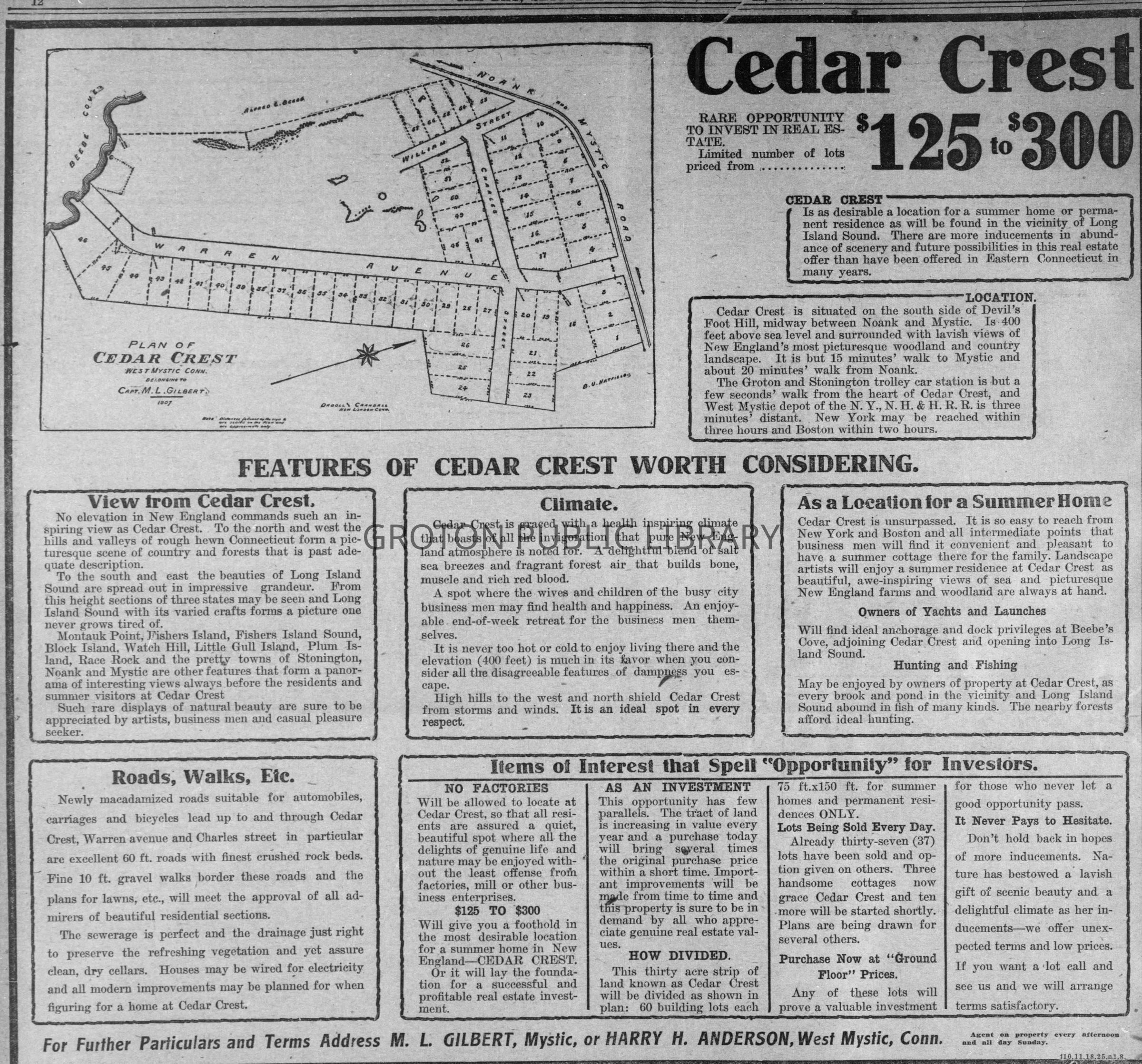
Notes: Newspaper advertisement for Cedar Crest was published in The Day on July 11, 1908 and was clipped from Newspapers.com