Name/Title
Preston Highway Survey, 1690Entry/Object ID
2026.014.065Scope and Content
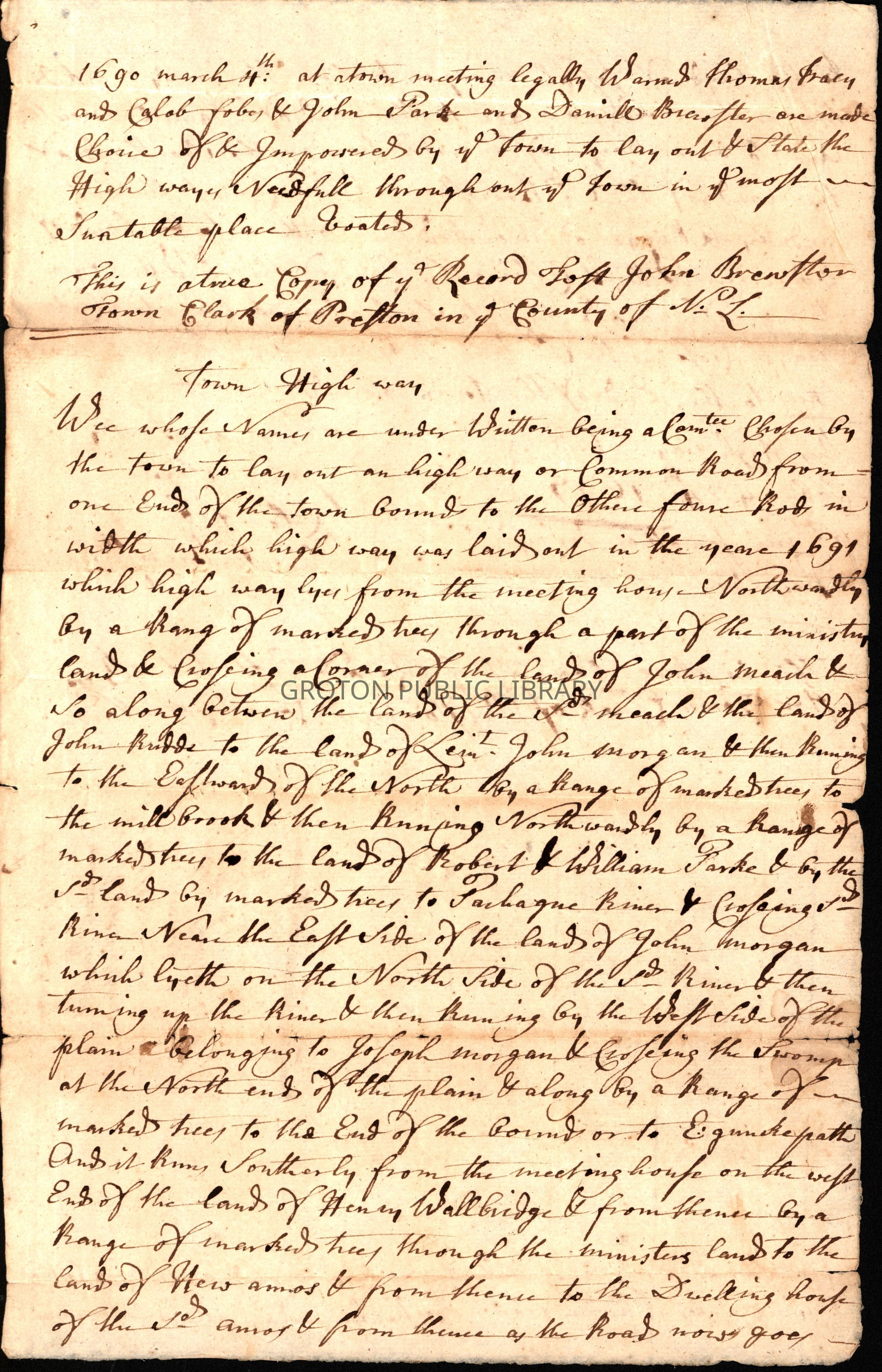
Survey for the layout of a Town Highway running the length of Preston, CT and approved at a town meeting held March 4, 1690.
"1690 March 4th: at a town meeting legally warned Thomas [Tracy?] and Caleb [?] and John Parke and Daniel Brewster are made choice of and improved by said town to layout and state the highway needful throughout said town in said most suitable place [?].
This is a true copy of said record [?] John Brewster, Town Clerk of Preston in said County of New London.
Town Highway
We whose names are under written being a committee chosen by the town to lay out a highway or common road from one end of the town bounds to the other four rods in width which highway was laid out in the year 1691 which highway lies from the meeting house northwardly by a range of marked hay through a part of the ministry land and crossing a corner of the lands of John Meach and so along between the lands of said Meach and the land of John [Bridds?] to the land of Lieut. John Morgan and then running to the eastward of the north by a range of marked trees to the mill brook and then running northwardly by a range of marked trees to the land of Robert & William Parke and by the said land by said marked trees to [Pachague?] River and crossing said river near the east side of the lands of John Morgan which lyeth on the north side of said river and then turning up the river and running by the west side of the plain belonging to Joseph Morgan and crossing the swamp at the north end of the plain and along by a range of marked trees to the bounds or the [?] path and it runs southerly from the meeting house on the west end of the land of Henry Wallbridge and from thence by a range of marked trees through the ministers land to the land of New Amos and from thence to the dwelling house of the said Amos and from thence as the road now goes to the lands of Joseph Morgan and from thence by marked trees as the road now goes to the land of Daniel Brewster and so by a range of marked trees on the north end of the land of the said Brewster until it comes to the hill and by a range of marked trees southeast to the lands of Ebenezer Witter and crossing the land of the said Witter by a range of marked trees to Poquetanuck River to a cartway and crossing the said river and running by a range of marked trees to the end of the town bounds. This Highway entered February 24th, 1697."
Signed by Thomas Tracy, John Parke, Caleb [?] and Daniel Brewster.Collection
Lacerte CollectionAcquisition
Accession
2026.014Source or Donor
James LacerteAcquisition Method
GiftLexicon
Search Terms
Road Construction, PrestonArchive Details
Date(s) of Creation
1690Archive Notes
Date(s): 1690