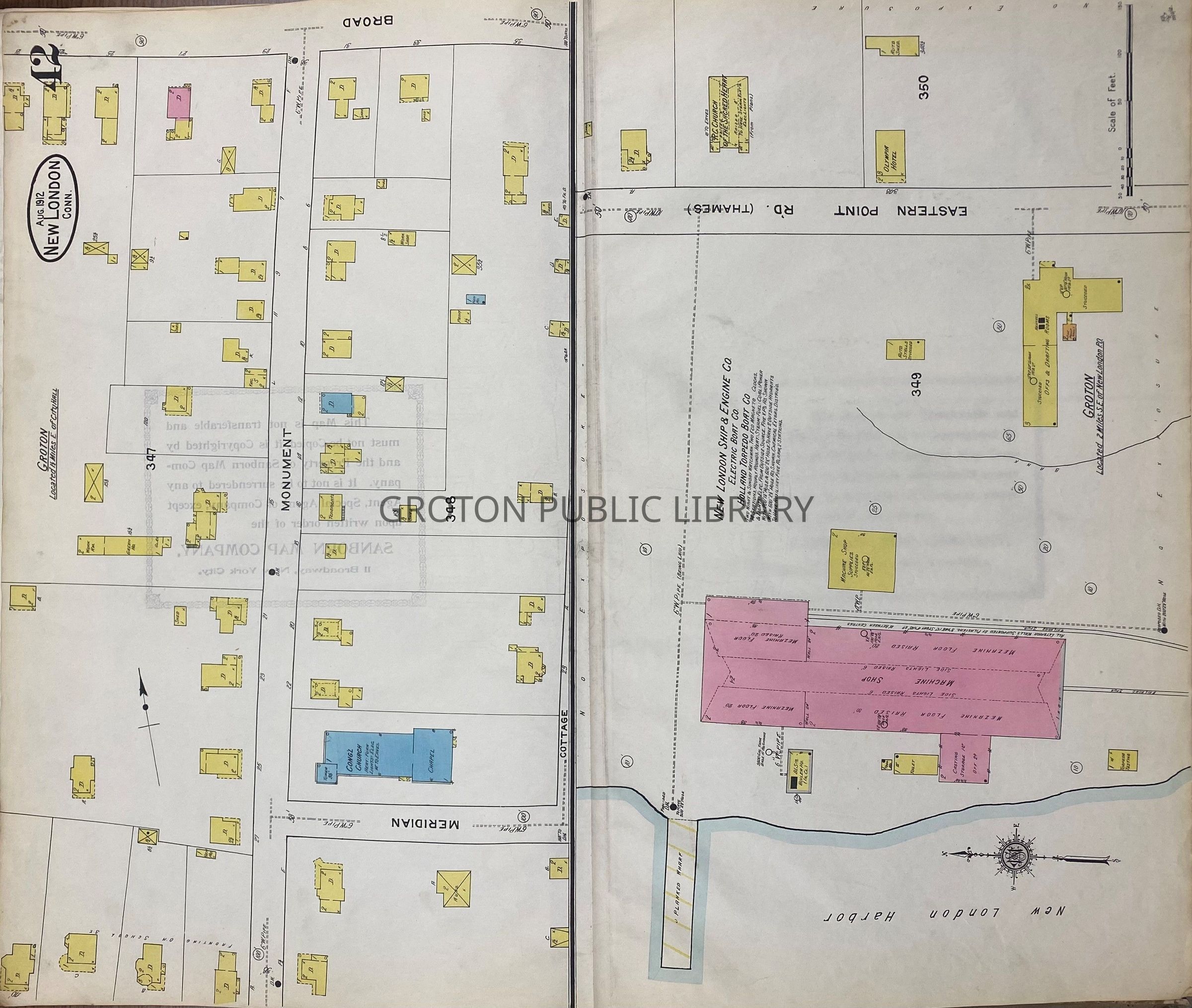
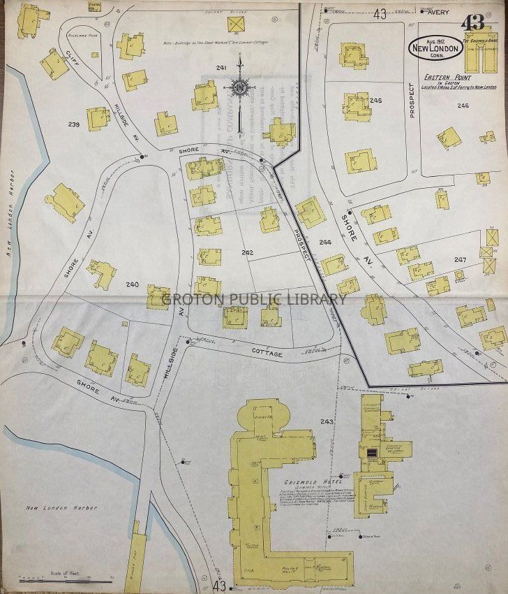
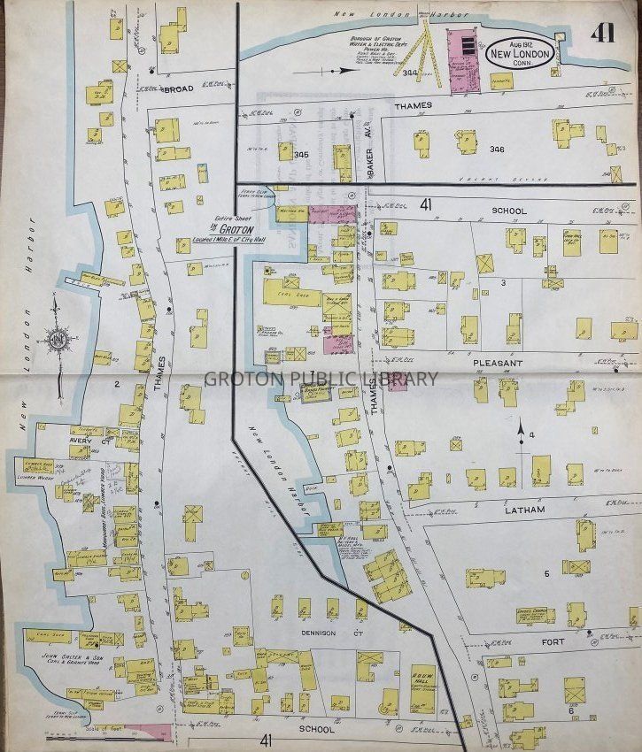
Sanborn Insurance Map of New London, 1912

Sanborn Insurance Map of New London, 1912

Name/Title

Sanborn Insurance Map of New London, 1912

Entry/Object ID

2026.023.001

Scope and Content

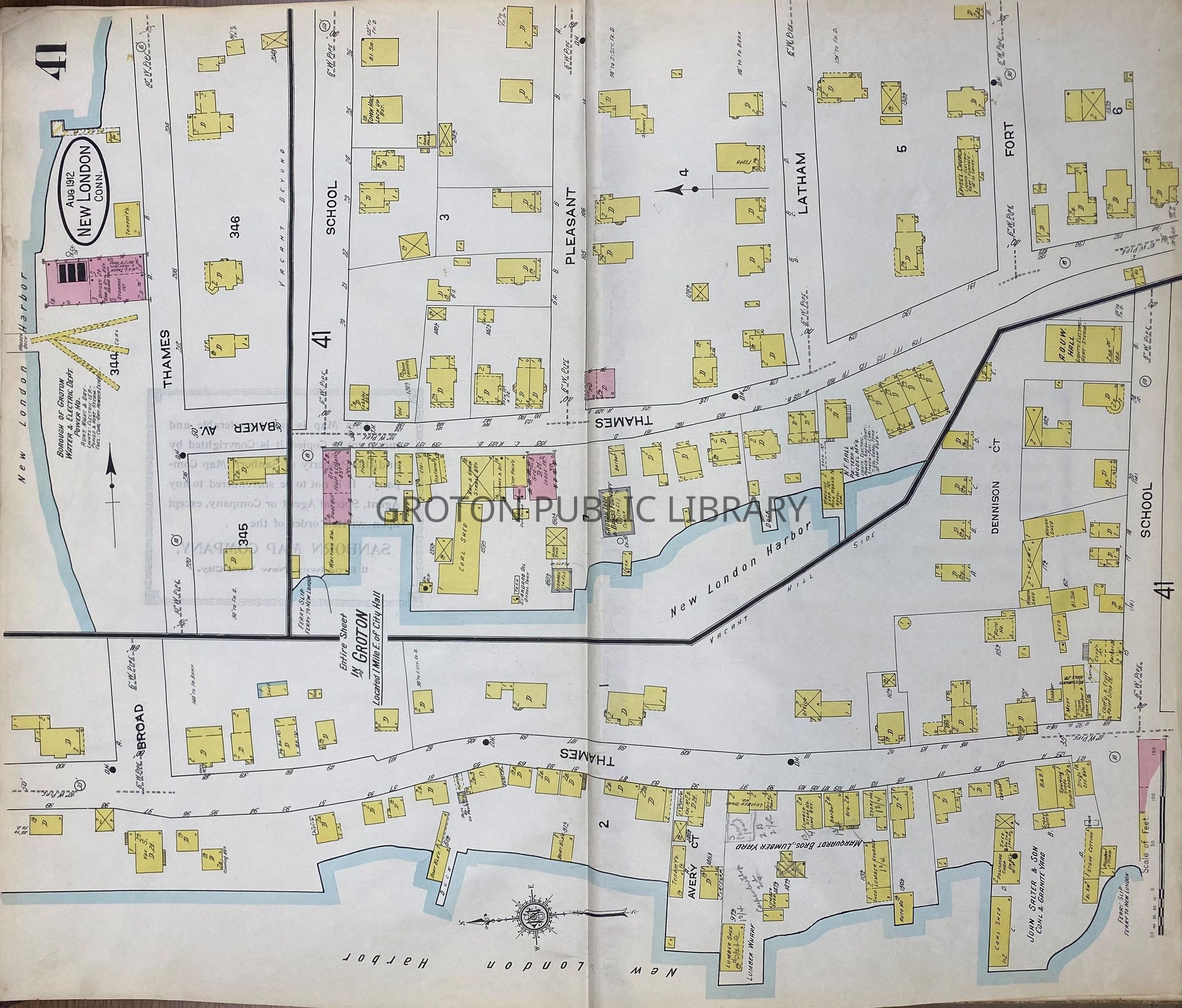
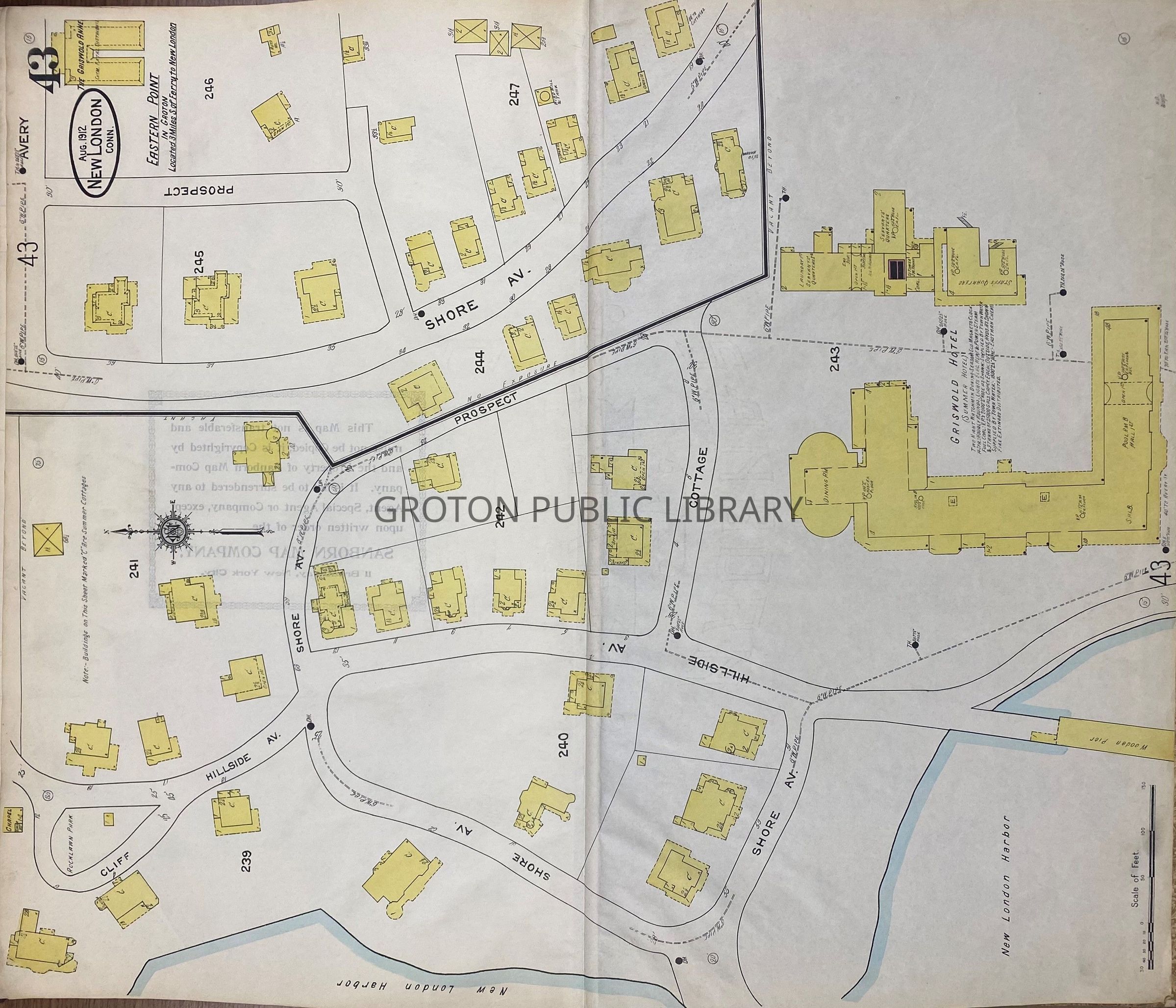
Sanborn Insurance Map of New London, published 1912. This map includes detailed information on the size, layout, function and construction of each building. Pages 41-43 feature sections of the City of Groton along the Thames River including Thames Street, Monument Street, the New London Ship & Engine Co. and Shore Avenue.

Collection

Streeter Collection

Acquisition

Accession

2026.023

Source or Donor

Mr. James L. Streeter

Acquisition Method

Donation

Lexicon

Nomenclature 4.0

Nomenclature Secondary Object Term

Map

Nomenclature Primary Object Term

Cartograph

Nomenclature Sub-Class

Graphic Documents

Nomenclature Class

Documentary Objects

Nomenclature Category

Category 08: Communication Objects

Search Terms

Thames Street, Shore Ave., School St., Pleasant St., Fort Street, Monument Street, Hillside Avenue, Cottage Place, Broad St., Latham St., Circle Ave., Sacred Heart Catholic Church, Sacred Heart Church, New London Ship & Engine Company, Electric Boat, Olympia Tea Room, Griswold Dock, Griswold Hotel, Groton Congregational Church, Ferry, Marquardt Bros. Lumber Yard, John Salter & Sons, Power House
Archive Details

Creator

Sanborn Insurance Co.

Date(s) of Creation

1912