Name/Title
Army Air Forces Cloth ChartSecondary Title
Philippine SeriesDescription
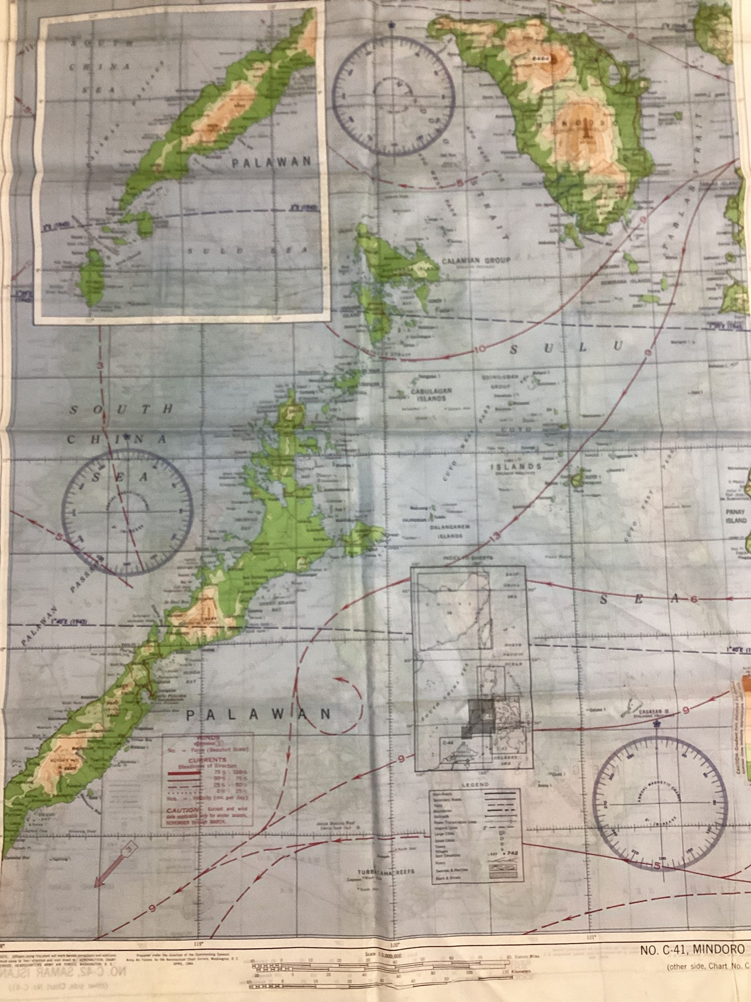
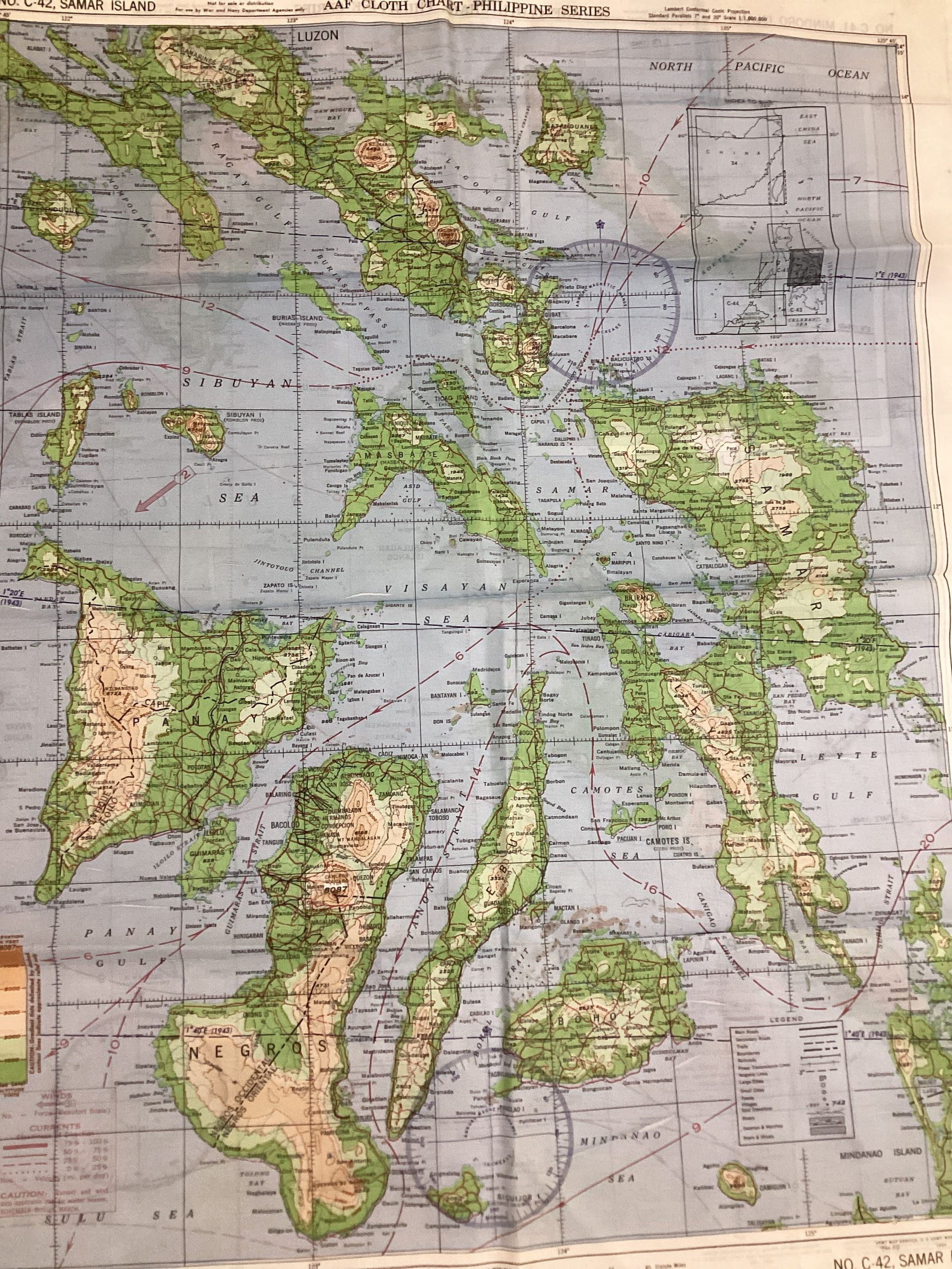
Color map printed on silk; top of map has black printing "AAF Cloth Chart --Philippine Series"; printed on both sides depicting different parts of Philippine Islands chain; also printed on map is navigational information plus wind & current tables.
Bottom right corner of map is printed "Army Map Service, U.S. Army, Washington, D.C. 34047"Context
This map was used by the donor, Lawrence Dismore. Dismore was a B-24 navigator during World War II. Part of his duty was to distrbute maps to each crew member in case the plane was shot down. The maps were printed on silk so they could withstand ocean ditching.Collection
Lawrence DismoreAcquisition
Accession
1988.032Source or Donor
Lawrence Wesley DismoreAcquisition Method
DonationMap Details
Maker or Creator
U.S. Army Map ServiceArea or Region
Country
PhilippinesRegion
Southeast AsiaContinent
AsiaPublisher
U.S. Army Map ServicePlace Published
City
Washington, D.C.State/Province
District of ColumbiaRegion
NortheastContinent
North AmericaCountry
United States of AmericaDate Published
Jul 1944Time Period
20th CenturyMedium
SilkPublication Language
EnglishCreate Date
March 4, 2002Update Date
January 23, 2025