Name/Title
MapEntry/Object ID
2013.07.33Description
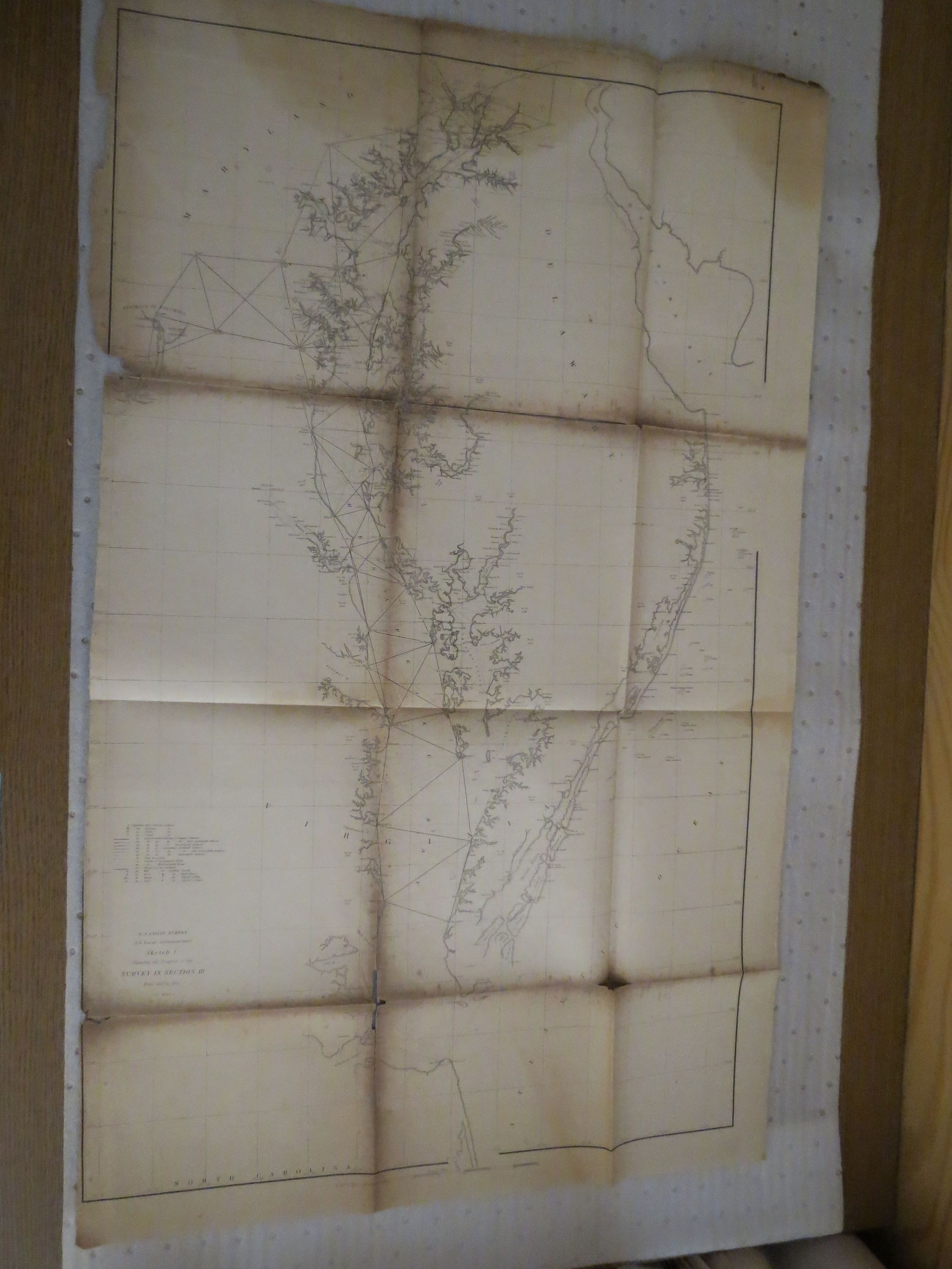
Map of the Chesapeake Bay, 1851. U.S. Coast Survey, A.D. Bache Superintendent, Sketch C, showing the progress of the survery in section III, from 1843 to 1851.Condition
Overall Condition
PoorDate Examined
May 3, 2014Examined By
MN-BNotes
Folded map, worn away at spine points. Very fragile condition.