Description
Two folders containing Final Survey Report (Preservation Consultants, 1987); National Register Registration form for the Sullivan's Island Historic District; National Register Registration form for Historic Resources of Sullivan's Island; National Register Registration form for the U.S. Coast Guard District; "Sullivan's Island Pest Houses: Beginning of an Archaeological Investigation" (Nichols, 1989); history of Sullivan's Island (Ames, undated); description of Sullivan's Island (Resources & Attractions of Charleston, 1898); excerpt from Vernacular Architecture of Charleston; miscellaneous articles, information, and images (including the Devereux House); list of Sullivan's Island historic districts; list of Sullivan's Island landmarks; email correspondence and meeting notes (HCF in consultation with the Sullivan's Island Town Council (2007).
Note: Sullivan's Island recently placed on the National Register of Historic Places.Container
Sullivans IslandNotes
Container: Box 1B: Neighborhoods/AreasDescription
Contains image of "McKinley House [formerly] owned by the Champions" and information about the Wando Terminal, DuPont Plant, Pinckney land / Snee Farm, sweetgrass baskets, and Hobcaw development.Container
Mount PleasantNotes
Container: Box 1B: Neighborhoods/AreasDescription
Contains information about Civil War sites. Also contains information about Parrot Point including two archaeological reports:
"Cultural Resources Survey and Testing of the Parrot Point Tract [Revised Draft Report," Brockington (David Baluha, Michael Hendrix, Ralph Bailey, May 2001),
"Revised Treatment Plan, Archaeological Site 38CH1781, Parrot Point Tract," Brockington (Ralph Bailey, July, 2001), with associated letter from Carl Steen, Diachronic Research Foundation.Container
James IslandNotes
Container: Box 1B: Neighborhoods/AreasDescription
Contains National Register nomination form for the Hickory Valley Historic District in Walterboro, which includes information about the Paul House, Klein House, Edward B. Fishburne House, 507 Wichman Street, Beck-Savage House, and more.Container
Elmore Henderson HouseNotes
Container: Box 2: Homes Outside Charleston/Historic SitesDescription
North Charleston file has histories on Chicora Place and Nafair and the Historical and Archaeological Survey, 2010.002.068.Container
North CharlestonNotes
Container: Box 1B Neighborhoods/AreasDescription
Contains the Johns Island Plan (2011.002.006); South Carolina Statewide Survey Site Form for the Andell House / Stringfellow House (4480 Bohicket Road)..Container
Johns IslandNotes
Container: Box 1B_Neighborhoods/AreasDescription
St. Andrews Church file includes letter from William Izard Bull to Emily McPherson Ravenel, dated June 10, 1889. Also contains a restoration plan by Glenn Keyes.Container
St. Andrews ChurchNotes
Container: Box 3: Rural/Lowcountry ChurchesDescription
Wadmalaw file includes Wadmalaw Island Planned Development Guidelines, 2011.002.013; report "High Point, Wadmalaw Island: A History" by Robert Stockton (Aug. 5, 1982); etc.Container
WadmalawNotes
Container: Box 4: Areas Outside CharlestonDescription
Cainhoy files include documentation of effort to create historic "village district"; archaeological report "Treatment Plan for Site 38BK2551, Cain Hoy Plantation" (Brockington, Jan. 2018); CofC student report on the Cainhoy Massacre of 1876; description and list of cultural resources; maps; National Register Nomination Form ("Cainhoy Historic District" a/k/a Lewisville, Louisville); South Carolina Statewide Survey Site forms for several Cainhoy sites, etc..
See also Cainhoy Development files in Preservation Issues/Topics.Container
Cainhoy [Cain Hoy]Notes
Container: Box 1A: Neighborhoods/AreasDescription
Includes newspaper article about the Charleston and the South Carolina Inter-State and West Indian Exposition, 100 years later.Container
Hampton ParkNotes
Container: Box 2: Homes Outside Charleston/Historic SitesDescription
West Ashley file contains news articles about the history of the area, revitalization efforts, and various West Ashley properties; "West Ashley Strategic Plan" (2014); City of Charleston Design Divisio reports on the Sam Rittenberg Corridor and Citadel Mall; report on Windermere (HCF 2017); research materials for the area referred to as Dupont Station; and information about the Coburg Cow (Savannah Highway) and the Coburg Dairy.Container
West AshleyNotes
Container: Box 1C: Neighborhoods/AreasDescription
Contains photo layout of house entitled "Potential Purchases" (11/17/1977): 103 Alexander, 112 Alexander, 114 Alexander, 30 Chapel, 35 Chapel, 39 Chapel, 10 Elizabeth, 12 Elizabeth, 14 Elizabeth, 30 Mary, 32 Mary, 121 Alexander, 157 Alexander, 159 Alexander, 42 Chapel, 34 Mary.Container
Mazyckborough-WraggboroughNotes
Container: Box 1B: Neighborhoods/AreasDescription
Includes newspaper article "A Bit on Maryville" (West Of, n.d.); thesis "Maryville, South Carolina: An All-Black Town and its White Neighbors (Allen Carrington Hutcheson, 1995); two graduate student reports "Maryville: From the Past Into the Future" and "Ashleyville and Maryville: Responsible Revitalization in West Ashley's Disenfranchised and Neglected Twin Cities" (Kenneth G. Marolda, 2018); archaeological report "Research Investigations at Potential Location of Lords Proprietors Plantation, Ashleyville/Maryville" (Andrew Agha, ca. 2012); report "The Dissolution of the town of Maryville and the Construction of St. Andrew's Boulevard (Kenneth G. Marolda, 2019); print-out of a presentation on Maryville by Meadors (2016).Container
MaryvilleNotes
Container: Box 1B: Neighborhoods/AreasDescription
Contains archaeological report "An Archaeological and Historical Reconnaissance of Encampment Plantation" (Trinkley, Chicora Foundation Research Contribution 1657, 1995).Container
Adams RunNotes
Container: Box 1A: Neighborhoods/AreasDescription
Edisto Island file includes National Register nomination form for "Edisto Island Multiple Resource Area.Container
Edisto IslandNotes
Container: Box 4: Areas Outside CharlestonDescription
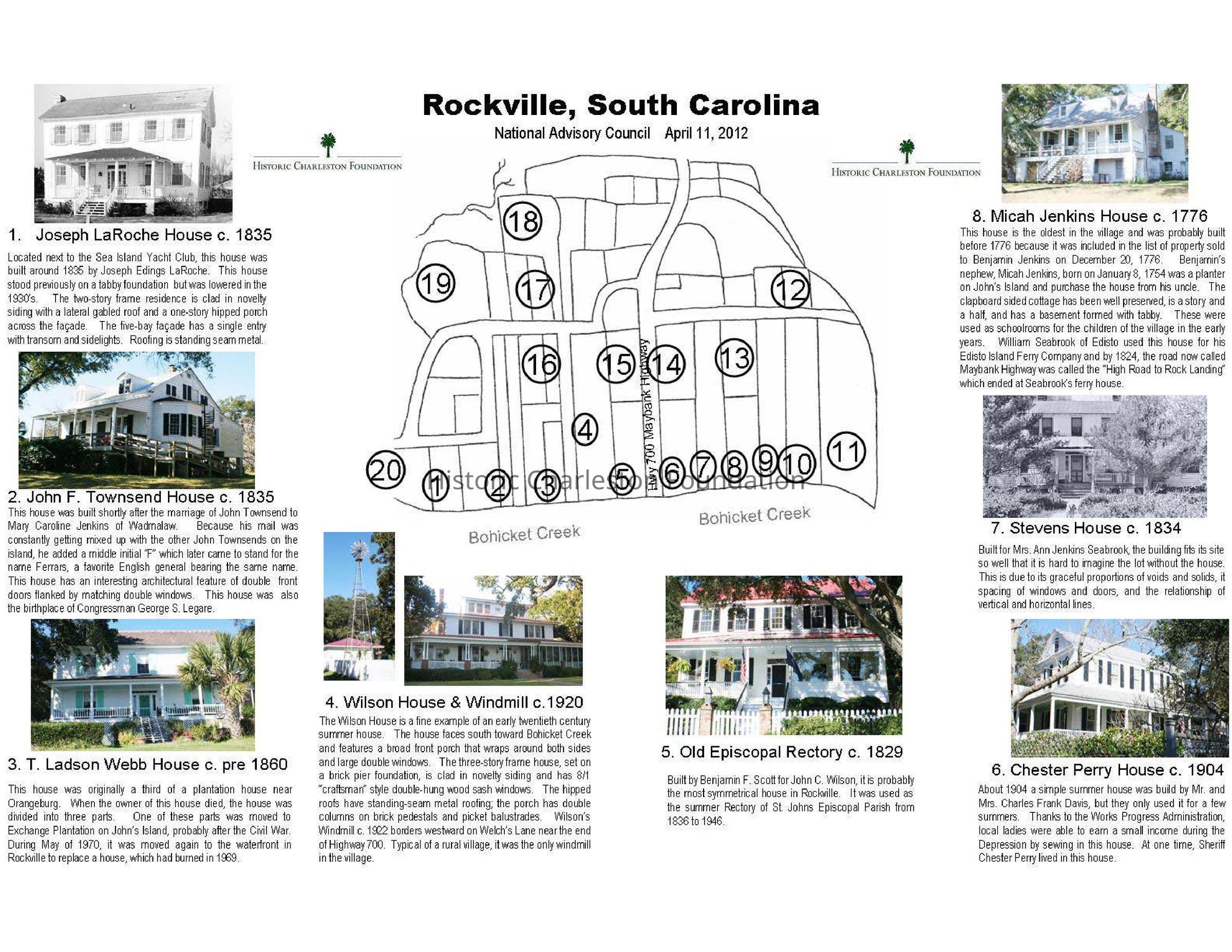
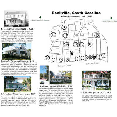
Rockville file includes photocopy of unpublished 1928 Sanborn Fire Insurance Map; HCF Rockville tour map (map and photos/descriptions of historic houses); Village of Rockville Historic District National Register nomination form; Rockville Presbyterian Church National Register nomination form; booklet "Rockville Presbyterian Church: the Early 1700s-1975" (Annie Jenkins Batson, 1976); contents of a resident's historical research including photocopy of paper about Rockville presented by Sophie Seabrook Jenkins (published and typed versions); magazine article "A Treasured Place" (SC Wildlife magazine, 1996);Container
RockvilleNotes
Container: Box 4: Areas Outside CharlestonDescription
Inventory Form for the Hutchinson House created for the National Register Nomination; miscellaneous news articles; Preservation Magazine article (2021), etc.
Link to Preservation Magazine article: https://tinyurl.com/yy89z3o5.Container
Hutchinson HouseNotes
Container: Box 2: Homes Outside Charleston/Historic SitesDescription
Harleston Village file contains "Harleston Village Zoning Study" (HCF, 2013); Preservation Progress article "Harleston Village: Reclaiming an Historic District (Preservation Society, 1972); history of Harleston Village and excerpt from Buildings of Charleston (Poston); newspaper articles; various maps showing boundaries of Harleston Village.Container
Harleston VillageNotes
Container: Box 1A: Neighborhoods/Areas