Name/Title
Aerial Views and Photographs of Charleston: Hurricane Hugo AftermathEntry/Object ID
2009.003.10hDescription
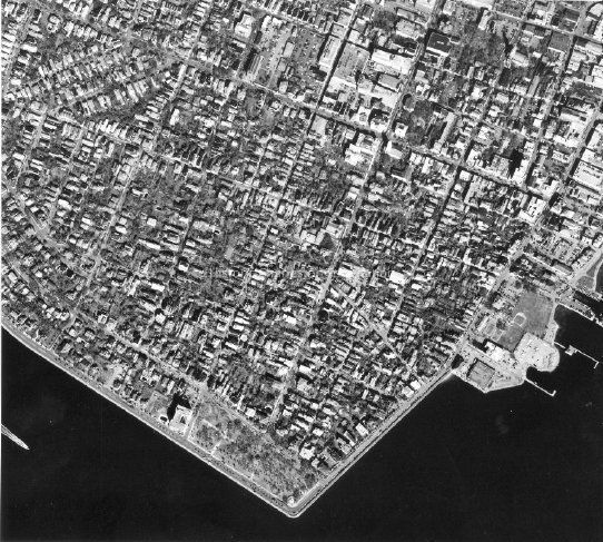
Twenty-seven B&W aerial photographs -- various views -- taken in the aftermath of Hurricane Hugo on 10/3/1989 by Air Photographics, Inc. File also includes an aerial map coded to match the sites of the photographs. Photos measure 8x10 or 8x9. (Only two scanned.)Collection
HCF Image CollectionAcquisition
Accession
2009.003.Source or Donor
New Photos Catalog Records (2009)Acquisition Method
Found in CollectionMade/Created
Artist
Air Photographics, Inc.Date made
1989Lexicon
Nomenclature 4.0
Nomenclature Primary Object Term
PhotographNomenclature Sub-Class
Graphic DocumentsNomenclature Class
Documentary ObjectsNomenclature Category
Category 08: Communication ObjectsLOC Thesaurus for Graphic Materials
Aerial photographsSearch Terms
AerialViews/Photographs, Charleston (S.C.)--Aerial views, Hurricane Hugo, 1989Location
Location
Container
PhotoBox 12Shelf
AV MaterialsRoom
Margaretta P. Childs ArchivesBuilding
Missroon HouseCategory
PermanentDate
February 7, 2023Relationships
Related Publications
Notes
Aerial view of King Street and vicinity, ca. 1990s, KING.412.2.Copyright
Copyright Details
Must obtain permission to reproduce from the photographer.Created By
admin@catalogit.appCreate Date
September 24, 2012Updated By
sferguson@historiccharleston.orgUpdate Date
July 25, 2023