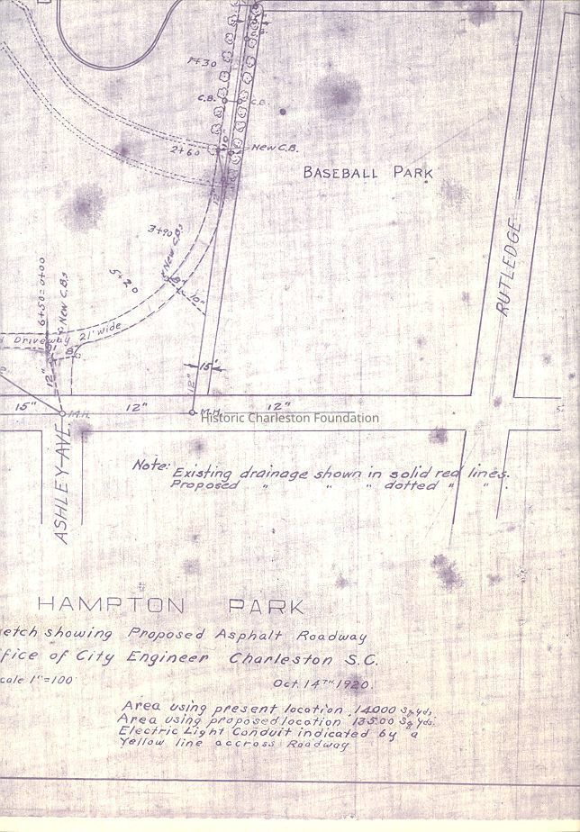
Name/Title
Hampton Park Sketch Showing Proposed Asphalt RoadwayEntry/Object ID
2008.001.5Scope and Content
Sketch by the Office of City Engineer Charleston, SC, showing proposed asphalt roadway in Hampton Park.
Area using present location -14000 sqyds. Area using proposed location - 13500 sqyds. Electric light conduit indicated by a yellow line across roadway (not visible on copy). Existing drainage shown in solid red line (not visible on copy). Proposed drainage shown in dotted red lines (not visible on copy).Collection
HCF Map CollectionAcquisition
Accession
2008.001.Source or Donor
New Archives Catalog Records (2008)Acquisition Method
Collected by StaffLexicon
Nomenclature 4.0
Nomenclature Secondary Object Term
MapNomenclature Primary Object Term
CartographNomenclature Sub-Class
Graphic DocumentsNomenclature Class
Documentary ObjectsNomenclature Category
Category 08: Communication ObjectsSearch Terms
Park maps/highway maps, Hampton Park (Charleston, S.C.)Archive Details
Date(s) of Creation
Oct 14, 1920Archive Size/Extent
1 map (photocopied), 28.5" x 21.5"Archive Notes
Date(s): 1920
Publication Date: October 14, 1920
Publisher: City of Charleston
Scale: 1" = 100Dimensions
Dimension Notes
28.5" x 21.5"Location
Location
Container
FolderDrawer
Drawer 4Cabinet
Blueprints-Maps 5Room
Margaretta P. Childs ArchivesBuilding
Missroon HouseCategory
PermanentDate
February 7, 2023Created By
admin@catalogit.appCreate Date
August 28, 2008Updated By
admin@catalogit.appUpdate Date
February 16, 2023