Name/Title
Existing General Land Use Plan: Peninsular Portion of the City of CharlestonEntry/Object ID
2008.001.41Scope and Content
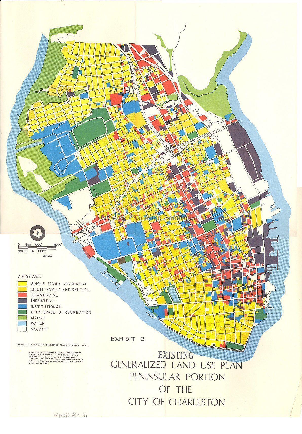
Peninsula map depicting existing land use on the peninsula of Charleston, using color coding to indicate residential, commercial, industrial, institutional, open space, marsh, water, and vacant.
Stamped "Exhibit 2"; 2nd of 3 maps that had been stapled together as an exhibit (see related tab); purpose/use of Exhibit not indicated.Collection
HCF Map CollectionAcquisition
Accession
2008.001.Source or Donor
New Archives Catalog Records (2008)Acquisition Method
Collected by StaffLexicon
Nomenclature 4.0
Nomenclature Secondary Object Term
MapNomenclature Primary Object Term
CartographNomenclature Sub-Class
Graphic DocumentsNomenclature Class
Documentary ObjectsNomenclature Category
Category 08: Communication ObjectsSearch Terms
Peninsula maps, Charleston (S.C.)--MapsArchive Details
Date(s) of Creation
Jul 1973Archive Size/Extent
1 map, 17" x 22"Archive Notes
Date(s): 1973
Publisher: Berkeley-Charleston-Dorchester Regional Planning CouncilLocation
Location
Container
FolderDrawer
Drawer 4Cabinet
Blueprints-Maps 5Room
Margaretta P. Childs ArchivesBuilding
Missroon HouseCategory
PermanentDate
February 7, 2023Relationships
Related Places
Place
City
CharlestonState/Province
South CarolinaCountry
United States of AmericaRelated Entries
Notes
2008.001.40, 2008.001.42Created By
admin@catalogit.appCreate Date
September 17, 2008Updated By
admin@catalogit.appUpdate Date
February 16, 2023