Name/Title
Map of Charles Towne, 1691Entry/Object ID
2008.001.51Scope and Content
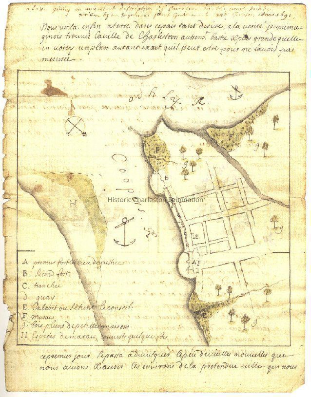
Copy of map of hand-drawn map of Charles Towne, by Jean Boyd. Possibly the one of the earliest known maps of Charles Towne.
Includes legend.
Source: Transactions of the Huguenot Society of South Carolina, no. 110, 2006.Collection
HCF Map CollectionAcquisition
Accession
2008.001.Source or Donor
New Archives Catalog Records (2008)Acquisition Method
Collected by StaffLexicon
Nomenclature 4.0
Nomenclature Secondary Object Term
MapNomenclature Primary Object Term
CartographNomenclature Sub-Class
Graphic DocumentsNomenclature Class
Documentary ObjectsNomenclature Category
Category 08: Communication ObjectsSearch Terms
Historic maps of Charleston, Charleston (S.C.)--MapsArchive Details
Creator
Boyd, JeanDate(s) of Creation
1691Archive Size/Extent
1 map (photocopy), 8.5" x 11"Archive Notes
Date(s): 1691 (date of original)Dimensions
Dimension Notes
8.5" x 11"Location
Location
Container
FolderDrawer
Drawer 4Cabinet
Blueprints-Maps 5Room
Margaretta P. Childs ArchivesBuilding
Missroon HouseCategory
PermanentDate
February 7, 2023Location
Container
Folder 2Drawer
Drawer 5Room
Margaretta P. Childs ArchivesBuilding
Missroon HouseCategory
PermanentRelationships
Related Places
Place
City
CharlestonState/Province
South CarolinaCountry
United States of AmericaCreated By
admin@catalogit.appCreate Date
September 17, 2008Updated By
admin@catalogit.appUpdate Date
February 17, 2023