Name/Title
Proposed Buildings Height RestrictionsEntry/Object ID
2008.001.57Scope and Content
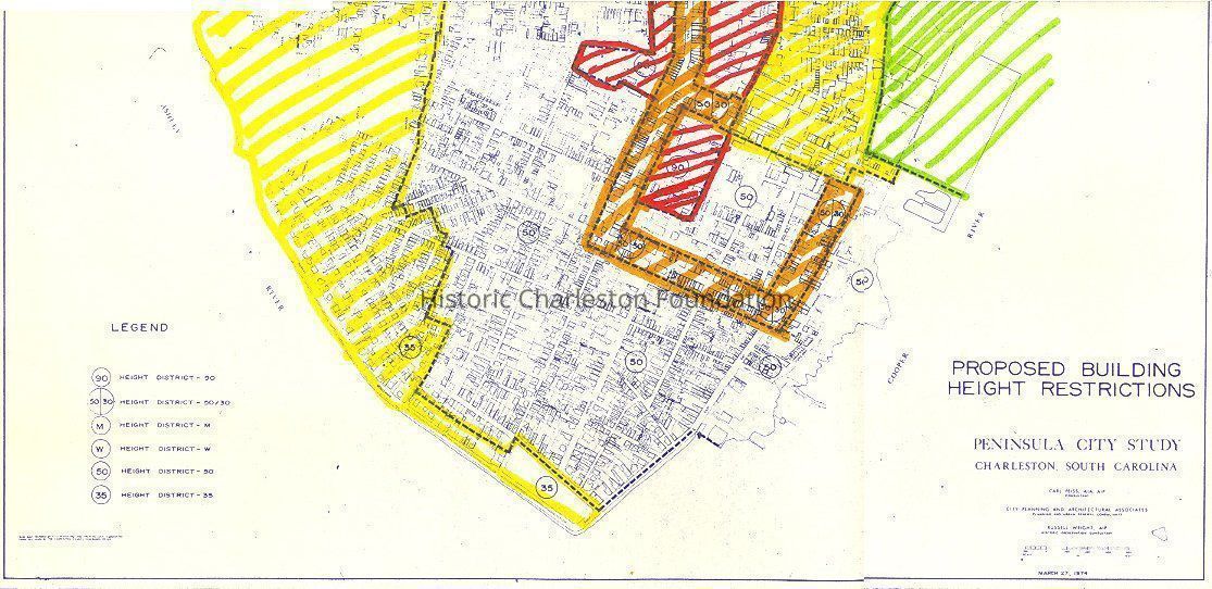
Peninsula City Study-Proposed Height Restriction.
Areas shaded with color markers. Hand-colored with coded legend.
Created by City Planning and Architectural Associates.Collection
HCF Map CollectionAcquisition
Accession
2008.001.Source or Donor
New Archives Catalog Records (2008)Acquisition Method
Collected by StaffLexicon
Nomenclature 4.0
Nomenclature Secondary Object Term
MapNomenclature Primary Object Term
CartographNomenclature Sub-Class
Graphic DocumentsNomenclature Class
Documentary ObjectsNomenclature Category
Category 08: Communication ObjectsSearch Terms
Peninsula city study maps, Charleston (S.C.)--Maps, City planning--South Carolina--Charleston--MapsArchive Details
Creator
City Planning and Architectural AssociatesDate(s) of Creation
Mar 27, 1974Archive Size/Extent
3 copies: 1 hand-colored and coded, 1 hand-colored, 1 original. Each measures approx. 20" x 20"Archive Notes
Date(s): 1974Dimensions
Dimension Notes
18" x 19.5"Location
Location
Container
Folder 1Drawer
Drawer 5Cabinet
Blueprints-Maps 5Room
Margaretta P. Childs ArchivesBuilding
Missroon HouseCategory
PermanentDate
February 7, 2023Relationships
Related Places
Place
City
CharlestonState/Province
South CarolinaCountry
United States of AmericaCreated By
admin@catalogit.appCreate Date
September 17, 2008Updated By
admin@catalogit.appUpdate Date
February 17, 2023