Name/Title
Longitude Lane (General)Entry/Object ID
LONGITUDE.GEN.1Scope and Content
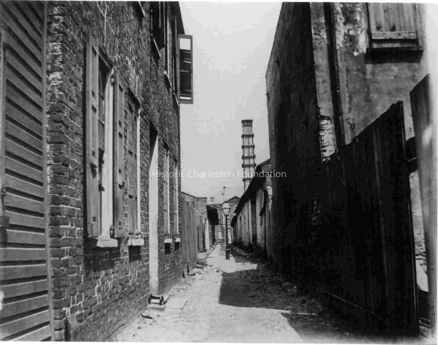
Developed before 1788. Developed by the mid-18th century, Charleston's urban core included several narrow alleys. One of these alleys, Longitude Lane, bisected larger central blocks, thus creating new lots for future development. Fully improved by the end of the 18th century, some of these lots contained substantial structures, many owned by the Russell-Dehon families. At the southwest corner of East Bay Street and Longitude Lane stood the 17th century house of the landgrave, Thomas Smith, governor of Carolina from 1693 to 1694. Longitude Lane, one of the surviving small alleys of the original city, formerly accessed rear buildings for the lots on Tradd Street as well as individual structures. Prior to construction of 51 Meeting Street, the Nathaniel Russell family lived at the northwest corner of Longitude and East Bay Street. (Poston, Buildings of Charleston.)
File contains handwritten (HCF staff) scant references to properties owned by Nathaniel Russell on Church Street (1784) and Tradd Street (1788); deed and plat of (BK X4, PG 145, 1788) Longitude Lane property where Russell lived prior to moving to Meeting Street; property owned by Nathaniel Russell newspaper article (1958) about restoration of the brick dwelling "just off Church Street" (28 Longitude?); newspaper article (1961) about a cannon on Longitude Lane and the Battle of Longitude Lane; copy of 1852 plat by E.B. White of north side of Longitude Lane and south side of Tradd Street; letter to City of Charleston from architect William D. Evans (2002) regarding the history of 6 Longitude Lane, with enclosures (maps, plats).Collection
Historic Charleston Foundation Property RecordsAcquisition
Accession
LONGITUDE.GEN.Source or Donor
Longitude Lane (General)Acquisition Method
Collected by StaffLexicon
Search Terms
Longitude Lane, Historic buildings--South Carolina--Charleston, Streets--South Carolina--CharlestonArchive Details
Archive Size/Extent
1 File FolderArchive Notes
Finding Aids: Index to Property Files
Level of Description: FolderLocation
Location
Shelf
Property File ShelvesRoom
Margaretta P. Childs ArchivesBuilding
Missroon HouseCategory
PermanentDate
February 7, 2023Location
Container
PF Box 65Shelf
Prop File Shelves, Property File ShelvesRoom
Margaretta P. Childs ArchivesBuilding
Missroon HouseCategory
PermanentRelationships
Related Entries
Notes
2004.021.041, 2017.024.39
Related Units of Description: A Walk Around Ye Olde Charleston (photo, ca. 1912), 2005.001.02
Photograph of 25 Longitude Lane in Harper Scrapbook, 2010.001.04.Related Publications
Notes
Buildings of Charleston (see Abstract), pg. 119-120 and pg. 74 (74 Church St.)General Notes
Note
Notes: Photo 1, Sams Collection. Photo 2, Staats Collection.Created By
admin@catalogit.appCreate Date
March 9, 2010Updated By
admin@catalogit.appUpdate Date
February 17, 2023