Name/Title
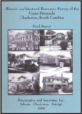
A Historic Architectural Resources Survey of the Upper Peninsula, Charleston, South Carolina: Final ReportEntry/Object ID
2005.003.0024Description
A survey of over 4,000 historic architectural resources within a "survey universe" of approximately 2,058 acres. The results of the survey serve as an archival record of the Upper Peninsula's historic resources and contain an inventory of every site recorded during the fieldwork. The project was part of the Statewide Survey of Historic Places, a program coordinated by the South Carolina State Historic Preservation Office (SHPO), the purpose of which is to highlight those cultural resources that are eligible for the National Register of Historic Places and for local designation. Includes the following sections: overview of the historic settlement of the Upper Peninsula; previously identified historic architectural resources; survey results; and recommendations
Properties, sites, and individual resources include: Hampton Park Terrace Historic District; Lowndes Grove; Enston Homes; Magnolia Cemetery; Florence Crittenton Home; North of 17 Historic District; Carondolet Street Historic District; Dingle Street Historic District; North Tracy Street Historic District; 74 Fishburne Street; Colin MiKissick Grant Home; Immigration Center; Charleston Railway Bus Barn; Charleston Fire Department Engine Number Eight Building; Citadel Parade Ground Historic District; Citadel Officers' Quarters Historic District; Magnolia Umbra Cemetery District; Rutledge Avenue Improvement Historic District; East Riverside Park Historic District; West Grove Street Historic District; 541 Rutledge Avenue; 167 Congress Street; 10 Parkwood Avenue; 573 Huger Street; 555 Huger Street; 39 Parkwood Avenue; 491 Huger Street; 117 Moultrie Street; 463 Huger Street; Hampton Park; 540 Rutledge Avenue; 90 Fishburne Street; 298 Sumter Street; Greek Orthodox Church; Bethany Cemetery; Saint Lawrence Cemetery; Saint Barnabas Evangelical Lutheran Church; County Hall (1000 King Street); 981 King Street; 807 Rutledge Avenue; 809 Rutledge Avenue; 1126 King Street; 28 Maple Street; 60 Poplar Street; 842 Rutledge Avenue; 31 Cypress Street; 887 Rutledge Avenue; 66 San Souci Street; 164 Maple Street; 165 Maple Street; 187 Grove Street; 308 Grove Street.
See Media tab for full Table of Contents.
xi, 147 leaves., 79 leaves., [23] folded leaves, ill., maps, ppbk, spiralboundCollection
Historic Charleston Foundation LibraryAcquisition
Accession
2005.003.Source or Donor
New Library Catalog Records (2005)Acquisition Method
Found in CollectionLexicon
Nomenclature 4.0
Nomenclature Primary Object Term
BookNomenclature Sub-Class
Other DocumentsNomenclature Class
Documentary ObjectsNomenclature Category
Category 08: Communication ObjectsSearch Terms
Fine arts, Architecture, Aesthetics of cities, city planning, city beautifying, Historic districts, Upper Peninsula, Architecture--South Carolina--Charleston--Surveys, Historic buildings--South Carolina--Charleston--Surveys, Charleston (S.C.)--Buildings, structures, etc.--SurveysBook Details
Publisher
Brockington and AssociatesPlace Published
Location
Atlanta, Charleston, RaleighDate Published
2004Call No.
NA9053 .H55 H578 2004Notes
Copy No.: 0Location
Location
Room
Margaretta P. Childs ArchivesBuilding
Missroon HouseCategory
PermanentDate
February 7, 2023Moved By
Winslow HastieDate
May 4, 2021Moved By
Winslow HastieDate
January 22, 2015General Notes
Note
Notes: Prepared for City of Charleston Design, Development and Preservation Department, Charleston, South Carolina.
Prepared by John Beaty, Architectural Historian, and Ralph Bailey, Principal Investigator.
Includes bibliographical references (p. 140-147).
Includes a variety of map portions of locations, and appendices include an inventory of surveyed resources; location of surveyed resources (County tax maps); and a detailed map of the Upper Peninsula Survey Universe.
See Multimedia Link for list of illustrations.Created By
admin@catalogit.appCreate Date
February 16, 2005Updated By
sferguson@historiccharleston.orgUpdate Date
May 24, 2023