Name/Title
Map "Attack on Fort Moultrie on Sullivans Island"Entry/Object ID
77.8.1Tags
Needs reviewDescription
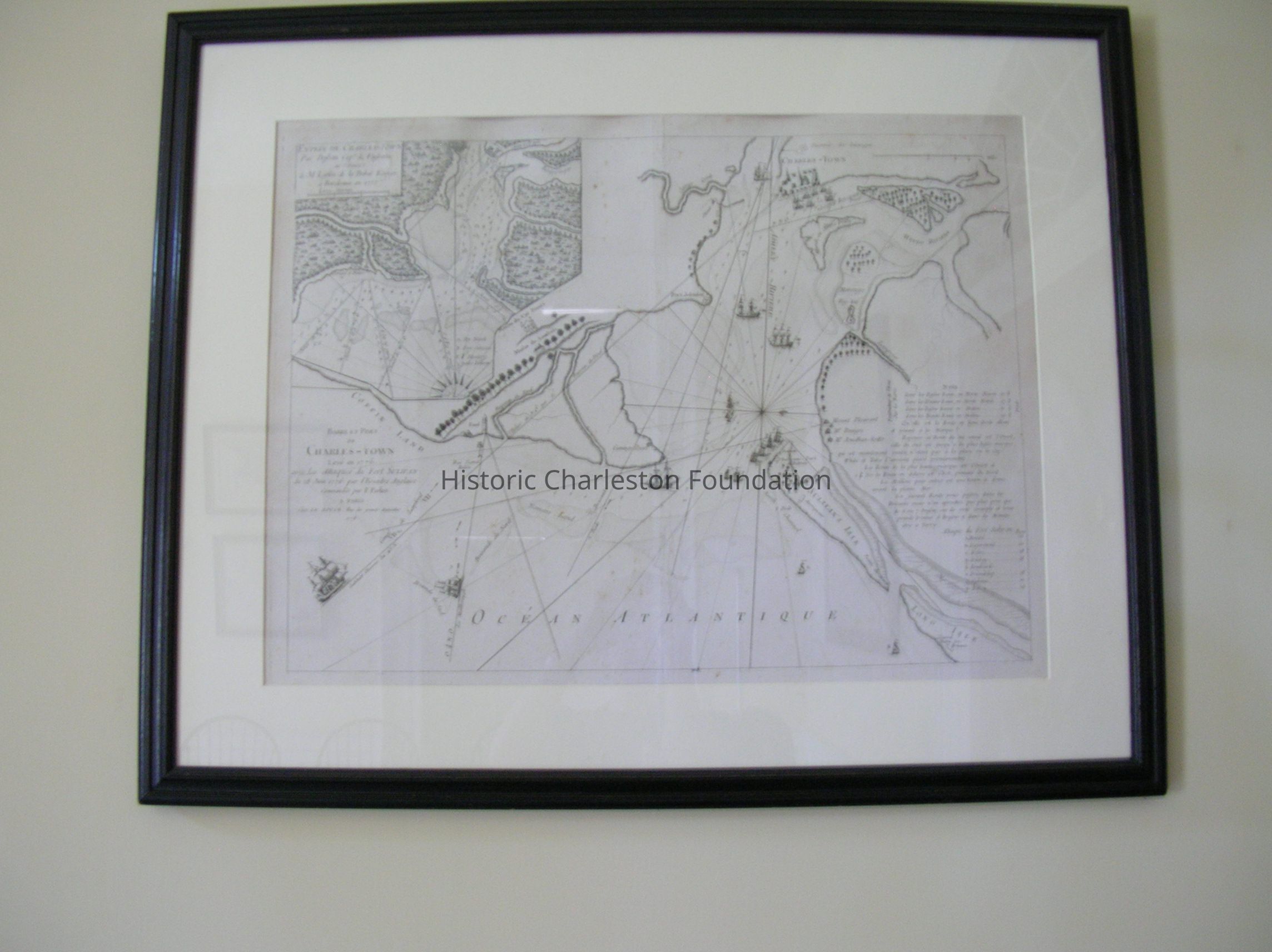
George Louis Le Rouge (1707-1790)
Map of the Attack on Fort Moultrie
1778
Ink on paper
Lerouge Map of the Attack on Fort Moultrie. Barre Et Port De Charles Town Leve En 1776 Avec Les Attaques Du Fort Sulivan Du 28 Juin 1776 Par L'Eascadre Anglaise. Commande Par P. Parker a Paris. Chez La Rouge, Rue Des Grands Augustins 1778.Collection
Historic Charleston Foundation CollectionAcquisition
Accession
77.8.Source or Donor
Patten, Mr. and Mrs. WalterAcquisition Method
GiftLexicon
Nomenclature 4.0
Nomenclature Secondary Object Term
MapNomenclature Primary Object Term
CartographNomenclature Sub-Class
Graphic DocumentsNomenclature Class
Documentary ObjectsNomenclature Category
Category 08: Communication ObjectsOther Names and Numbers
Other Numbers
Number Type
Other NumberOther Number
77.1.2Number Type
Old NumberOther Number
77.1.4Dimensions
Dimension Notes
[height] __[length] __[width] __[depth] __[diameter] __[size] __[other]Location
Location
Room
101ABuilding
Nathaniel Russell HouseMoved By
June HawkinsDate
June 25, 2002Notes
Until: / /Location
Building
NR RECEPTION ROOMMoved By
RedDate
June 3, 1998Notes
Until: / /Location
Room
101ABuilding
Nathaniel Russell HouseCategory
PermanentGeneral Notes
Note
Tag Date: 2022-11-03 14:19:12
Tag Notes: missing NR101A
Notes: Originally Ea Number 77.1 (C).4
Status: OK
Location Details1: 1Created By
admin@catalogit.appCreate Date
June 3, 1998Updated By
sferguson@historiccharleston.orgUpdate Date
May 1, 2023