Name/Title
Petrie Map of CharlestonEntry/Object ID
78.1.2Tags
Needs new photographyDescription
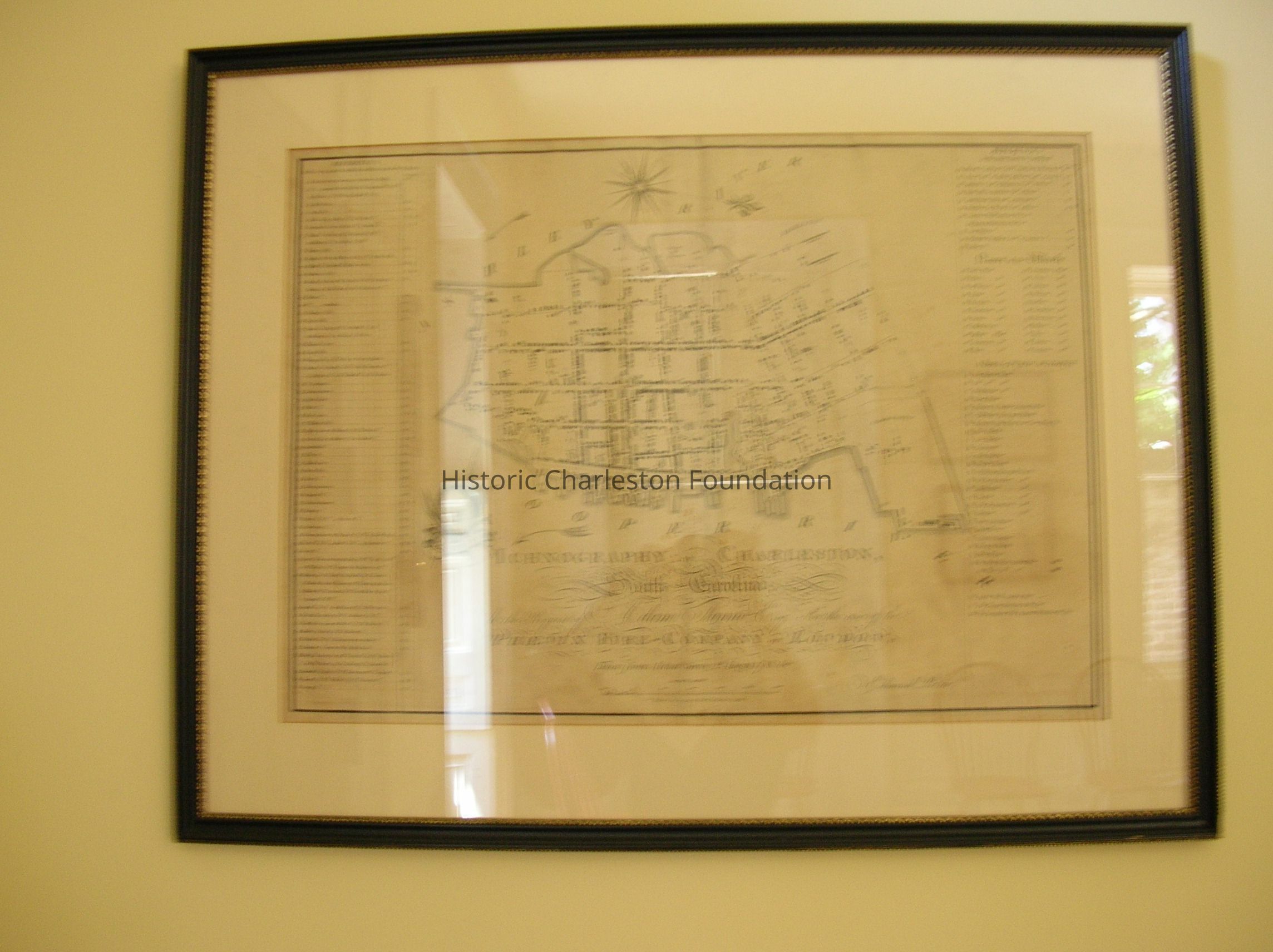
Edmund Petrie
Ichnography of Charleston, South Carolina
Taken from actual survey, 2nd August 1788 by Edmund Petrie
Publish'd 1st Jany. 1790 by E. Petrie No. 13 America Square
Charleston
Ink on paper
Map of Charleston By Edmund Petrie Cartographer, Done For the Phoenix Fire Insurance Co. and Believed To Be the First Published Fire Insurance Company Map of an American City.Collection
Historic Charleston Foundation CollectionAcquisition
Accession
78.1.2Acquisition Method
PurchaseLexicon
Nomenclature 4.0
Nomenclature Secondary Object Term
MapNomenclature Primary Object Term
CartographNomenclature Sub-Class
Graphic DocumentsNomenclature Class
Documentary ObjectsNomenclature Category
Category 08: Communication ObjectsLocation
Location
Room
101ABuilding
Nathaniel Russell HouseCategory
PermanentDate
February 7, 2023Location
Room
101ABuilding
Nathaniel Russell HouseMoved By
June HawkinsDate
June 25, 2002Notes
Until: / /Location
Building
NR RECEPTION ROOMMoved By
RedDate
June 3, 1998Notes
Until: / /Relationships
Related Entries
Notes
2005.002.001, 2007.002.0037General Notes
Note
Status: OK
Location Details1: 1Created By
admin@catalogit.appCreate Date
June 3, 1998Updated By
sferguson@historiccharleston.orgUpdate Date
May 1, 2023