Name/Title
Plat Showing Blackbird Alley (Burns Lane)Entry/Object ID
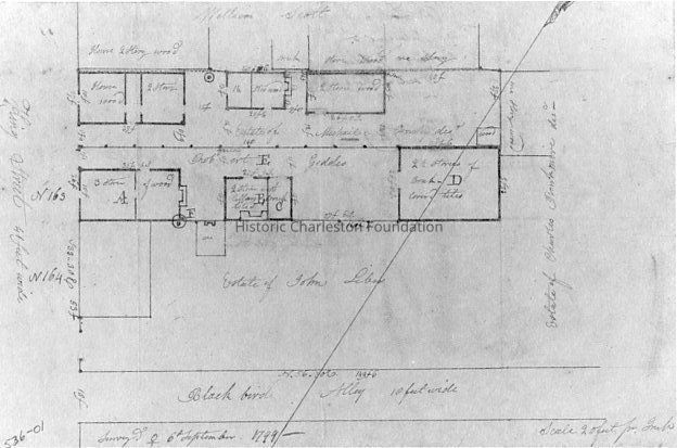
BURNS.GEN.1Description
Photographic reprint of a 1799 plat showing Blackbird Alley (now Burns Lane).
Burns Lane was established by 1801. Small tradesmen and laborers lived in Blackbird Alley, later named Burns Lane, through the 19th century. Most of the small dwellings have been removed, but the scale and finish of 20 Burns Lane are indicative of some of those buildings that were demolished. The Horlbeck family built this house before 1852, as well as the building at 22 Burns Lane, possibly an outbuilding to a Horlbeck house that faced Calhoun Street. The structure at 21 Burns Lane was built as an inexpensive tavern or brothel by 1820 and formerly contained more than ten fireplaces. As a tenement occupied by black families until the mid-20th century, the structure was renovated with additions by a developer in 1987. (Buildings of Charleston, p. 426.)Collection
Historic Charleston Foundation Property RecordsAcquisition
Accession
BURNS.GEN.Source or Donor
Burns Lane (General)Acquisition Method
Found in CollectionLexicon
Nomenclature 4.0
Nomenclature Tertiary Object Term
PlatNomenclature Secondary Object Term
MapNomenclature Primary Object Term
CartographNomenclature Sub-Class
Graphic DocumentsNomenclature Class
Documentary ObjectsNomenclature Category
Category 08: Communication ObjectsLOC Thesaurus for Graphic Materials
PlatsSearch Terms
Streets, Burns Lane, Ansonborough, Blackbird Alley, Streets--South Carolina--CharlestonLocation
Location
Cabinet
Photo File CabinetsRoom
Margaretta P. Childs ArchivesBuilding
Missroon HouseCategory
PermanentDate
February 7, 2023Provenance
Notes
Plat from the Charleston Register of Mesne Conveyance; possibly no. 536-01 (written at lower right corner).Created By
admin@catalogit.appCreate Date
October 30, 2014Updated By
admin@catalogit.appUpdate Date
February 17, 2023