Name/Title
19 Elliott StreetEntry/Object ID
ELLIOTT.019.1Scope and Content
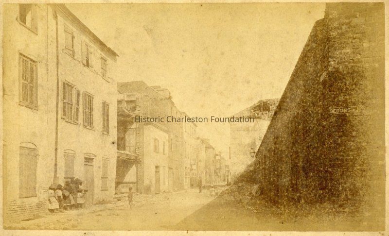
The parcel on the southeast corner of Elliott Street and Bedons Alley can be dated back to the 1678 Grand Modell Map of Charles Towne. Located only a block away from the heart of the Towne, 19 Elliott was a part of a rather large parcel of land numbered 10 in the Grand Modell map. This huge lot of land owned by Mr. Barnard Schenckingh was bounded by East Bay Street on the east, Elliott Street to the north, and Bedons Alley to the west, and was later owned by William Elliott. Interestingly, an alley was carved on this lot in 1683 which would connect to the waterside named as Caillabeuf's lane in 1722, later renamed as Elliott Street only in 1740. The property underwent various phases of divisions and consolidations to form one large property that we see today. The earliest property records for this corner lot can be dated back to 1787. (Kamath, Annotated Chain-of-Title.)
File contains historical/title research including chain-of-title, photocopies of deeds, plats, Sanborn Maps, and photograph; color-coded property research map (Rucha Kamath, HCF Summer Intern, 2018).Collection
Historic Charleston Foundation Property RecordsAcquisition
Accession
ELLIOTT.019.Source or Donor
19 Elliott StreetAcquisition Method
Collected by StaffLexicon
Search Terms
Elliott StreetArchive Details
Archive Size/Extent
1 File FolderLocation
Location
Shelf
Property File ShelvesRoom
Margaretta P. Childs ArchivesBuilding
Missroon HouseCategory
PermanentDate
February 7, 2023Location
Container
PF Box 41Shelf
Prop File Shelves, Property File ShelvesRoom
Margaretta P. Childs ArchivesBuilding
Missroon HouseCategory
PermanentCreated By
admin@catalogit.appCreate Date
August 13, 2018Updated By
admin@catalogit.appUpdate Date
February 17, 2023