Name/Title
Ansonborough Rehabilitation Project [Project Map]Entry/Object ID
HCF.005.3B.3Scope and Content
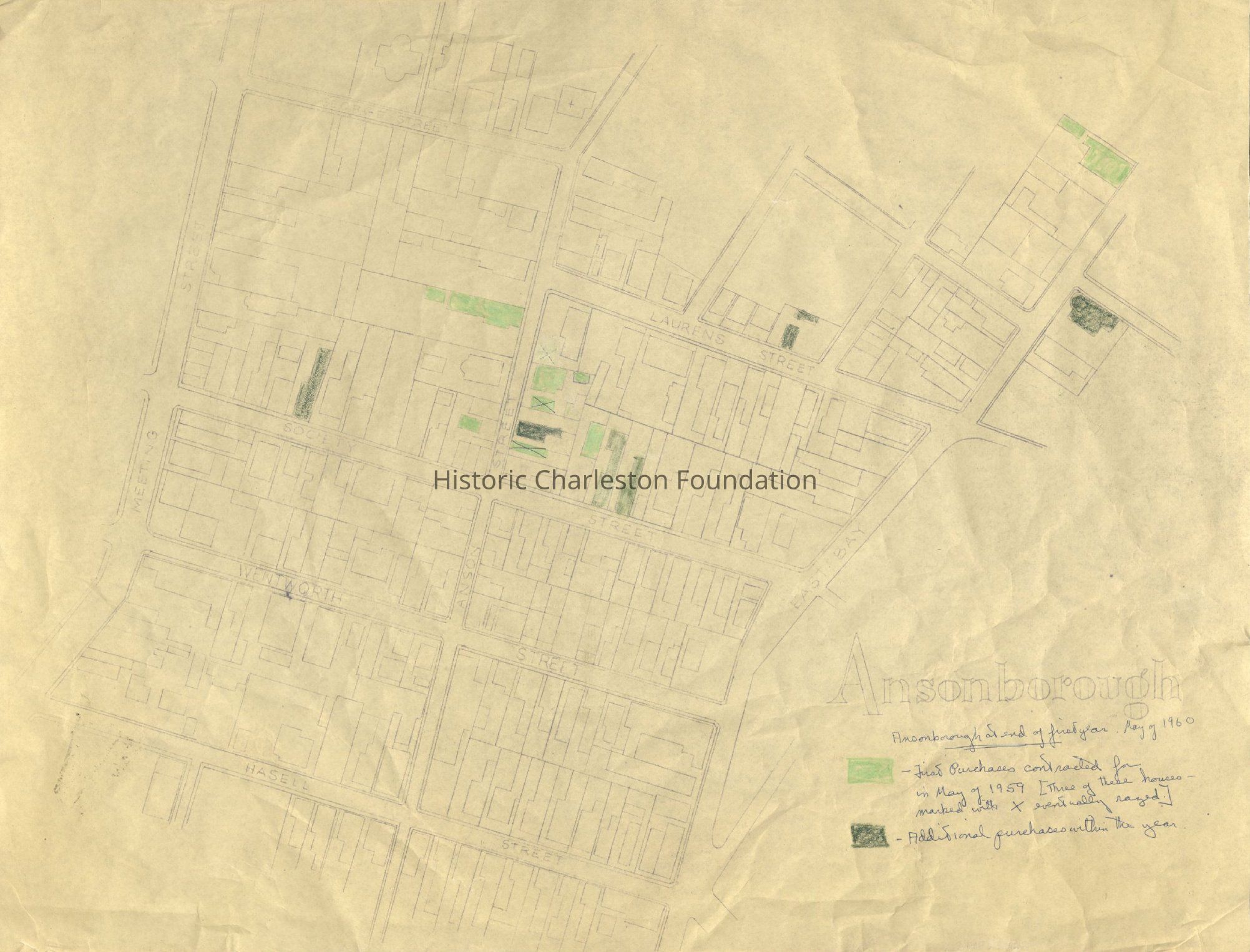
Three maps showing the footprints of Ansonborough buildings, annotated to indicate the status and progress of the Ansonborough Rehabilitation Project.
Sheet 1: "Ansonborough at end of first year, May of 1960," identifying the first purchases contracted for in May of 1959 and additional purchases within the year.
Sheet 2: "Ansonborough at end of fourth year, May of 1963," identifying additional purchases from May 1960-1963.
Sheet 3: Map showing houses for sale; houses sold and restored or in process of restoration by owners; houses in rental endowment; and "done over" since 1959 by [unknown] individuals.Collection
HCF Map CollectionLexicon
Nomenclature 4.0
Nomenclature Secondary Object Term
MapNomenclature Primary Object Term
CartographNomenclature Sub-Class
Graphic DocumentsNomenclature Class
Documentary ObjectsNomenclature Category
Category 08: Communication ObjectsSearch Terms
Ansonborough, Ansonborough Rehabilitation Project (ARP), Neighborhoods--Conservation and restoration--South Carolina--Charleston, Neighborhood planning--South Carolina--Charleston, Historic preservation--South Carolina--CharlestonArchive Details
Creator
Historic Charleston FoundationArchive Size/Extent
3 sheets; 20" x 15.25"Archive Notes
Date(s) Created: 1960s
Date(s): 1960s
Level of Description: ItemLocation
Location
Drawer
Drawer 2Cabinet
Blueprints-Maps 5Room
Margaretta P. Childs ArchivesBuilding
Missroon HouseCategory
PermanentDate
February 7, 2023Date
September 10, 2014Notes
Reason: Digitization for LCDL & LDHI Exhibit
Authorized By: Karen EmmonsRelationships
Related Entries
Notes
2013.003.04, HCF.005.3A, HCF.005.3B, HCF.005.3B.1, HCF.005.3B.2, HCF.005.3B.4, HCF.005.3B.5, HCF.005.3B.6, HCF.005.3B.7Created By
admin@catalogit.appCreate Date
September 9, 2014Updated By
admin@catalogit.appUpdate Date
February 17, 2023