Name/Title
Commercial Area: Preliminary Study Sheet [Map]Entry/Object ID
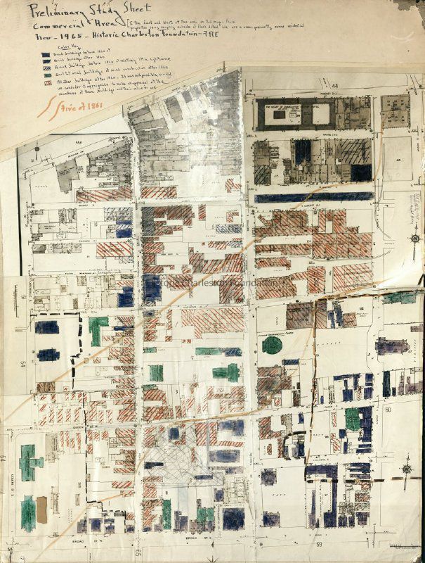
HCF.005.10hScope and Content
Copy of a Sanborn Map hand-colored and annotated for use by Historic Charleston Foundation to study the commercial area bounded by Beaufain Street/Hasell Street/Pinckney Street, Church Street, Broad Street, and Archdale Street). Indicates the path of the fire of 1861.
Color-coding depicts building status and condition; see color key for details.
Created by F.R.E. (Frances R. Edmunds), November 1965.Collection
HCF Map CollectionAcquisition
Accession
HCF.Source or Donor
HCF Institutional RecordsAcquisition Method
Collected by StaffLexicon
Nomenclature 4.0
Nomenclature Secondary Object Term
MapNomenclature Primary Object Term
CartographNomenclature Sub-Class
Graphic DocumentsNomenclature Class
Documentary ObjectsNomenclature Category
Category 08: Communication ObjectsSearch Terms
HCF project maps, Charleston (S.C.)--Maps, Neighborhoods--South Carolina--Charleston, Commercial buildings--South Carolina--CharlestonArchive Details
Creator
Edmunds, Frances R.Date(s) of Creation
Nov 1965Archive Size/Extent
Photocopy of map mounted on matboard, 30" x 39"Archive Notes
Date(s): 1965
Level of Description: ItemLocation
Location
Container
Oversize Box 9Shelf
Top of Archives A/BRoom
Margaretta P. Childs ArchivesBuilding
Missroon HouseCategory
PermanentDate
February 7, 2023Exhibitions
Notes
Exhibit Start: 2015-11-16Created By
admin@catalogit.appCreate Date
July 12, 2017Updated By
admin@catalogit.appUpdate Date
February 16, 2023