Name/Title
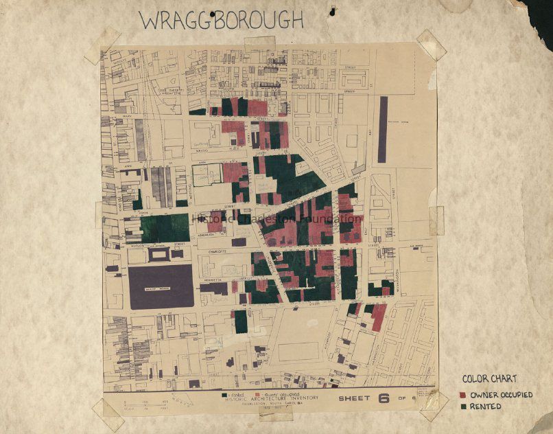
Wraggborough: Owner-Occupied and Rented Properties [Map]Entry/Object ID
2017.001.2Scope and Content
Copy of a "Historic Architecture Inventory" map showing the area in Wraggborough bounded by Reid Street, Washington Street, Calhoun Street, and King Street. Color-coded to indicate owner-occupied and rented properties.Collection
HCF Map CollectionAcquisition
Accession
2017.001Source or Donor
New Archives Catalog Records (2017)Acquisition Method
Collected by StaffLexicon
Nomenclature 4.0
Nomenclature Secondary Object Term
MapNomenclature Primary Object Term
CartographNomenclature Sub-Class
Graphic DocumentsNomenclature Class
Documentary ObjectsNomenclature Category
Category 08: Communication ObjectsSearch Terms
HCF project maps, Wraggborough, Charleston (S.C.)--Maps, Neighborhoods--South Carolina--CharlestonArchive Details
Creator
Historic Charleston FoundationDate(s) of Creation
circa 1975Archive Size/Extent
1 map mounted on matboard, 28" x 22"Archive Notes
Date(s): ca. 1975
Level of Description: ItemLocation
Location
Container
Folder 4Drawer
Drawer 4Cabinet
Blueprints-Maps 5Room
Margaretta P. Childs ArchivesBuilding
Missroon HouseCategory
PermanentDate
February 7, 2023Created By
admin@catalogit.appCreate Date
July 12, 2017Updated By
admin@catalogit.appUpdate Date
February 16, 2023