Name/Title
Maps of Charleston S.C. Office of City Engineer [Traffic Survey]: 1942Entry/Object ID
2019.001.1Scope and Content
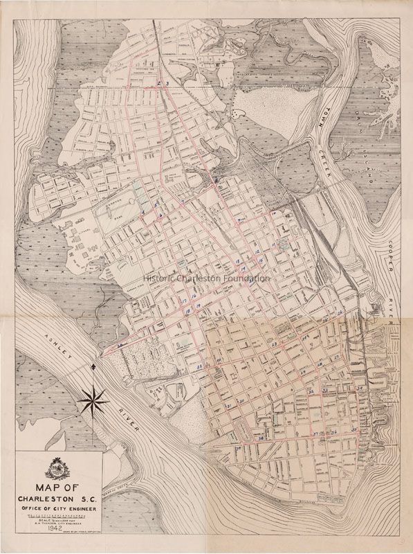
Map of the Charleston peninsula showing the traffic count locations for a survey done by the Metropolitan Council (Civic Services Committee). Boundaries of the survey in red pencil. Street names indicated.
Created by Office of City Engineer.Collection
HCF Map CollectionAcquisition
Accession
2019.001Source or Donor
New Archives Catalog Records (2019)Acquisition Method
Collected by StaffLexicon
Nomenclature 4.0
Nomenclature Secondary Object Term
MapNomenclature Primary Object Term
CartographNomenclature Sub-Class
Graphic DocumentsNomenclature Class
Documentary ObjectsNomenclature Category
Category 08: Communication ObjectsSearch Terms
Peninsula maps, Charleston (S.C.)--Maps, Traffic surveys--MapsArchive Details
Date(s) of Creation
1942Archive Size/Extent
1 map, 20" x 15"Archive Notes
Date(s): 1942
Scale: 1:1000Location
Location
Container
See Notes TabRoom
Margaretta P. Childs ArchivesBuilding
Missroon HouseCategory
PermanentDate
February 7, 2023Relationships
Related Places
Place
City
CharlestonState/Province
South CarolinaCountry
United States of AmericaGeneral Notes
Note
Notes: Filed in Civic Services Collection, Folder 46.Created By
admin@catalogit.appCreate Date
February 5, 2019Updated By
admin@catalogit.appUpdate Date
February 17, 2023