Name/Title
Maps of the State of South CarolinaEntry/Object ID
2019.001.5a-dScope and Content
Photocopies of maps of the state of South Carolina:
a: Map dated 1838. "Entered according to Act of Congress in the year 1838 by T.C. Bradford, in the Clerk's Office of the District Court of Massachusetts. Engraved by G.W. Boynton." (Measures 11" x 15.5".)
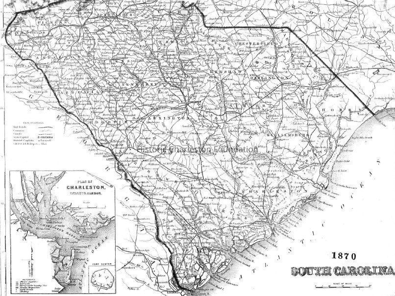
b: Map dated 1870. Includes inset featuring "Plan of Charleston, Vicinity and Harbor." (Measures 16" x 11".)
c: "The Century Atlas, South Carolina." Map dated 1897, by The Century Company. Includes inset featuring "Map of Charleston, Harbor and Vicinity." (Measures 11" x 17".)
d: Map dated 1906, by Dodd, Mead & Co. Includes indexes to "Counties of South Carolina" and "Principal Cities and Towns of South Carolina." (Measures 11" x 15.5".)
Sources of original maps not indicated.Collection
HCF Map CollectionAcquisition
Accession
2019.001Source or Donor
New Archives Catalog Records (2019)Acquisition Method
Collected by StaffLexicon
Nomenclature 4.0
Nomenclature Secondary Object Term
MapNomenclature Primary Object Term
CartographNomenclature Sub-Class
Graphic DocumentsNomenclature Class
Documentary ObjectsNomenclature Category
Category 08: Communication ObjectsSearch Terms
South Carolina--MapsArchive Details
Archive Notes
Date(s): 1838-1906
Finding Aids: See Finding Aid to Architectural Drawings, Maps, and Plats.
See List of Properties; then locate Cabinet, Drawer, Folder.
Level of Description: ItemLocation
Location
Container
Misc. Plats & MapsDrawer
Drawer 1Cabinet
Blueprints-Maps 6Room
Margaretta P. Childs ArchivesBuilding
Missroon HouseCategory
PermanentDate
February 7, 2023Created By
admin@catalogit.appCreate Date
February 11, 2019Updated By
admin@catalogit.appUpdate Date
February 17, 2023