Name/Title
A Sketch of the Operations before Charleston, the Capital of South CarolinaEntry/Object ID
2019.001.13Scope and Content
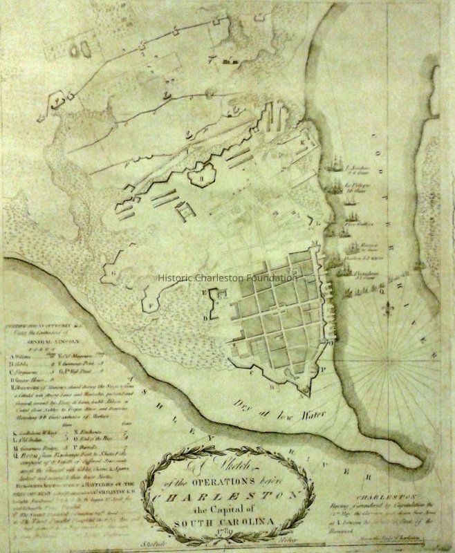
A Sketch of the Operations before Charleston, the Capital of South Carolina, 1780.
"Charleston having surrendered by capitulation the 12th of May, the garrison laid down their arms at I, between the abbatis in front of the hornwork."
Table of references identifies features and details of the Siege including fortifications. Ships in the harbor also identified.
Print of an original map by Abernethie.Collection
HCF Map CollectionAcquisition
Accession
2019.001Source or Donor
New Archives Catalog Records (2019)Acquisition Method
Collected by StaffLexicon
Nomenclature 4.0
Nomenclature Secondary Object Term
MapNomenclature Primary Object Term
CartographNomenclature Sub-Class
Graphic DocumentsNomenclature Class
Documentary ObjectsNomenclature Category
Category 08: Communication ObjectsSearch Terms
Historic maps of Charleston, Charleston (S.C.)--Maps--Early works to 1800, Charleston (S.C.)--History--Siege, 1780--MapsArchive Details
Creator
Abernethie, ThomasArchive Size/Extent
1 map, ~11.5" x 14.5"Archive Notes
Date(s) Created: 1780 (original); date of print
Date(s): 1780 (date of original)
Publisher: Hayden Brother & Co.
Place Published: CharlestonLocation
Location
Container
FolderDrawer
Drawer 4Cabinet
Blueprints-Maps 5Room
Margaretta P. Childs ArchivesBuilding
Missroon HouseCategory
PermanentDate
February 7, 2023Created By
admin@catalogit.appCreate Date
February 15, 2019Updated By
admin@catalogit.appUpdate Date
February 16, 2023