Name/Title
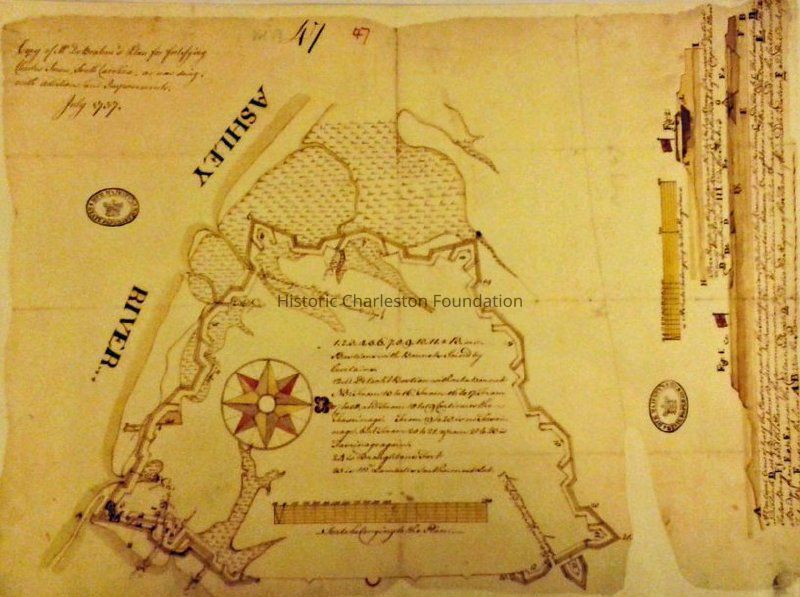
Plan for Fortifying Charles Town, South CarolinaEntry/Object ID
2019.001.15Scope and Content
Photographic reprint of DeBrahm's July 1757 "Plan for Fortifying Charles Town, South Carolina, as Now Doing, with Additions and Improvements." Shows the fortification wall surrounding the City [Walled City]. Includes references to points of interest.
Source of original map not indicated.Collection
HCF Map CollectionAcquisition
Accession
2019.001Source or Donor
New Archives Catalog Records (2019)Acquisition Method
Collected by StaffLexicon
Nomenclature 4.0
Nomenclature Secondary Object Term
MapNomenclature Primary Object Term
CartographNomenclature Sub-Class
Graphic DocumentsNomenclature Class
Documentary ObjectsNomenclature Category
Category 08: Communication ObjectsSearch Terms
Historic maps of Charleston, Wall Street, Forts and fortifications--South Carolina--Charleston--Maps, Charleston (S.C.)--MapsArchive Details
Creator
De Brahm, William Gerard, 1717-1799Date(s) of Creation
Jul 1757Archive Size/Extent
Photographic reprint of map, 15.5" x 20" (2 copies)Archive Notes
Date(s): 1757 (date of original)Location
Location
Container
FolderDrawer
Drawer 4Cabinet
Blueprints-Maps 5Room
Margaretta P. Childs ArchivesBuilding
Missroon HouseCategory
PermanentDate
February 7, 2023General Notes
Note
Notes: Two copies of reprint.Created By
admin@catalogit.appCreate Date
February 19, 2019Updated By
admin@catalogit.appUpdate Date
February 16, 2023