Name/Title
Map of American Defenses During the Siege of CharlestonEntry/Object ID
2019.001.22Scope and Content
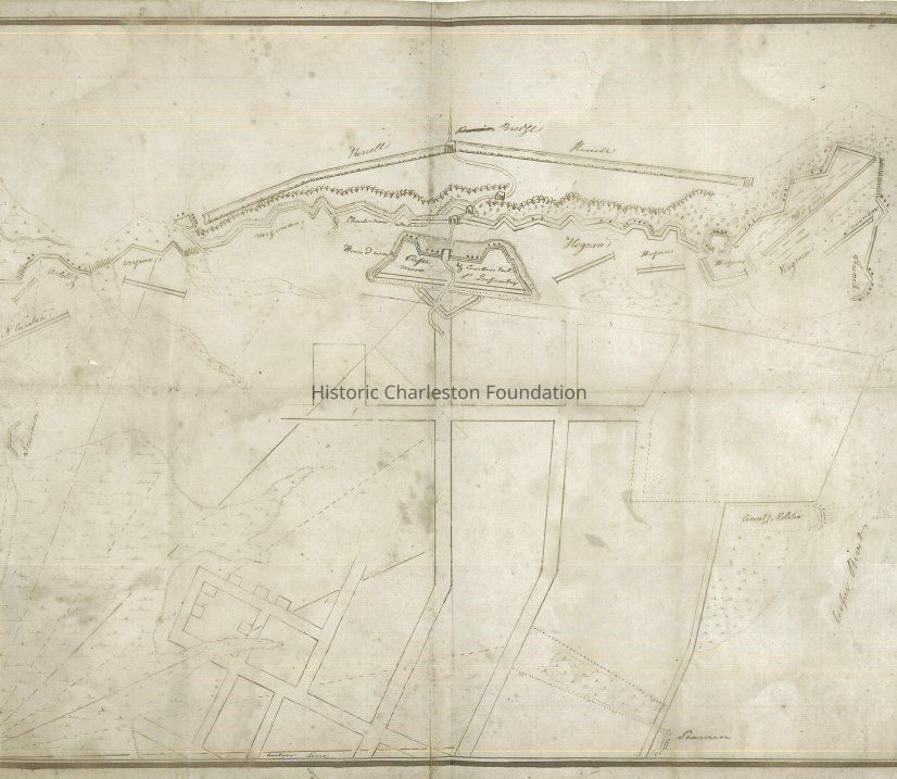
Reproduction of a map done by a volunteer with the American forces showing the American defenses during the Siege of Charleston in 1780. Distinguishing feature is the "horn work" at the upper center of the map.
Possibly reproduced by the Cincinnati Society. Original map in the Yale Univrsity Library.Collection
HCF Map CollectionAcquisition
Accession
2019.001Source or Donor
New Archives Catalog Records (2019)Acquisition Method
Collected by StaffLexicon
Nomenclature 4.0
Nomenclature Secondary Object Term
MapNomenclature Primary Object Term
CartographNomenclature Sub-Class
Graphic DocumentsNomenclature Class
Documentary ObjectsNomenclature Category
Category 08: Communication ObjectsSearch Terms
Historic maps of Charleston, Charleston (S.C.)--Defenses--Maps--Early works to 1800Archive Details
Archive Size/Extent
1 map (reproduction), 19.5" x 15.5"Archive Notes
Date(s) Created: 1780 (date of original)
Date(s): 1780 (date of original)Location
Location
Container
FolderDrawer
Drawer 4Cabinet
Blueprints-Maps 5Room
Margaretta P. Childs ArchivesBuilding
Missroon HouseCategory
PermanentDate
February 7, 2023General Notes
Note
Notes: Information about the map provided by Carl Borick, Charleston Museum. See Media tab.Created By
admin@catalogit.appCreate Date
February 25, 2019Updated By
admin@catalogit.appUpdate Date
February 17, 2023