Name/Title
Construction of the James Island ConnectorEntry/Object ID
2020.003.8Description
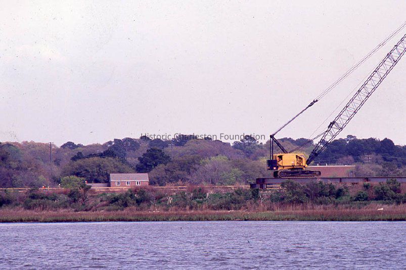
Forty-three color slides documenting the construction of the James Island Connector. Also includes marsh and waterfront views that show context.
Photos 1-4 scanned.
The route was proposed as early as the 1960s to provide a second and more direct connection between James Island and downtown Charleston. It opened on September 4, 1993, and provided a route off the island that did not require crossing a drawbridge. (Wikipedia.) Historic Charleston Foundation was integral to the planning of the bridge and advocated for the current location instead of routes that were planned by the SC Department of Transportation that would have impacted the historic district.Collection
HCF Image CollectionAcquisition
Accession
2020.003Source or Donor
New Photos Catalog Records (2020)Acquisition Method
Found in CollectionMade/Created
Artist
Historic Charleston FoundationLexicon
Nomenclature 4.0
Nomenclature Tertiary Object Term
Transparency, SlideNomenclature Secondary Object Term
TransparencyNomenclature Primary Object Term
PhotographNomenclature Sub-Class
Graphic DocumentsNomenclature Class
Documentary ObjectsNomenclature Category
Category 08: Communication ObjectsSearch Terms
Express highways--South Carolina--Charleston--Design and construction, Express highways--South Carolina--Charleston, Express highways--South Carolina--James Island, Marshes--South Carolina--Charleston, Waterfronts--South Carolina--CharlestonLocation
Location
Container
See Notes TabShelf
AV MaterialsRoom
Margaretta P. Childs ArchivesBuilding
Missroon HouseCategory
PermanentDate
February 7, 2023Copyright
Copyright Details
In copyrightGeneral Notes
Note
Notes: Filed in slide box labeled "Miscellaneous & Unidentified #1."Created By
admin@catalogit.appCreate Date
July 17, 2020Updated By
admin@catalogit.appUpdate Date
February 17, 2023