Name/Title
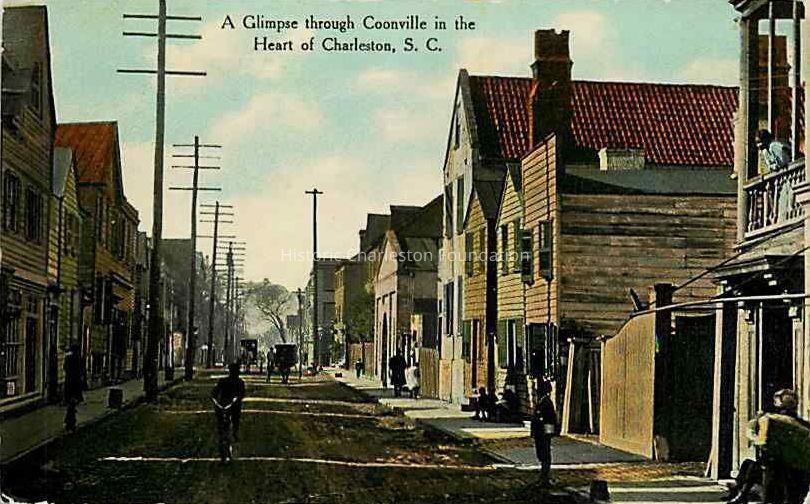
"A Glimpse Through Coonville in the Heart of Charleston" [Beaufain Street, 30-40 Block]Entry/Object ID
2015.015.4Tags
Content warningDescription
Historic Charleston Foundation denounces the use of the derogatory and racist language that appears in the original item.
Postcard (scan) featuring the view looking west on Beaufain Street (the 30 block) showing the African American neighborhood that was between Coming Street and near Archdale Street, where today the triangle of land between Memminger and the Canterbury House (near St. Philip and Archdale) are now. The houses were demolished. Pedestrians are on the sidewalk, carts and a man riding a bicycle are on the street.Collection
HCF Image CollectionAcquisition
Accession
2015.015Source or Donor
Eberle, KevinAcquisition Method
OtherCredit Line
Courtesy of Kevin EberleLexicon
Nomenclature 4.0
Nomenclature Primary Object Term
PostcardNomenclature Sub-Class
Writing MediaNomenclature Class
Written Communication T&ENomenclature Category
Category 06: Tools & Equipment for CommunicationLOC Thesaurus for Graphic Materials
PedestriansSearch Terms
Postcards, Beaufain Street, Demolished buildings, lost buildings, Streets--South Carolina--Charleston, African American neighborhoods--South Carolina--Charleston, Lost architecture--South Carolina--Charleston, Carts and wagons, Bicycle ridersLocation
Category
PermanentDate
February 7, 2023Relationships
Related Entries
Notes
2009.013.20, 2015.015.4X, BEAUFAIN.039.1
See 2009.013.20, similar image a few years earlier. Record also contains views of 1888 and 1902 Sanborn Maps and research notes by Kevin Eberle.Provenance
Notes
Scan of postcard provided via email by Kevin Eberle 9/22/2015. Source not identified.Copyright
Copyright Details
Public domain.Created By
admin@catalogit.appCreate Date
September 23, 2015Updated By
sferguson@historiccharleston.orgUpdate Date
September 25, 2023