Properties in the Right-of-Way

Building on Right-of-Way of Road S-13: Origsize: 5x7; Origformat: Print-Photographic; Resolution: 75 dpi
Building on Right-of-Way of Road S-13

Origsize: 5x7; Origformat: Print-Photographic; Resolution: 75 dpi

Name/Title

Properties in the Right-of-Way

Entry/Object ID

2009.022.1

Description

B&W photographs of buildings and other properties located in Charleston County that were destroyed, relocated, or otherwise modified because they were in the right-of-way of where roads were being constructed or widened. Building and dwelling types include houses, apartment buildings, freedman's cottages, mobile homes, commercial and industrial buildings, churches, schools, gas stations, restaurants, grocery stores and corner markets, garages, sheds, outhouses, and other outbuildings. Roads: * I-26, Route 171 (Folly Road/St. Andrews Boulevard), Route 17 (Savannah Highway), State Road 31 (Reynolds Avenue), and State Road 13 (Remount Road). Stamped on back of photos is docket number, route number, county, property owner, tract number, station, and date; information filled in by hand. See Notes for explanation of surveyor measurements regarding "station." Photographs are grouped by docket number and within those groupings, photos of neighboring properties are (mostly) consecutive. See the entire collection on the Lowcountry Digital Library at http://lcdl.library.cofc.edu/content/scdot-photographs-properties-right-way.

Collection

HCF Image Collection

Acquisition

Accession

2009.022.

Source or Donor

South Carolina Department of Transportation

Acquisition Method

Other

Credit Line

Gift of the SC Dept. of Transportation

Made/Created

Artist

South Carolina Department of Transportation

Date made

1960 - 1969

Lexicon

Nomenclature 4.0

Nomenclature Primary Object Term
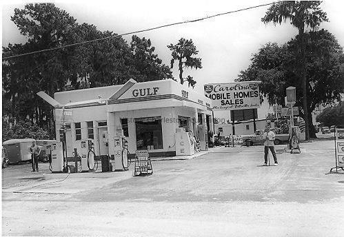
Photograph

Nomenclature Sub-Class

Graphic Documents

Nomenclature Class

Documentary Objects

Nomenclature Category

Category 08: Communication Objects

Search Terms

Demolished buildings, lost buildings, West Ashley, Lowcountry Digital Library, Cars, Gas stations, Lost architecture--South Carolina--Charleston County, Right of way--South Carolina - Charleston County, Highway planning--South Carolina--Charleston County, Streets--South Carolina--Charleston County, Charleston (S.C.)--Buildings, structures, etc., North Charleston (S.C.)--Buildings, structures, etc., Commercial buildings--South Carolina--Charleston County, Grocery stores--South Carolina--Charleston County, Vernacular architecture--South Carolina--Charleston County, Automobile dealers--South Carolina--Charleston County, Automobile repair shops--South Carolina--Charleston County, Backyards--South Carolina--Charleston County, Barbershops--South Carolina--Charleston County, Bars (Drinking establishments)--South Carolina--Charleston County, Billboards--South Carolina--Charleston County, Bowling alleys--South Carolina--Charleston County, Church buildings--South Carolina--Charleston County, Garages--South Carolina--Charleston County, Hardware stores--South Carolina--Charleston County, Industrial buildings--South Carolina--Charleston County, Industrial sites--South Carolina--Charleston County, Junk yards--South Carolina--Charleston County, Lumber-yards--South Carolina--Charleston County, Multipurpose buildings--South Carolina--Charleston County, Outbuildings--South Carolina--Charleston County, Outhouses--South Carolina--Charleston County, Parking lots--South Carolina--Charleston County, Public housing--South Carolina--Charleston County, Railroad tracks--South Carolina--Charleston County, Restaurants--South Carolina--Charleston County, School buildings--South Carolina--Charleston County, Self-service laundries--South Carolina--Charleston County, Service stations--South Carolina--Charleston County, Sheds--South Carolina--Charleston County, Supermarkets--South Carolina--Charleston County, Trailer camps--South Carolina--Charleston County, Warehouses--South Carolina--Charleston County

Dimensions

Height

5 in

Width

7 in

Location

Location

Container

PhotoBox 16-18

Shelf

AV Materials

Room

Margaretta P. Childs Archives

Building

Missroon House

Category

Permanent

Date

February 7, 2023

Relationships

Related Entries

Notes

2015.002.027

Provenance

Notes

Given by an SCDOT employee to Katherine Saunders Pemberton in June 2003. The photographs were going to be thrown out but the employee contacted Katherine before discarding.

Copyright

Copyright Details

Public domain.

General Notes

Note Type

In-House Note

Note

Notes: Stored in acid-free photograph envelopes (two per envelope). High resolution TIF files on DVDs: 1: DOTPhoto_0001-0427 2: DOTPhoto_0428-0856 3: DOTPhoto_0857-1282 4: DOTPhoto_1283-1669 + Verso 1-6 5: DOTPhoto_1670-2096 6: DOTPhoto_2097-2270 CONSULT LCDL METADATA FOR SCAN FILENAME. Also on External Hard Drive My Passport1: folder name "SCDOTPhotos." The following is a brief guide to understanding the station description: +: Plus sign ±: Plus or minus Rt: Right side of the road Lt: Left side of the road CL: Center line of the road R/W: Right-of-way N.B.: Northbound S.B.: Southbound ?: Triangular area of land or a median The stationing of roads is done in survey feet, not inches. Surveyors use feet, tenths, and hundredths of a foot. For example, the beginning of a road would be 0+00 (zero feet) and for every 100 feet, the number increases to 1+00, 2+00, etc. Therefore, if a station is 42+00 Rt, it is 4,200 ft. from the beginning of the road on the right side. (Note that right and left are related to the stations as they increase.) The beginning stations are usually at the start of a subdivision or at the "T-intersection" of roads. (Explanations provided by Roy T. Adams, Surveyor, SC Dept. of Transportation.) Kevin Eberle mapped several Crosstown and I-26 photos using the 1951 Sanborn Maps. See Media link. Box 16 contains Docket Nos. 439, 494, 518, 524, 541, 551, 562, 597, 600 (all non-I-26) Box 17 contains Docket Nos. 471, 480, 486, 490 (all I-26) Box 18 contains Docket Nos. 503, 510, 517 (all I-26) Originally documented to include photographs of State Road 894 (Azalea Drive) but none found in metadata for LDCL.

Created By

admin@catalogit.app

Create Date

September 11, 2009

Updated By

sferguson@historiccharleston.org

Update Date

August 7, 2023