Name/Title
Earthquake Damage Assessment, a/k/a Record of Earthquake Damages, a/k/a Earthquake Damages, 1886Entry/Object ID
2008.010.9Scope and Content
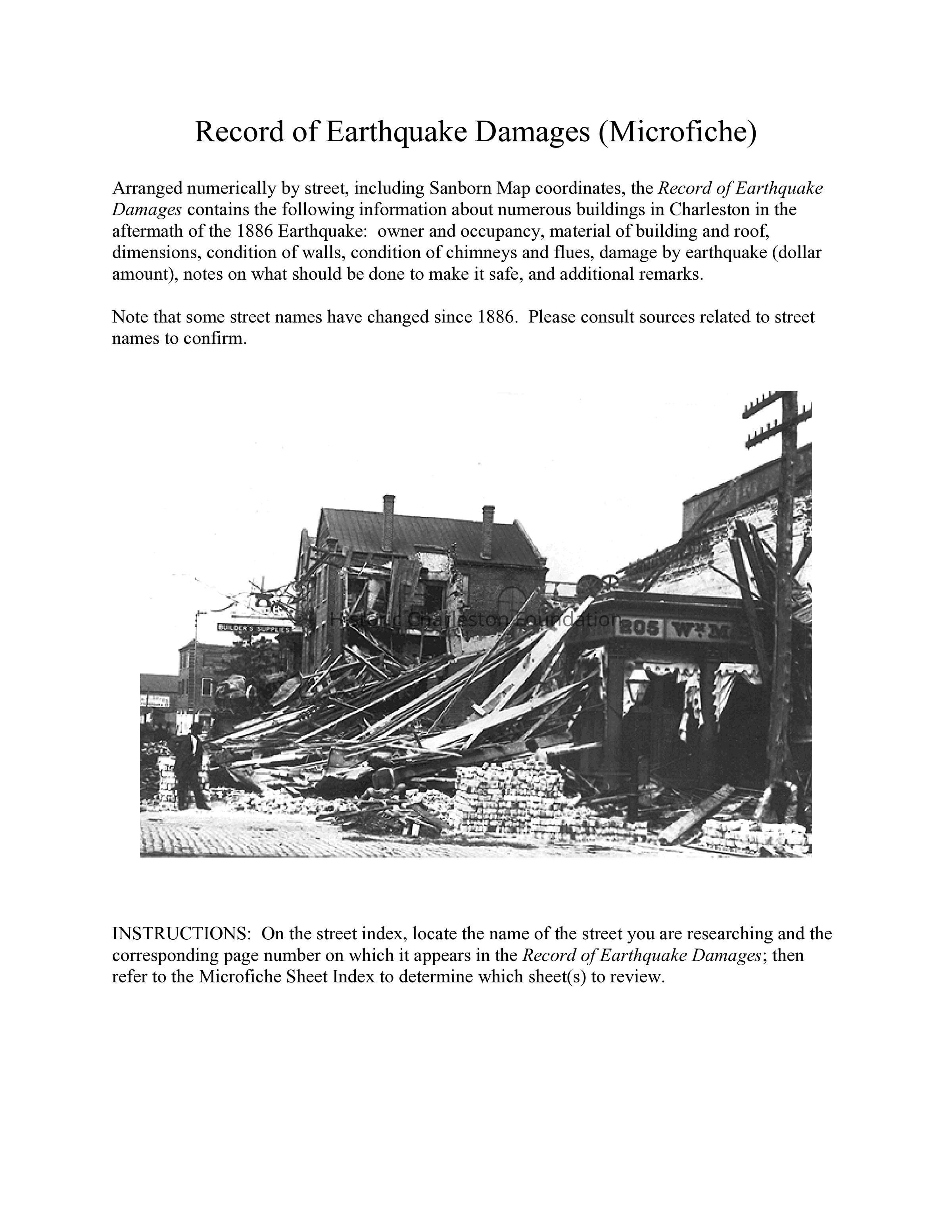
Arranged numerically by street. Includes Sanborn Map coordinates, property owner name, building material description, dimensions, extent of damage, and remarks on repairs.
As well as containing an index to the wharfs and streets of downtown Charleston, there is also a report of buildings that should be demolished, as well as a list of buildings identified as "special hazards."Collection
1886 Earthquake CollectionAcquisition
Accession
2008.010.Source or Donor
1886 Earthquake CollectionAcquisition Method
Collected by StaffLexicon
Nomenclature 4.0
Nomenclature Secondary Object Term
MicroficheNomenclature Primary Object Term
MicroformNomenclature Sub-Class
Other DocumentsNomenclature Class
Documentary ObjectsNomenclature Category
Category 08: Communication ObjectsArchive Details
Archive Size/Extent
1 File Folder containing 22 microfiche sheets
PDF of assessment on CD in file and on External Hard Drive MyPassport1Archive Notes
Level of Description: ItemLocation
Location
Container
Earthquake Collection BoxShelf
General ResearchRoom
Margaretta P. Childs ArchivesBuilding
Missroon HouseCategory
PermanentDate
February 7, 2023General Notes
Note
Notes: Microfiche copy of printed volume. See Multimedia link for index.
PDF of assessment on CD in file and External Hard Drive MyPassport1.Created By
admin@catalogit.appCreate Date
July 14, 2008Updated By
admin@catalogit.appUpdate Date
February 17, 2023