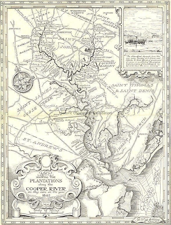
Map Showing the Plantations Along the Cooper River as They Were in 1842
Entry/Object ID
2008.001.59
Scope and Content
Map showing the plantations along the Cooper River as they were in 1842. Inset features information about the steamboat departure. Drawn by S.G. Stoney in 1932.
Original source of map not indicated.
Collection
HCF Map Collection
Acquisition
Accession
2008.001.
Source or Donor
New Archives Catalog Records (2008)
Acquisition Method
Collected by Staff
Lexicon
Nomenclature 4.0
Nomenclature Secondary Object Term
Map
Nomenclature Primary Object Term
Cartograph
Nomenclature Sub-Class
Graphic Documents
Nomenclature Class
Documentary Objects
Nomenclature Category
Category 08: Communication Objects
Search Terms
Charleston vicinity maps, Plantations--South Carolina--Cooper River Region--Maps