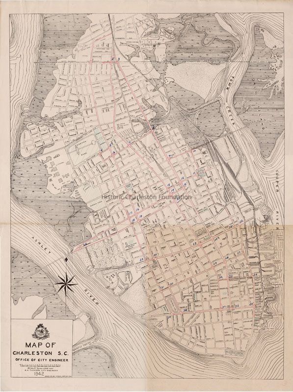
Maps of Charleston S.C. Office of City Engineer [Traffic Survey]: 1942
Entry/Object ID
2019.001.1
Scope and Content
Map of the Charleston peninsula showing the traffic count locations for a survey done by the Metropolitan Council (Civic Services Committee). Boundaries of the survey in red pencil. Street names indicated.
Created by Office of City Engineer.