Name/Title
The WissahickonEntry/Object ID
2013.34.1.24a-cDescription
The Edwin C. Jellett Series of Scrapbooks, Volume 1- The Wissahickon
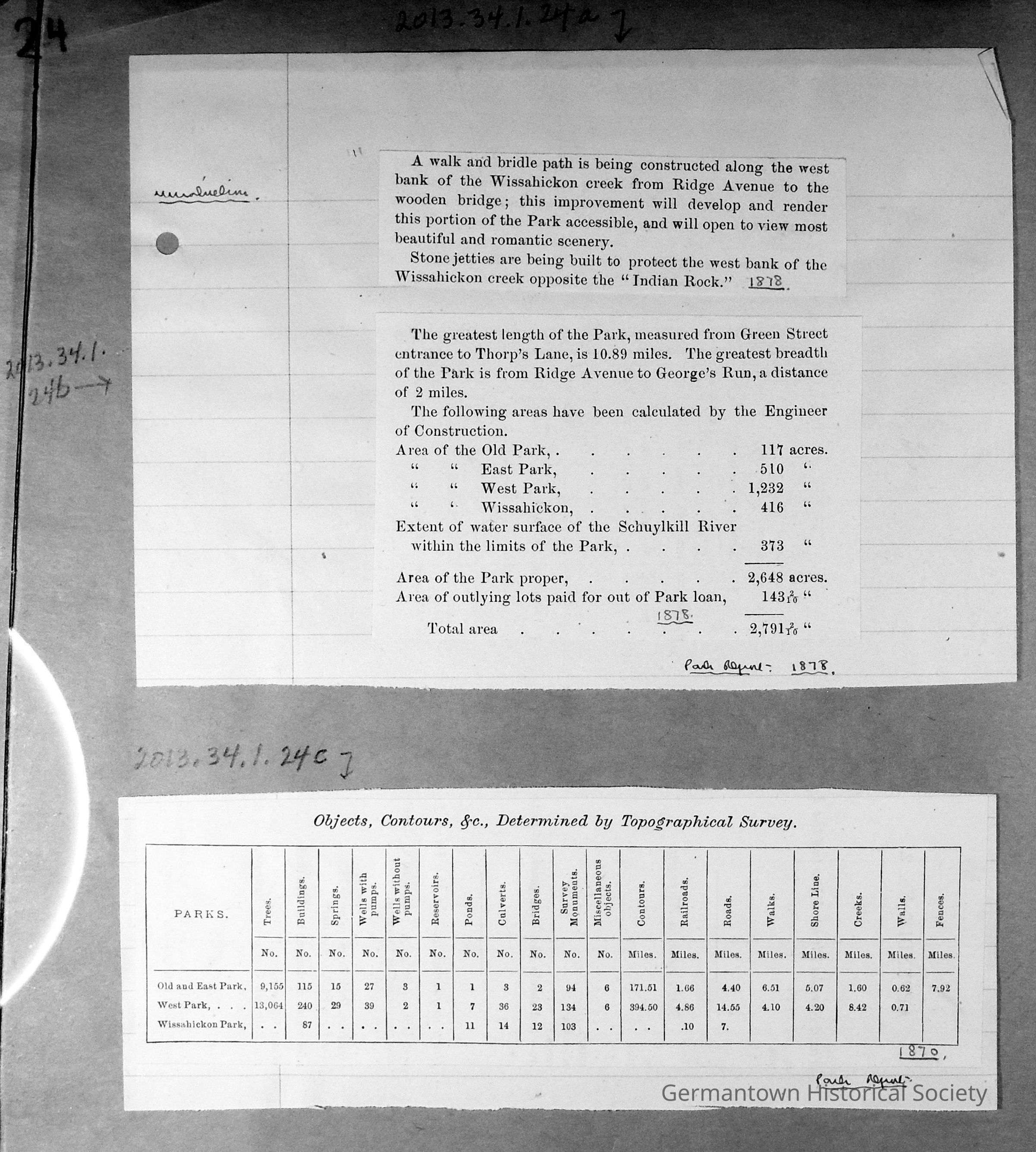
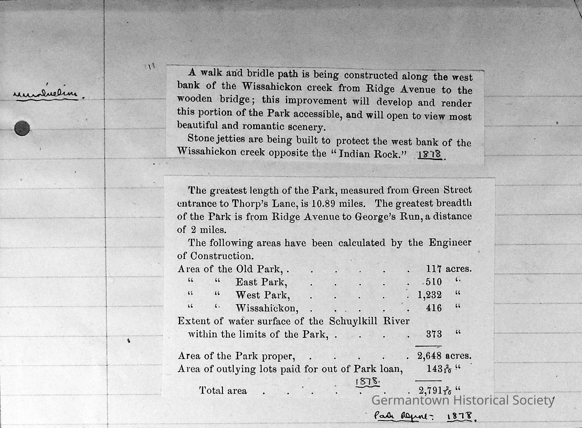
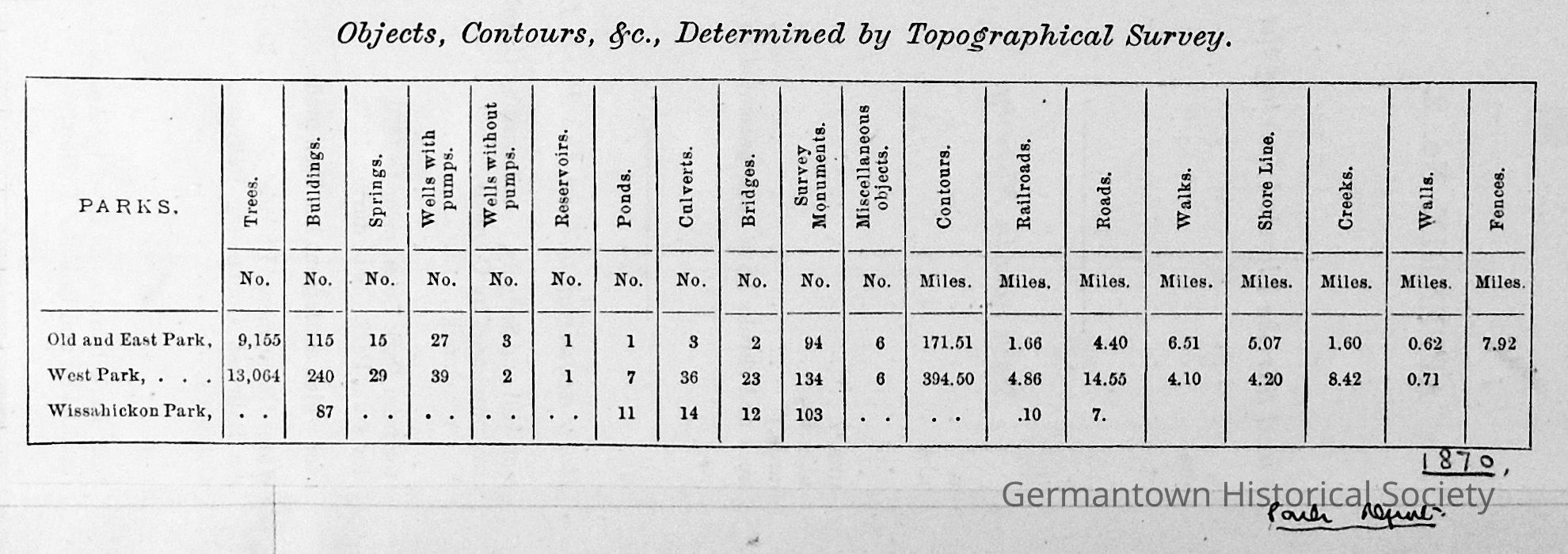
Page 24 contains portions of three articles, which appear to be part of the original article entitled "Report on the Acquisition of Lands for Fairmount Park". (This does not appear to be in sequential mode following previous entries. These articles are attached to a piece of white lined notepaper which is affixed to the scrapbook page. In the left hand margin is the word "wissahickon" written in pencil. At the bottom of the top article is the handwritten notation: Park Report, 1878. At the bottom of the center article is the handwritten notation: "Park Report, 1878". At the end of the bottom article is the handwritten notation: "Park Report, 1870".
Top (a): This small article (seven lines long) describes the construction of a walk and bridle path along the west back of the Wissahickon Creek from Ridge Avenue to the wooden bridge, which will render this portion of the Park accessbile. Stone jetties are also being constructed along the west bank of the creek opposite "Indian Rock".
Center (b): This portion of the article makes mention of Park distances and measurements: the greatest length of the Park is almost 11 miles, while the greatest breadth of the Park is 2 miles. It lists acreages of various sections of the Park , with the area of the Park proper as 2,648 acres. Some outlying lots paid for add an addtitional total of 143 acres to Park lands.
Bottom (c): This is a Table entitled: " Objects, Contours, &., Determined by Topographical Survey." This table lists various categories for The Old & East Park; West Park; and Wissahickon Park.
consists of two separate pages one superimposed over the other. It would appear to begin on the reverse side of the top page with a salutation to the Hon. Morton McMichael detailing a report on operations and labor from 1872. The article mentions that Fairmount Park covers more than three times the area of New York City's Central Park. The article ends with a table listing appropriations for the Park from 1872 through 1877. Unfortunately, the table has been cut off. The bottom page starts with numbers 16 through 25 and lists parcels of land to be disposed of. If the top page is again turned over, it reveals a continuation of lands to be disposed of with numbers 26 and 27. The last paragraph suggests that outside lands (up the Wissahickon) should be considered for purchase to add to the Park. The cost is estimated at between $300 - $600 per acre. The report is signed by Eli K. Price, Chair of the Commission on Land Purchases.Collection
GHS Scrapbook Collection